Property Record
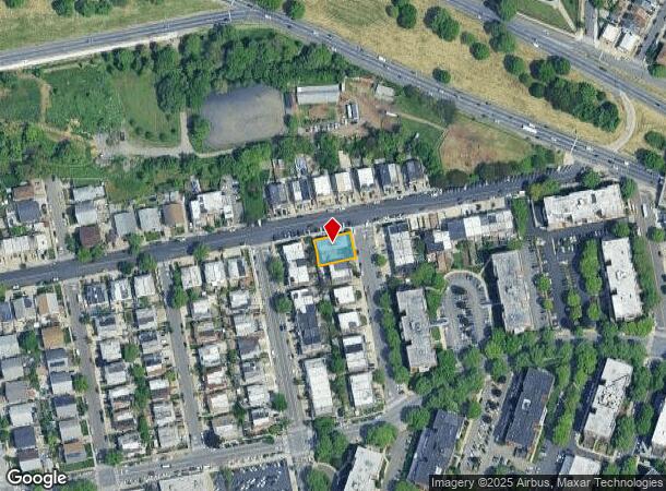
14902 85Th St, Howard Beach, NY 11414
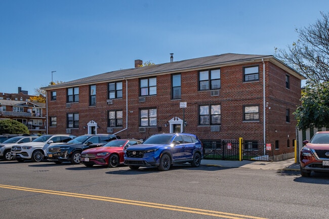
This Property Is For Sale
NEARBY LISTINGS FOR SALE OR LEASE
-
-
No Photo
-
-
-
-
-
-
-
-
-
-
-
-
-
-
-
-
-
-
View all Howard Beach listings for sale on LoopNet.com
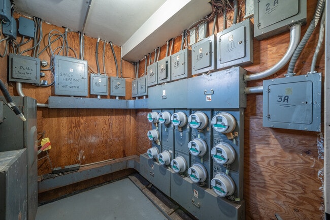
Property Detail
14902 85Th St
11416-0002
Queens
Multifamilydwelling
New York
X
2
3604970236F
0.16 AC
2024
Lindenwood
2025
Long Island (New York)
089201
New York-Jersey City-White Plains, NY-NJ
5,120 SF
DEMOGRAPHICS near 14902 85Th St
1 Mile
3 Mile
5 Mile
2024 Total Population
62,325
491,522
1,604,291
2029 Population
57,052
448,749
1,486,140
Pop Growth 2024-2029
(8.46%)
(8.70%)
(7.36%)
Average Age
41
40
40
2024 Total Households
21,349
159,285
558,473
HH Growth 2024-2029
(8.67%)
(9.01%)
(7.62%)
Median Household Inc
$61,418
$62,566
$65,656
Avg Household Size
2.80
2.90
2.70
2024 Avg HH Vehicles
1.00
1.00
1.00
Median Home Value
$622,727
$667,659
$675,742
Median Year Built
1959
1949
1950
Nearby Places
Map Layers
Map Styles
 Street
 Aerial
- Restaurants
- Banks
- Shops
- Fitness
- Groceries
PUBLIC TRANSPORTATION
TRANSIT/SUBWAY
88 Street (A - New York MTA Subway (The Subway))
DRIVE
WALK
Distance
88 Street (A - New York MTA Subway (The Subway))
4 min
20 min
1.0 mi
COMMUTER RAIL
East New York Station (Far Rockaway Branch - Long Island Rail Road, Long Beach Branch - Long Island Rail Road, West Hempstead Branch - Long Island Rail Road)
DRIVE
WALK
Distance
East New York Station (Far Rockaway Branch - Long Island Rail Road, Long Beach Branch - Long Island Rail Road, West Hempstead Branch - Long Island Rail Road)
9 min
4.0 mi
Kew Gardens Station (Babylon Branch - Long Island Rail Road, Hempstead Branch - Long Island Rail Road, Long Beach Branch - Long Island Rail Road, Port Jefferson Branch - Long Island Rail Road)
DRIVE
WALK
Distance
Kew Gardens Station (Babylon Branch - Long Island Rail Road, Hempstead Branch - Long Island Rail Road, Long Beach Branch - Long Island Rail Road, Port Jefferson Branch - Long Island Rail Road)
11 min
4.2 mi
AIRPORT
John F Kennedy International
DRIVE
WALK
Distance
John F Kennedy International
10 min
5.2 mi
LaGuardia
DRIVE
WALK
Distance
LaGuardia
20 min
12.2 mi
Newark Liberty International
DRIVE
WALK
Distance
Newark Liberty International
42 min
21.9 mi
Freight Ports
NY - Red Hook Container Terminal
DRIVE
WALK
Distance
NY - Red Hook Container Terminal
21 min
10.8 mi
Nearby Properties
Address
Land Use
TOTAL SIZE
Lot Size
Zoning
Address
Land Use
TOTAL SIZE
Lot Size
Zoning
477.04 AC
PARKUS
Address
Land Use
TOTAL SIZE
Lot Size
Zoning
1,845,252 SF
172 AC
C8-1
Address
Land Use
TOTAL SIZE
Lot Size
Zoning
54,170 SF
229.57 AC
PARK
Address
Land Use
TOTAL SIZE
Lot Size
Zoning
5,302 SF
366.15 AC
PARK
Address
Land Use
TOTAL SIZE
Lot Size
Zoning
1,688,760 SF
24.65 AC
R5
Address
Land Use
TOTAL SIZE
Lot Size
Zoning
532,011 SF
2.48 AC
R6
Address
Land Use
TOTAL SIZE
Lot Size
Zoning
600 SF
33.07 AC
PARK
Address
Land Use
TOTAL SIZE
Lot Size
Zoning
126.85 AC
PARK
Address
Land Use
TOTAL SIZE
Lot Size
Zoning
24,400 SF
33.98 AC
C4-2
Address
Land Use
TOTAL SIZE
Lot Size
Zoning
1,493,793 SF
14.19 AC
R5
Address
Land Use
TOTAL SIZE
Lot Size
Zoning
1,485,000 SF
20.28 AC
R5
Address
Land Use
TOTAL SIZE
Lot Size
Zoning
1,420,000 SF
19.61 AC
R5
Address
Land Use
TOTAL SIZE
Lot Size
Zoning
363,548 SF
1.81 AC
Address
Land Use
TOTAL SIZE
Lot Size
Zoning
2,193 SF
94.72 AC
PARK
Address
Land Use
TOTAL SIZE
Lot Size
Zoning
307,038 SF
7.84 AC
M1-1
Address
Land Use
TOTAL SIZE
Lot Size
Zoning
28.64 AC
PARK
Address
Land Use
TOTAL SIZE
Lot Size
Zoning
474,715 SF
1.72 AC
M14R8A
Address
Land Use
TOTAL SIZE
Lot Size
Zoning
490,600 SF
12.01 AC
M1-1
Address
Land Use
TOTAL SIZE
Lot Size
Zoning
1,136,208 SF
30.25 AC
R5
Address
Land Use
TOTAL SIZE
Lot Size
Zoning
4,761.05 AC
PARK
Address
Land Use
TOTAL SIZE
Lot Size
Zoning
997,720 SF
8.23 AC
R5
Address
Land Use
TOTAL SIZE
Lot Size
Zoning
158,402 SF
3.64 AC
C4-2
Address
Land Use
TOTAL SIZE
Lot Size
Zoning
230,580 SF
3.41 AC
C8-1
Address
Land Use
TOTAL SIZE
Lot Size
Zoning
940,800 SF
11.55 AC
R5
Address
Land Use
TOTAL SIZE
Lot Size
Zoning
203,132 SF
3.09 AC
C4-2
Address
Land Use
TOTAL SIZE
Lot Size
Zoning
29.68 AC
C4-2
Address
Land Use
TOTAL SIZE
Lot Size
Zoning
107,000 SF
1.84 AC
R6
Address
Land Use
TOTAL SIZE
Lot Size
Zoning
552,216 SF
9.41 AC
R4
Address
Land Use
TOTAL SIZE
Lot Size
Zoning
205,831 SF
0.78 AC
R8A
Address
Land Use
TOTAL SIZE
Lot Size
Zoning
1,382,400 SF
10.67 AC
R6
The World's #1 Commercial Real Estate Marketplace
Connect with us
© 2026 CoStar Group
The information above has been obtained from sources believed reliable. While we do not doubt its accuracy we have not verified it and make no guarantee, warranty or representation about it. It is your responsibility to independently confirm its accuracy and completeness. Any projections, opinions, assumptions, or estimates used are for example only and do not represent the current or future performance of the property. The value of this transaction to you depends on tax and other factors which should be evaluated by your tax, financial, and legal advisors. You and your advisors should conduct a careful, independent investigation of the property to determine to your satisfaction the suitability of the property for your needs.