Property Record
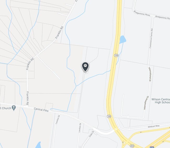
14905 Central Pike, Lebanon, TN 37090
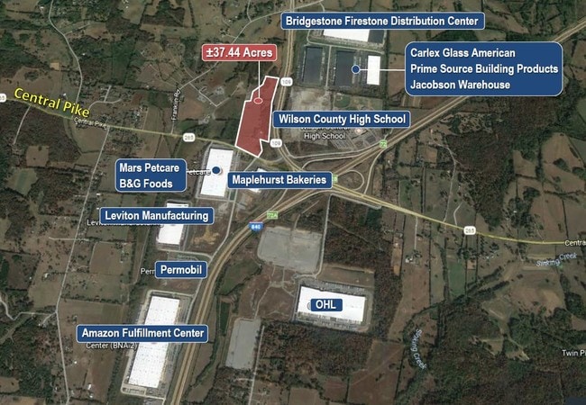
NEARBY LISTINGS FOR SALE OR LEASE
Property Detail
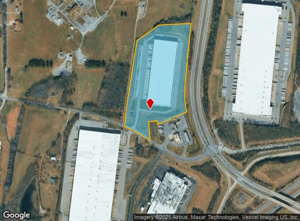
14905 Central Pike
Nashville-Davidson--Murfreesboro--Franklin, TN
Bluestone
101-033.01
PB 30 PG 426 LOT 2
Commercialnec
Wilson
X
Tennessee
47189C0170E
2
2024
19.81 AC
2024
Wilson County
030907
Nashville
250,264 SF
DEMOGRAPHICS near 14905 Central Pike
1 Mile
3 Mile
5 Mile
2024 Total Population
340
6,113
23,798
2029 Population
410
7,385
28,362
Pop Growth 2024-2029
+ 20.59%
+ 20.81%
+ 19.18%
Average Age
40
40
42
2024 Total Households
128
2,389
9,457
HH Growth 2024-2029
+ 20.31%
+ 20.85%
+ 18.99%
Median Household Inc
$99,999
$94,444
$90,206
Avg Household Size
2.60
2.50
2.50
2024 Avg HH Vehicles
2.00
2.00
2.00
Median Home Value
$437,500
$422,564
$408,080
Median Year Built
1999
2004
2010
Nearby Places
- Restaurants
- Banks
- Shops
- Fitness
- Groceries
PUBLIC TRANSPORTATION
COMMUTER RAIL
Martha (East Corridor Line - Tennessee Regional Transportation Authority Music City Star (Music City Star))
DRIVE
WALK
Distance
Martha (East Corridor Line - Tennessee Regional Transportation Authority Music City Star (Music City Star))
9 min
7.4 mi
AIRPORT
Nashville International
DRIVE
WALK
Distance
Nashville International
26 min
21.6 mi
Freight Ports
Port of Mobile
DRIVE
WALK
Distance
Port of Mobile
502 min
462.0 mi
SALE & LEASE HISTORY
LISTING DATE
SALE/LEASE

Jul 11, 2019
For Sale
Nearby Properties
Address
Land Use
TOTAL SIZE
Lot Size
Zoning
Address
Land Use
TOTAL SIZE
Lot Size
Zoning
922,378 SF
88.62 AC
IP
Address
Land Use
TOTAL SIZE
Lot Size
Zoning
1,015,348 SF
61.76 AC
Address
Land Use
TOTAL SIZE
Lot Size
Zoning
995,376 SF
50.86 AC
Address
Land Use
TOTAL SIZE
Lot Size
Zoning
651,828 SF
40.94 AC
Address
Land Use
TOTAL SIZE
Lot Size
Zoning
685,017 SF
48.77 AC
M4
Address
Land Use
TOTAL SIZE
Lot Size
Zoning
377,860 SF
32.86 AC
Address
Land Use
TOTAL SIZE
Lot Size
Zoning
492,017 SF
40.31 AC
Address
Land Use
TOTAL SIZE
Lot Size
Zoning
586,982 SF
42.24 AC
M4
Address
Land Use
TOTAL SIZE
Lot Size
Zoning
655,269 SF
32.57 AC
M4
Address
Land Use
TOTAL SIZE
Lot Size
Zoning
558,917 SF
29.03 AC
IP
Address
Land Use
TOTAL SIZE
Lot Size
Zoning
219,549 SF
15.18 AC
RM6
Address
Land Use
TOTAL SIZE
Lot Size
Zoning
457,073 SF
27.50 AC
Address
Land Use
TOTAL SIZE
Lot Size
Zoning
457,073 SF
26.70 AC
Address
Land Use
TOTAL SIZE
Lot Size
Zoning
460,478 SF
23.97 AC
H4
Address
Land Use
TOTAL SIZE
Lot Size
Zoning
407,642 SF
22.82 AC
H4
Address
Land Use
TOTAL SIZE
Lot Size
Zoning
206,820 SF
26 AC
Address
Land Use
TOTAL SIZE
Lot Size
Zoning
277,672 SF
20.08 AC
Address
Land Use
TOTAL SIZE
Lot Size
Zoning
188,773 SF
17.05 AC
B4
Address
Land Use
TOTAL SIZE
Lot Size
Zoning
29,924 SF
15.31 AC
Address
Land Use
TOTAL SIZE
Lot Size
Zoning
133.81 AC
Address
Land Use
TOTAL SIZE
Lot Size
Zoning
232.43 AC
Address
Land Use
TOTAL SIZE
Lot Size
Zoning
Address
Land Use
TOTAL SIZE
Lot Size
Zoning
1,296 SF
50.07 AC
Address
Land Use
TOTAL SIZE
Lot Size
Zoning
5,446 SF
117.39 AC
Address
Land Use
TOTAL SIZE
Lot Size
Zoning
5,567 SF
5.01 AC
Address
Land Use
TOTAL SIZE
Lot Size
Zoning
23.24 AC
Address
Land Use
TOTAL SIZE
Lot Size
Zoning
3,780 SF
87.33 AC
Address
Land Use
TOTAL SIZE
Lot Size
Zoning
157.87 AC
M4
Address
Land Use
TOTAL SIZE
Lot Size
Zoning
2.22 AC
The World's #1 Commercial Real Estate Marketplace
Connect with us
© 2025 CoStar Group
The information above has been obtained from sources believed reliable. While we do not doubt its accuracy we have not verified it and make no guarantee, warranty or representation about it. It is your responsibility to independently confirm its accuracy and completeness. Any projections, opinions, assumptions, or estimates used are for example only and do not represent the current or future performance of the property. The value of this transaction to you depends on tax and other factors which should be evaluated by your tax, financial, and legal advisors. You and your advisors should conduct a careful, independent investigation of the property to determine to your satisfaction the suitability of the property for your needs.