Property Record
14905 Dumfries Rd, Manassas, VA 20112

Property Detail
14905 Dumfries Rd
Washington-Arlington-Alexandria, DC-VA-MD-WV
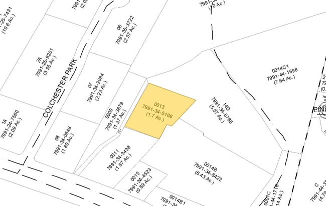
PCL 1 34-1-13
7991-34-5166
PRINCE WILLIAM
Vacantlandnec
Virginia
M2
5166
B and X Area of moderate flood hazard, usually the area between the limits of the 100-year and 500-year floods.
1.70 AC
2024
Woodbridge/I-95 Corridor
2025
Washington, DC
901234
NEARBY LISTINGS FOR SALE OR LEASE
DEMOGRAPHICS near 14905 Dumfries Rd
1 mile
3 mile
5 mile
2025 Total Population
1,016
32,644
105,819
2030 Population
1,043
33,348
108,235
Pop Growth 2025-2030
+ 2.66%
+ 2.16%
+ 2.28%
Average Age
39
39
39
2025 Total Households
297
9,428
31,664
HH Growth 2025-2030
+ 2.36%
+ 2.06%
+ 2.24%
Median Household Inc
$210,759
$167,190
$148,713
Avg Household Size
3.30
3.30
3.20
2025 Avg HH Vehicles
3.00
3.00
2.00
Median Home Value
$722,340
$603,190
$538,840
Median Year Built
1998
1993
1987
Nearby Places
Map Layers
Map Styles
 Street
 Aerial
Transit
 Traffic
 Biking
Places
Listings with unknown addresses are not visible on the map
- Restaurants
- Banks
- Shops
- Fitness
- Groceries
PUBLIC TRANSPORTATION
AIRPORT
Washington Dulles International
Drive
Walk
Distance
Washington Dulles International
50 min
28.7 mi
Ronald Reagan Washington Ntl
Drive
Walk
Distance
Ronald Reagan Washington Ntl
50 min
34.1 mi
Freight Ports
Port of Baltimore
Drive
Walk
Distance
Port of Baltimore
108 min
75.0 mi
Nearby Properties
Address
Land Use
TOTAL SIZE
Lot Size
Zoning
Address
Land Use
TOTAL SIZE
Lot Size
Zoning
380,453 SF
109.20 AC
A1
Address
Land Use
TOTAL SIZE
Lot Size
Zoning
147,145 SF
1,061.98 AC
A1
Address
Land Use
TOTAL SIZE
Lot Size
Zoning
283,209 SF
72.49 AC
A1
Address
Land Use
TOTAL SIZE
Lot Size
Zoning
280,309 SF
79.07 AC
R4
Address
Land Use
TOTAL SIZE
Lot Size
Zoning
326,561 SF
46.60 AC
A1
Address
Land Use
TOTAL SIZE
Lot Size
Zoning
145,747 SF
20.29 AC
A1
Address
Land Use
TOTAL SIZE
Lot Size
Zoning
326,559 SF
11.45 AC
RPC
Address
Land Use
TOTAL SIZE
Lot Size
Zoning
212,338 SF
65.19 AC
A1
Address
Land Use
TOTAL SIZE
Lot Size
Zoning
110,332 SF
19.47 AC
A1
Address
Land Use
TOTAL SIZE
Lot Size
Zoning
132,794 SF
29.46 AC
A1
Address
Land Use
TOTAL SIZE
Lot Size
Zoning
130,339 SF
3.40 AC
RPC
Address
Land Use
TOTAL SIZE
Lot Size
Zoning
70,763 SF
15.85 AC
RPC
Address
Land Use
TOTAL SIZE
Lot Size
Zoning
81,015 SF
15.58 AC
RPC
Address
Land Use
TOTAL SIZE
Lot Size
Zoning
60,673 SF
15.05 AC
RPC
Address
Land Use
TOTAL SIZE
Lot Size
Zoning
93,507 SF
18.05 AC
R4
Address
Land Use
TOTAL SIZE
Lot Size
Zoning
20,902 SF
4.17 AC
MT
Address
Land Use
TOTAL SIZE
Lot Size
Zoning
3.55 AC
MT
Address
Land Use
TOTAL SIZE
Lot Size
Zoning
23,286 SF
13.48 AC
B1
Address
Land Use
TOTAL SIZE
Lot Size
Zoning
26,500 SF
10.60 AC
MT
Address
Land Use
TOTAL SIZE
Lot Size
Zoning
77,572 SF
10.83 AC
B2
Address
Land Use
TOTAL SIZE
Lot Size
Zoning
58,946 SF
6.38 AC
B2
Address
Land Use
TOTAL SIZE
Lot Size
Zoning
2.57 AC
MT
Address
Land Use
TOTAL SIZE
Lot Size
Zoning
16,859 SF
132.73 AC
A1
Address
Land Use
TOTAL SIZE
Lot Size
Zoning
23,425 SF
9.54 AC
A1
Address
Land Use
TOTAL SIZE
Lot Size
Zoning
2.23 AC
MT
Address
Land Use
TOTAL SIZE
Lot Size
Zoning
2.18 AC
MT
Address
Land Use
TOTAL SIZE
Lot Size
Zoning
2.09 AC
MT
Address
Land Use
TOTAL SIZE
Lot Size
Zoning
2.08 AC
MT
Address
Land Use
TOTAL SIZE
Lot Size
Zoning
3,672 SF
17.13 AC
M1
Address
Land Use
TOTAL SIZE
Lot Size
Zoning
1.89 AC
MT
The World's #1 Commercial Real Estate Marketplace
Connect with us
© 2026 CoStar Group
The information above has been obtained from sources believed reliable. While we do not doubt its accuracy we have not verified it and make no guarantee, warranty or representation about it. It is your responsibility to independently confirm its accuracy and completeness. Any projections, opinions, assumptions, or estimates used are for example only and do not represent the current or future performance of the property. The value of this transaction to you depends on tax and other factors which should be evaluated by your tax, financial, and legal advisors. You and your advisors should conduct a careful, independent investigation of the property to determine to your satisfaction the suitability of the property for your needs.