Property Record
1491 Blue Oaks Blvd, Roseville, CA 95747


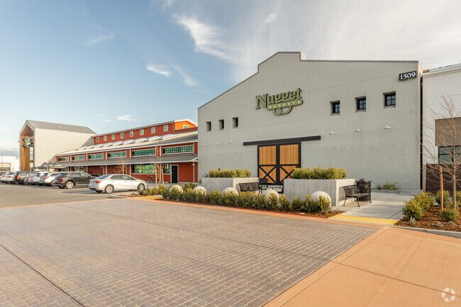
NEARBY LISTINGS FOR SALE OR LEASE
Property Detail
1491 Blue Oaks Blvd
Sacramento-Roseville-Folsom, CA
Parcel Map Of Campus Oaks Town Center Su
481-320-001
4.348 AC LOT 1 CAMPUS OAKS TOWN CENTER MOR FF-13
Storebuilding
Placer
X
California
06061C0937H
1
2024
4.35 AC
2025
Roseville/Rocklin
021044
Sacramento
42,890 SF
DEMOGRAPHICS near 1491 Blue Oaks Blvd
1 Mile
3 Mile
5 Mile
2024 Total Population
12,497
95,728
197,074
2029 Population
13,500
103,501
212,779
Pop Growth 2024-2029
+ 8.03%
+ 8.12%
+ 7.97%
Average Age
40
40
39
2024 Total Households
4,422
34,281
70,400
HH Growth 2024-2029
+ 8.25%
+ 8.11%
+ 7.97%
Median Household Inc
$124,127
$119,372
$112,498
Avg Household Size
2.80
2.70
2.70
2024 Avg HH Vehicles
2.00
2.00
2.00
Median Home Value
$687,676
$664,412
$651,269
Median Year Built
2004
2002
2000
Nearby Places
Map Layers
Map Styles
 Street
 Aerial
- Restaurants
- Banks
- Shops
- Fitness
- Groceries
PUBLIC TRANSPORTATION
COMMUTER RAIL
Roseville (California Zephyr - Amtrak, Capitol Corridor - Amtrak)
DRIVE
WALK
Distance
Roseville (California Zephyr - Amtrak, Capitol Corridor - Amtrak)
10 min
4.7 mi
Rocklin Amtrak Station (Capitol Corridor - Amtrak)
DRIVE
WALK
Distance
Rocklin Amtrak Station (Capitol Corridor - Amtrak)
12 min
7.8 mi
AIRPORT
Sacramento International
DRIVE
WALK
Distance
Sacramento International
37 min
24.6 mi
Freight Ports
Port of Stockton
DRIVE
WALK
Distance
Port of Stockton
84 min
71.5 mi
Nearby Properties
Address
Land Use
TOTAL SIZE
Lot Size
Zoning
Address
Land Use
TOTAL SIZE
Lot Size
Zoning
341,145 SF
12 AC
Address
Land Use
TOTAL SIZE
Lot Size
Zoning
471,741 SF
15.14 AC
Address
Land Use
TOTAL SIZE
Lot Size
Zoning
280,129 SF
14.90 AC
Address
Land Use
TOTAL SIZE
Lot Size
Zoning
401,656 SF
28 AC
Address
Land Use
TOTAL SIZE
Lot Size
Zoning
130,228 SF
11.10 AC
Address
Land Use
TOTAL SIZE
Lot Size
Zoning
1,032,692 SF
81.30 AC
INPDC
Address
Land Use
TOTAL SIZE
Lot Size
Zoning
243,765 SF
14.24 AC
Address
Land Use
TOTAL SIZE
Lot Size
Zoning
144,760 SF
26.70 AC
Address
Land Use
TOTAL SIZE
Lot Size
Zoning
222,702 SF
10.57 AC
Address
Land Use
TOTAL SIZE
Lot Size
Zoning
769,698 SF
50.39 AC
Address
Land Use
TOTAL SIZE
Lot Size
Zoning
411,344 SF
41.50 AC
Address
Land Use
TOTAL SIZE
Lot Size
Zoning
244,077 SF
8.70 AC
Address
Land Use
TOTAL SIZE
Lot Size
Zoning
401,175 SF
19.80 AC
Address
Land Use
TOTAL SIZE
Lot Size
Zoning
193,126 SF
75.84 AC
Address
Land Use
TOTAL SIZE
Lot Size
Zoning
217,756 SF
8.90 AC
Address
Land Use
TOTAL SIZE
Lot Size
Zoning
132,784 SF
9.80 AC
Address
Land Use
TOTAL SIZE
Lot Size
Zoning
718,131 SF
42 AC
Address
Land Use
TOTAL SIZE
Lot Size
Zoning
159,069 SF
6.09 AC
Address
Land Use
TOTAL SIZE
Lot Size
Zoning
12,176 SF
22.70 AC
Address
Land Use
TOTAL SIZE
Lot Size
Zoning
310,720 SF
16.90 AC
Address
Land Use
TOTAL SIZE
Lot Size
Zoning
314,360 SF
18.90 AC
Address
Land Use
TOTAL SIZE
Lot Size
Zoning
222,453 SF
27.60 AC
Address
Land Use
TOTAL SIZE
Lot Size
Zoning
198,824 SF
29.66 AC
Address
Land Use
TOTAL SIZE
Lot Size
Zoning
474,641 SF
30.80 AC
Address
Land Use
TOTAL SIZE
Lot Size
Zoning
200,928 SF
3.65 AC
Address
Land Use
TOTAL SIZE
Lot Size
Zoning
118,199 SF
5.50 AC
Address
Land Use
TOTAL SIZE
Lot Size
Zoning
111,110 SF
11.73 AC
The World's #1 Commercial Real Estate Marketplace
Connect with us
© 2026 CoStar Group
The information above has been obtained from sources believed reliable. While we do not doubt its accuracy we have not verified it and make no guarantee, warranty or representation about it. It is your responsibility to independently confirm its accuracy and completeness. Any projections, opinions, assumptions, or estimates used are for example only and do not represent the current or future performance of the property. The value of this transaction to you depends on tax and other factors which should be evaluated by your tax, financial, and legal advisors. You and your advisors should conduct a careful, independent investigation of the property to determine to your satisfaction the suitability of the property for your needs.