Property Record
1491 Dunn Rd, Florissant, MO 63033

NEARBY LISTINGS FOR SALE OR LEASE
Property Detail
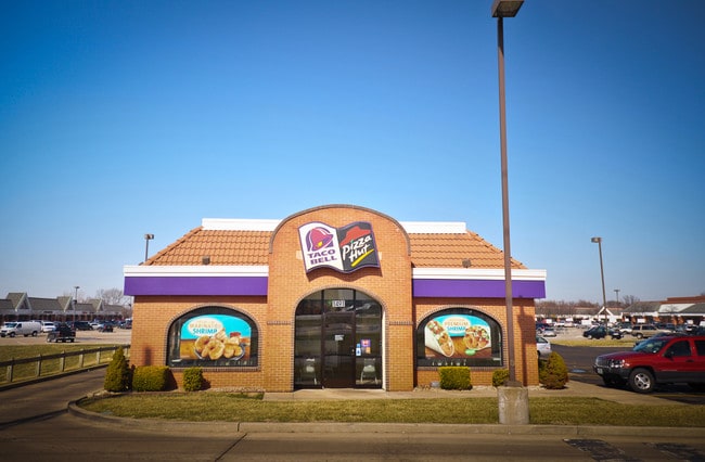
1491 Dunn Rd
St. Louis, MO-IL
St Ferdinand Commons
09H-11-0045
ST FERDINAND COMMONS BLK PTS 114 & 122 & FATIMA ACRES PLAT NO 1 LOTS 2 THRU 7 & LOT PT 1
Regionalshoppingcenterormallwithanchorstore
St. Louis
X
Missouri
29183C0325G
2-7,1
2024
30.12 AC
2025
North County
211101
St. Louis
222,813 SF
DEMOGRAPHICS near 1491 Dunn Rd
1 Mile
3 Mile
5 Mile
2024 Total Population
11,189
99,030
240,812
2029 Population
10,945
98,095
238,227
Pop Growth 2024-2029
(2.18%)
(0.94%)
(1.07%)
Average Age
39
39
39
2024 Total Households
4,487
39,688
97,658
HH Growth 2024-2029
(2.25%)
(1.03%)
(1.11%)
Median Household Inc
$58,637
$50,744
$49,484
Avg Household Size
2.40
2.40
2.40
2024 Avg HH Vehicles
2.00
2.00
2.00
Median Home Value
$124,557
$118,775
$126,031
Median Year Built
1959
1961
1962
Nearby Places
Map Layers
Map Styles
 Street
 Aerial
- Restaurants
- Banks
- Shops
- Fitness
- Groceries
PUBLIC TRANSPORTATION
COMMUTER RAIL
Lambert Airport East Terminal (Lambert Airport Shiloh-Scott - St. Louis MetroLink (MetroLink))
DRIVE
WALK
Distance
Lambert Airport East Terminal (Lambert Airport Shiloh-Scott - St. Louis MetroLink (MetroLink))
10 min
6.4 mi
North Hanley (Lambert Airport Shiloh-Scott - St. Louis MetroLink (MetroLink))
DRIVE
WALK
Distance
North Hanley (Lambert Airport Shiloh-Scott - St. Louis MetroLink (MetroLink))
10 min
6.5 mi
AIRPORT
St Louis Lambert International
DRIVE
WALK
Distance
St Louis Lambert International
10 min
4.9 mi
Scott AFB/Midamerica St Louis
DRIVE
WALK
Distance
Scott AFB/Midamerica St Louis
59 min
37.7 mi
Freight Ports
Port Milwaukee
DRIVE
WALK
Distance
Port Milwaukee
423 min
372.4 mi
Nearby Properties
Address
Land Use
TOTAL SIZE
Lot Size
Zoning
Address
Land Use
TOTAL SIZE
Lot Size
Zoning
2,640,818 SF
159.97 AC
7M-1
Address
Land Use
TOTAL SIZE
Lot Size
Zoning
25,545 SF
82.84 AC
R1B
Address
Land Use
TOTAL SIZE
Lot Size
Zoning
71.29 AC
24R4
Address
Land Use
TOTAL SIZE
Lot Size
Zoning
815,658 SF
28.70 AC
M1
Address
Land Use
TOTAL SIZE
Lot Size
Zoning
816,783 SF
37.97 AC
7M-1
Address
Land Use
TOTAL SIZE
Lot Size
Zoning
35.96 AC
R2
Address
Land Use
TOTAL SIZE
Lot Size
Zoning
15.37 AC
R
Address
Land Use
TOTAL SIZE
Lot Size
Zoning
271,184 SF
13.67 AC
B3
Address
Land Use
TOTAL SIZE
Lot Size
Zoning
460,170 SF
152.70 AC
22M-1
Address
Land Use
TOTAL SIZE
Lot Size
Zoning
6.88 AC
H
Address
Land Use
TOTAL SIZE
Lot Size
Zoning
18,734 SF
38.83 AC
24R4
Address
Land Use
TOTAL SIZE
Lot Size
Zoning
1,428 SF
131.27 AC
C
Address
Land Use
TOTAL SIZE
Lot Size
Zoning
354,790 SF
22.46 AC
B6
Address
Land Use
TOTAL SIZE
Lot Size
Zoning
262,938 SF
11.32 AC
80H
Address
Land Use
TOTAL SIZE
Lot Size
Zoning
21.29 AC
24R4
Address
Land Use
TOTAL SIZE
Lot Size
Zoning
106,957 SF
6.10 AC
C
Address
Land Use
TOTAL SIZE
Lot Size
Zoning
320,176 SF
9.83 AC
24MFD
Address
Land Use
TOTAL SIZE
Lot Size
Zoning
196,819 SF
9.83 AC
7M-1
Address
Land Use
TOTAL SIZE
Lot Size
Zoning
58,818 SF
8.02 AC
22C-1
Address
Land Use
TOTAL SIZE
Lot Size
Zoning
169,426 SF
26.38 AC
R1
Address
Land Use
TOTAL SIZE
Lot Size
Zoning
76.67 AC
80I
Address
Land Use
TOTAL SIZE
Lot Size
Zoning
305,740 SF
15.77 AC
7M-1
Address
Land Use
TOTAL SIZE
Lot Size
Zoning
78,460 SF
4.13 AC
G
Address
Land Use
TOTAL SIZE
Lot Size
Zoning
11.27 AC
24R4
Address
Land Use
TOTAL SIZE
Lot Size
Zoning
7,449 SF
0.14 AC
H
Address
Land Use
TOTAL SIZE
Lot Size
Zoning
6,366 SF
25.07 AC
22R-1C
Address
Land Use
TOTAL SIZE
Lot Size
Zoning
148,974 SF
17.04 AC
C-8
Address
Land Use
TOTAL SIZE
Lot Size
Zoning
181,890 SF
27.54 AC
7M-1
Address
Land Use
TOTAL SIZE
Lot Size
Zoning
11.48 AC
24R4
Address
Land Use
TOTAL SIZE
Lot Size
Zoning
5.74 AC
C1
The World's #1 Commercial Real Estate Marketplace
Connect with us
© 2026 CoStar Group
The information above has been obtained from sources believed reliable. While we do not doubt its accuracy we have not verified it and make no guarantee, warranty or representation about it. It is your responsibility to independently confirm its accuracy and completeness. Any projections, opinions, assumptions, or estimates used are for example only and do not represent the current or future performance of the property. The value of this transaction to you depends on tax and other factors which should be evaluated by your tax, financial, and legal advisors. You and your advisors should conduct a careful, independent investigation of the property to determine to your satisfaction the suitability of the property for your needs.