Property Record
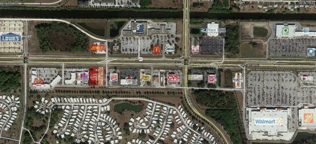
14914 Tamiami Trl, North Port, FL 34287
NEARBY LISTINGS FOR SALE OR LEASE
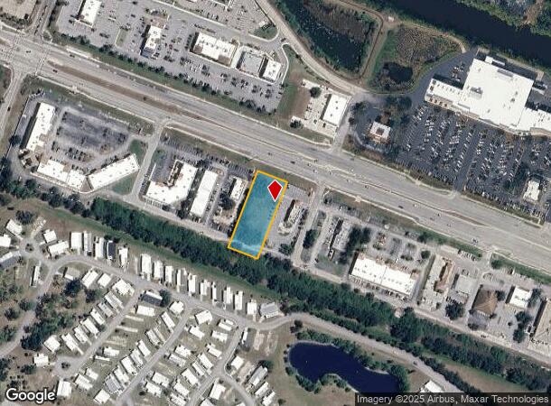
Property Detail
14914 Tamiami Trl
North Port-Sarasota-Bradenton, FL
Popeyes North Port
1000-24-0009
LOT 1, POPEYES NORTH PORT, BEING SAME LANDS DESC IN ORI 2023187828
Commercialacreage
Sarasota
X
Florida
12115C0386G
1
2023
0.88 AC
2024
Sarasota Outlying
002710
Tampa/St Petersburg
DEMOGRAPHICS near 14914 Tamiami Trl
1 Mile
3 Mile
5 Mile
2024 Total Population
5,657
37,312
71,890
2029 Population
6,556
42,953
82,942
Pop Growth 2024-2029
+ 15.89%
+ 15.12%
+ 15.37%
Average Age
53
48
47
2024 Total Households
2,730
16,039
29,760
HH Growth 2024-2029
+ 15.86%
+ 15.19%
+ 15.51%
Median Household Inc
$56,229
$58,210
$60,578
Avg Household Size
2.00
2.30
2.40
2024 Avg HH Vehicles
1.00
2.00
2.00
Median Home Value
$175,077
$227,557
$235,938
Median Year Built
1987
1993
2000
Nearby Places
- Restaurants
- Banks
- Shops
- Fitness
- Groceries
PUBLIC TRANSPORTATION
AIRPORT
Punta Gorda
DRIVE
WALK
Distance
Punta Gorda
32 min
17.7 mi
Freight Ports
Port Manatee
DRIVE
WALK
Distance
Port Manatee
71 min
54.3 mi
SALE & LEASE HISTORY
LISTING DATE
SALE/LEASE

Sep 28, 2023
For Lease
Sep 28, 2023
For Sale
Nov 28, 2017
For Lease
Apr 27, 2017
For Lease
Nearby Properties
Address
Land Use
TOTAL SIZE
Lot Size
Zoning
Address
Land Use
TOTAL SIZE
Lot Size
Zoning
521,450 SF
196.98 AC
GU
Address
Land Use
TOTAL SIZE
Lot Size
Zoning
218,356 SF
17.14 AC
PCDN
Address
Land Use
TOTAL SIZE
Lot Size
Zoning
267,412 SF
23.26 AC
AC1
Address
Land Use
TOTAL SIZE
Lot Size
Zoning
146,932 SF
39.48 AC
AC2
Address
Land Use
TOTAL SIZE
Lot Size
Zoning
9,511 SF
40.53 AC
PD
Address
Land Use
TOTAL SIZE
Lot Size
Zoning
104,383 SF
47.54 AC
GU
Address
Land Use
TOTAL SIZE
Lot Size
Zoning
205,624 SF
21.37 AC
AC1
Address
Land Use
TOTAL SIZE
Lot Size
Zoning
155,080 SF
8.96 AC
CG
Address
Land Use
TOTAL SIZE
Lot Size
Zoning
114,985 SF
29.77 AC
GU
Address
Land Use
TOTAL SIZE
Lot Size
Zoning
101,676 SF
8.83 AC
AC1
Address
Land Use
TOTAL SIZE
Lot Size
Zoning
79,944 SF
15.64 AC
PCDN
Address
Land Use
TOTAL SIZE
Lot Size
Zoning
196,163 SF
15.60 AC
AC1
Address
Land Use
TOTAL SIZE
Lot Size
Zoning
115,678 SF
8.58 AC
R3
Address
Land Use
TOTAL SIZE
Lot Size
Zoning
142,364 SF
13.87 AC
AC1
Address
Land Use
TOTAL SIZE
Lot Size
Zoning
40,161 SF
40 AC
GU
Address
Land Use
TOTAL SIZE
Lot Size
Zoning
65,103 SF
10.16 AC
AC2
Address
Land Use
TOTAL SIZE
Lot Size
Zoning
85,529 SF
11.41 AC
CG
Address
Land Use
TOTAL SIZE
Lot Size
Zoning
105,046 SF
12.69 AC
AC1
Address
Land Use
TOTAL SIZE
Lot Size
Zoning
17.48 AC
AC1
Address
Land Use
TOTAL SIZE
Lot Size
Zoning
43,387 SF
5.09 AC
AC2
Address
Land Use
TOTAL SIZE
Lot Size
Zoning
42,923 SF
403.06 AC
PCDN
Address
Land Use
TOTAL SIZE
Lot Size
Zoning
22.07 AC
PD
Address
Land Use
TOTAL SIZE
Lot Size
Zoning
63,016 SF
2.56 AC
AC1
Address
Land Use
TOTAL SIZE
Lot Size
Zoning
14,714 SF
81.28 AC
AC7B
Address
Land Use
TOTAL SIZE
Lot Size
Zoning
29,890 SF
7.78 AC
RMF
Address
Land Use
TOTAL SIZE
Lot Size
Zoning
19,816 SF
2.70 AC
AC2
Address
Land Use
TOTAL SIZE
Lot Size
Zoning
10,721 SF
3 AC
PD
Address
Land Use
TOTAL SIZE
Lot Size
Zoning
23,100 SF
1.60 AC
CG
Address
Land Use
TOTAL SIZE
Lot Size
Zoning
61,624 SF
3.48 AC
CG
Address
Land Use
TOTAL SIZE
Lot Size
Zoning
50.35 AC
AC1
The World's #1 Commercial Real Estate Marketplace
Connect with us
© 2025 CoStar Group
The information above has been obtained from sources believed reliable. While we do not doubt its accuracy we have not verified it and make no guarantee, warranty or representation about it. It is your responsibility to independently confirm its accuracy and completeness. Any projections, opinions, assumptions, or estimates used are for example only and do not represent the current or future performance of the property. The value of this transaction to you depends on tax and other factors which should be evaluated by your tax, financial, and legal advisors. You and your advisors should conduct a careful, independent investigation of the property to determine to your satisfaction the suitability of the property for your needs.