Property Record
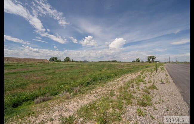
1492 N Highway 91 St, Shelley, ID 83274

NEARBY LISTINGS FOR SALE OR LEASE
Property Detail
1492 N Highway 91 St
Other Market Areas
Ridges Addition Ii
Blackfoot, ID
E PTN T-18075 LESS E PTN T-17290, T-17791 P/C 0457924 T1N R37E SEC 22
RP0457924
Bingham
Commercialnec
Idaho
2025
4.90 AC
2025
Idaho South Area
950102
DEMOGRAPHICS near 1492 N Highway 91 St
1 Mile
3 Mile
5 Mile
2024 Total Population
327
8,770
19,429
2029 Population
363
9,715
21,783
Pop Growth 2024-2029
+ 11.01%
+ 10.78%
+ 12.12%
Average Age
35
35
36
2024 Total Households
102
2,760
6,170
HH Growth 2024-2029
+ 10.78%
+ 10.80%
+ 12.07%
Median Household Inc
$82,143
$80,792
$99,961
Avg Household Size
3.20
3.20
3.10
2024 Avg HH Vehicles
2.00
2.00
2.00
Median Home Value
$386,110
$347,192
$396,902
Median Year Built
1998
1988
1999
Nearby Places
Map Layers
Map Styles
 Street
 Aerial
- Restaurants
- Banks
- Shops
- Fitness
- Groceries
PUBLIC TRANSPORTATION
AIRPORT
Idaho Falls Regional
DRIVE
WALK
Distance
Idaho Falls Regional
16 min
9.1 mi
Freight Ports
Port of Portland
DRIVE
WALK
Distance
Port of Portland
738 min
704.6 mi
SALE & LEASE HISTORY
LISTING DATE
SALE/LEASE

Jul 06, 2020
For Sale
Nearby Properties
Address
Land Use
TOTAL SIZE
Lot Size
Zoning
Address
Land Use
TOTAL SIZE
Lot Size
Zoning
54,748 SF
12.73 AC
Address
Land Use
TOTAL SIZE
Lot Size
Zoning
140,670 SF
8.59 AC
Address
Land Use
TOTAL SIZE
Lot Size
Zoning
89,980 SF
12.71 AC
Address
Land Use
TOTAL SIZE
Lot Size
Zoning
140,670 SF
7.22 AC
Address
Land Use
TOTAL SIZE
Lot Size
Zoning
3,520 SF
7.42 AC
Address
Land Use
TOTAL SIZE
Lot Size
Zoning
166,200 SF
6.75 AC
Address
Land Use
TOTAL SIZE
Lot Size
Zoning
6.15 AC
HC
Address
Land Use
TOTAL SIZE
Lot Size
Zoning
99,450 SF
5.75 AC
Address
Land Use
TOTAL SIZE
Lot Size
Zoning
96,320 SF
6.03 AC
R2
Address
Land Use
TOTAL SIZE
Lot Size
Zoning
113,720 SF
8.65 AC
R2
Address
Land Use
TOTAL SIZE
Lot Size
Zoning
15,708 SF
10.73 AC
C2
Address
Land Use
TOTAL SIZE
Lot Size
Zoning
1.20 AC
CB
Address
Land Use
TOTAL SIZE
Lot Size
Zoning
10,654 SF
12.43 AC
Address
Land Use
TOTAL SIZE
Lot Size
Zoning
14,098 SF
28.53 AC
R2
Address
Land Use
TOTAL SIZE
Lot Size
Zoning
1.89 AC
CB
Address
Land Use
TOTAL SIZE
Lot Size
Zoning
9.23 AC
Address
Land Use
TOTAL SIZE
Lot Size
Zoning
13,870 SF
4.12 AC
Address
Land Use
TOTAL SIZE
Lot Size
Zoning
9.02 AC
Address
Land Use
TOTAL SIZE
Lot Size
Zoning
31,266 SF
16.70 AC
Address
Land Use
TOTAL SIZE
Lot Size
Zoning
1.57 AC
Address
Land Use
TOTAL SIZE
Lot Size
Zoning
52,500 SF
4.07 AC
R2
Address
Land Use
TOTAL SIZE
Lot Size
Zoning
10,717 SF
7.38 AC
Address
Land Use
TOTAL SIZE
Lot Size
Zoning
7,206 SF
5.19 AC
R2
Address
Land Use
TOTAL SIZE
Lot Size
Zoning
20,200 SF
2.96 AC
Address
Land Use
TOTAL SIZE
Lot Size
Zoning
9.26 AC
Address
Land Use
TOTAL SIZE
Lot Size
Zoning
33,384 SF
5.45 AC
Address
Land Use
TOTAL SIZE
Lot Size
Zoning
0.48 AC
CB
Address
Land Use
TOTAL SIZE
Lot Size
Zoning
13,850 SF
3.42 AC
R2
Address
Land Use
TOTAL SIZE
Lot Size
Zoning
27,754 SF
4.86 AC
Address
Land Use
TOTAL SIZE
Lot Size
Zoning
16,200 SF
2.26 AC
The World's #1 Commercial Real Estate Marketplace
Connect with us
© 2026 CoStar Group
The information above has been obtained from sources believed reliable. While we do not doubt its accuracy we have not verified it and make no guarantee, warranty or representation about it. It is your responsibility to independently confirm its accuracy and completeness. Any projections, opinions, assumptions, or estimates used are for example only and do not represent the current or future performance of the property. The value of this transaction to you depends on tax and other factors which should be evaluated by your tax, financial, and legal advisors. You and your advisors should conduct a careful, independent investigation of the property to determine to your satisfaction the suitability of the property for your needs.