Property Record
14920 Chillicothe Rd, Novelty, OH 44072

Save to a Folder
{{folder.Name}}
{{folder.ListingIds.length}} Properties
{{folder.ListingIds.length}} Property
Create a New Folder
Property Detail
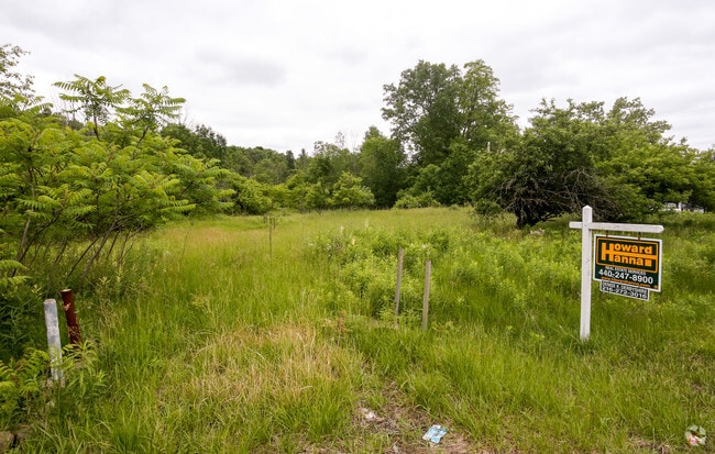
14920 Chillicothe Rd
Cleveland-Elyria, OH
LOT 6 MIDDLE SURVEY TR 2 PARCEL #1
26-089550
GEAUGA
Vacantlandnec
Ohio
OB
6
B and X Area of moderate flood hazard, usually the area between the limits of the 100-year and 500-year floods.
2.41 AC
2025
Geauga County
2025
Cleveland
311500
NEARBY LISTINGS FOR SALE OR LEASE
-
-
View all Novelty listings for sale on LoopNet.com
DEMOGRAPHICS near 14920 Chillicothe Rd
1 mile
3 mile
5 mile
2025 Total Population
1,214
11,904
32,500
2030 Population
1,211
11,854
32,453
Pop Growth 2025-2030
(0.25%)
(0.42%)
(0.14%)
Average Age
47
46
46
2025 Total Households
484
4,640
12,678
HH Growth 2025-2030
(0.41%)
(0.47%)
(0.19%)
Median Household Inc
$99,264
$108,455
$118,671
Avg Household Size
2.50
2.50
2.50
2025 Avg HH Vehicles
2.00
2.00
2.00
Median Home Value
$359,374
$390,287
$397,852
Median Year Built
1963
1966
1967
Nearby Places
Map Layers
Map Styles
 Street
 Aerial
Layers
 Traffic
 Biking
Places
Listings with unknown addresses are not visible on the map
- Restaurants
- Banks
- Shops
- Fitness
- Groceries
PUBLIC TRANSPORTATION
AIRPORT
Cleveland-Hopkins International
Drive
Walk
Distance
Cleveland-Hopkins International
46 min
29.8 mi
Freight Ports
Port of Toledo
Drive
Walk
Distance
Port of Toledo
160 min
130.7 mi
SALE & LEASE HISTORY
LISTING DATE
SALE/LEASE

Mar 01, 2017
For Sale
Nearby Properties
Address
Land Use
TOTAL SIZE
Lot Size
Zoning
Address
Land Use
TOTAL SIZE
Lot Size
Zoning
165,544 SF
15 AC
R
Address
Land Use
TOTAL SIZE
Lot Size
Zoning
2,620 SF
15.81 AC
R5A
Address
Land Use
TOTAL SIZE
Lot Size
Zoning
114,017 SF
30 AC
R
Address
Land Use
TOTAL SIZE
Lot Size
Zoning
93,610 SF
4.45 AC
RL
Address
Land Use
TOTAL SIZE
Lot Size
Zoning
67,861 SF
24.84 AC
R1A
Address
Land Use
TOTAL SIZE
Lot Size
Zoning
58,075 SF
10.63 AC
PI
Address
Land Use
TOTAL SIZE
Lot Size
Zoning
20,192 SF
363.31 AC
PPD
Address
Land Use
TOTAL SIZE
Lot Size
Zoning
38,845 SF
8.84 AC
B3
Address
Land Use
TOTAL SIZE
Lot Size
Zoning
125,740 SF
33.72 AC
RL
Address
Land Use
TOTAL SIZE
Lot Size
Zoning
36,827 SF
6.54 AC
R5A
Address
Land Use
TOTAL SIZE
Lot Size
Zoning
43,221 SF
14.17 AC
LIR
Address
Land Use
TOTAL SIZE
Lot Size
Zoning
60,714 SF
14.53 AC
R5
Address
Land Use
TOTAL SIZE
Lot Size
Zoning
56,518 SF
5.86 AC
RMF-10
Address
Land Use
TOTAL SIZE
Lot Size
Zoning
73.85 AC
C
Address
Land Use
TOTAL SIZE
Lot Size
Zoning
68,022 SF
3 AC
R3A
Address
Land Use
TOTAL SIZE
Lot Size
Zoning
45,366 SF
3.10 AC
RL
Address
Land Use
TOTAL SIZE
Lot Size
Zoning
20,114 SF
4.50 AC
R
Address
Land Use
TOTAL SIZE
Lot Size
Zoning
35,646 SF
4.79 AC
RMF-10
Address
Land Use
TOTAL SIZE
Lot Size
Zoning
20,234 SF
30 AC
R5A
Address
Land Use
TOTAL SIZE
Lot Size
Zoning
15,687 SF
3 AC
Address
Land Use
TOTAL SIZE
Lot Size
Zoning
0.92 AC
LI
Address
Land Use
TOTAL SIZE
Lot Size
Zoning
2,787 SF
1.60 AC
R1-100
Address
Land Use
TOTAL SIZE
Lot Size
Zoning
12,914 SF
10 AC
R3A
Address
Land Use
TOTAL SIZE
Lot Size
Zoning
19,708 SF
14.02 AC
R5
Address
Land Use
TOTAL SIZE
Lot Size
Zoning
4,739 SF
16.91 AC
R5
Address
Land Use
TOTAL SIZE
Lot Size
Zoning
5,580 SF
0.28 AC
R1-60
Address
Land Use
TOTAL SIZE
Lot Size
Zoning
100,617 SF
1.60 AC
B1
Address
Land Use
TOTAL SIZE
Lot Size
Zoning
5,358 SF
24.13 AC
R5
Address
Land Use
TOTAL SIZE
Lot Size
Zoning
39,196 SF
3 AC
RL
Address
Land Use
TOTAL SIZE
Lot Size
Zoning
3,281 SF
0.39 AC
R1-60
The World's #1 Commercial Real Estate Marketplace
Connect with us
© 2026 CoStar Group
The information above has been obtained from sources believed reliable. While we do not doubt its accuracy we have not verified it and make no guarantee, warranty or representation about it. It is your responsibility to independently confirm its accuracy and completeness. Any projections, opinions, assumptions, or estimates used are for example only and do not represent the current or future performance of the property. The value of this transaction to you depends on tax and other factors which should be evaluated by your tax, financial, and legal advisors. You and your advisors should conduct a careful, independent investigation of the property to determine to your satisfaction the suitability of the property for your needs.