Property Record
14929 Westpark Dr, Houston, TX 77082
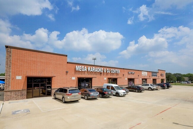

This Property Is For Sale
NEARBY LISTINGS FOR SALE OR LEASE
Property Detail
14929 Westpark Dr
1097330010003
Clayton Sec 1 Par R/P
Stripcommercialcenter
RES A1 BLK 1 CLAYTON SEC 1 PAR R/P
AE
Harris
48157C0175L
Texas
2024
0.91 AC
2025
Far Katy South
454303
Houston
11,960 SF
Houston-The Woodlands-Sugar Land, TX
DEMOGRAPHICS near 14929 Westpark Dr
1 Mile
3 Mile
5 Mile
2024 Total Population
20,287
139,020
356,035
2029 Population
20,585
147,004
381,825
Pop Growth 2024-2029
+ 1.47%
+ 5.74%
+ 7.24%
Average Age
37
37
37
2024 Total Households
7,029
47,971
124,372
HH Growth 2024-2029
+ 1.35%
+ 5.21%
+ 6.60%
Median Household Inc
$55,935
$56,745
$64,120
Avg Household Size
2.80
2.80
2.80
2024 Avg HH Vehicles
2.00
2.00
2.00
Median Home Value
$173,168
$201,784
$243,376
Median Year Built
1991
1989
1991
Nearby Places
Map Layers
Map Styles
 Street
 Aerial
- Restaurants
- Banks
- Shops
- Fitness
- Groceries
PUBLIC TRANSPORTATION
AIRPORT
William P Hobby
DRIVE
WALK
Distance
William P Hobby
47 min
29.6 mi
George Bush Intcntl/Houston
DRIVE
WALK
Distance
George Bush Intcntl/Houston
49 min
38.1 mi
Freight Ports
Port of Houston
DRIVE
WALK
Distance
Port of Houston
43 min
28.9 mi
Nearby Properties
Address
Land Use
TOTAL SIZE
Lot Size
Zoning
Address
Land Use
TOTAL SIZE
Lot Size
Zoning
1,376,776 SF
113.43 AC
Address
Land Use
TOTAL SIZE
Lot Size
Zoning
403,080 SF
19.17 AC
Address
Land Use
TOTAL SIZE
Lot Size
Zoning
403,650 SF
20.19 AC
Address
Land Use
TOTAL SIZE
Lot Size
Zoning
488,573 SF
20.57 AC
Address
Land Use
TOTAL SIZE
Lot Size
Zoning
499,216 SF
6.30 AC
Address
Land Use
TOTAL SIZE
Lot Size
Zoning
489,192 SF
23.11 AC
Address
Land Use
TOTAL SIZE
Lot Size
Zoning
359,116 SF
15.35 AC
Address
Land Use
TOTAL SIZE
Lot Size
Zoning
386,068 SF
18.36 AC
Address
Land Use
TOTAL SIZE
Lot Size
Zoning
288,868 SF
9.37 AC
Address
Land Use
TOTAL SIZE
Lot Size
Zoning
370,358 SF
9.96 AC
Address
Land Use
TOTAL SIZE
Lot Size
Zoning
370,132 SF
9.56 AC
Address
Land Use
TOTAL SIZE
Lot Size
Zoning
421,435 SF
22.30 AC
Address
Land Use
TOTAL SIZE
Lot Size
Zoning
272,659 SF
12.30 AC
Address
Land Use
TOTAL SIZE
Lot Size
Zoning
526,945 SF
23.05 AC
Address
Land Use
TOTAL SIZE
Lot Size
Zoning
325,312 SF
13.66 AC
Address
Land Use
TOTAL SIZE
Lot Size
Zoning
363,177 SF
36.37 AC
YOS
Address
Land Use
TOTAL SIZE
Lot Size
Zoning
234,545 SF
10.42 AC
Address
Land Use
TOTAL SIZE
Lot Size
Zoning
690,119 SF
23 AC
Address
Land Use
TOTAL SIZE
Lot Size
Zoning
425,887 SF
26.70 AC
Address
Land Use
TOTAL SIZE
Lot Size
Zoning
364,571 SF
19.23 AC
Address
Land Use
TOTAL SIZE
Lot Size
Zoning
425,069 SF
25.14 AC
Address
Land Use
TOTAL SIZE
Lot Size
Zoning
258,125 SF
11.29 AC
Address
Land Use
TOTAL SIZE
Lot Size
Zoning
286,285 SF
11.78 AC
Address
Land Use
TOTAL SIZE
Lot Size
Zoning
419,988 SF
13.09 AC
Address
Land Use
TOTAL SIZE
Lot Size
Zoning
443,209 SF
25.13 AC
Address
Land Use
TOTAL SIZE
Lot Size
Zoning
189,521 SF
4.59 AC
Address
Land Use
TOTAL SIZE
Lot Size
Zoning
297,095 SF
Address
Land Use
TOTAL SIZE
Lot Size
Zoning
332,872 SF
13 AC
Address
Land Use
TOTAL SIZE
Lot Size
Zoning
256,199 SF
11.21 AC
Address
Land Use
TOTAL SIZE
Lot Size
Zoning
305,370 SF
11.49 AC
The World's #1 Commercial Real Estate Marketplace
Connect with us
© 2025 CoStar Group
The information above has been obtained from sources believed reliable. While we do not doubt its accuracy we have not verified it and make no guarantee, warranty or representation about it. It is your responsibility to independently confirm its accuracy and completeness. Any projections, opinions, assumptions, or estimates used are for example only and do not represent the current or future performance of the property. The value of this transaction to you depends on tax and other factors which should be evaluated by your tax, financial, and legal advisors. You and your advisors should conduct a careful, independent investigation of the property to determine to your satisfaction the suitability of the property for your needs.