Property Record
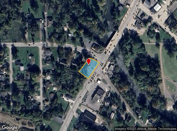
14931 Telegraph Rd, Flat Rock, MI 48134
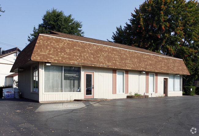
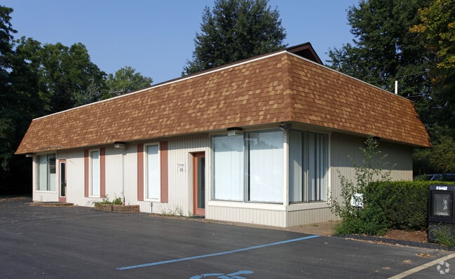
This Property Is For Sale
NEARBY LISTINGS FOR SALE OR LEASE
-
-
View all Flat Rock listings for sale on LoopNet.com
Property Detail
14931 Telegraph Rd
03-006-120-00
BR6-28B 781-801 833-992 SEC 6 T5S R10E .47 AC COM AT A PT ON S LI OF WILL-CARLETON RD S 89 DEG 35'50"E 1686.57 FT & S 0 DEG
Officebuilding
Monroe
X
Michigan
26115C0108E
0.47 AC
2025
Monroe County
2025
Detroit
830100
Monroe, MI
1,596 SF
DEMOGRAPHICS near 14931 Telegraph Rd
1 Mile
3 Mile
5 Mile
2024 Total Population
3,102
25,857
64,405
2029 Population
3,015
25,112
62,263
Pop Growth 2024-2029
(2.80%)
(2.88%)
(3.33%)
Average Age
41
41
42
2024 Total Households
1,211
10,143
25,489
HH Growth 2024-2029
(2.73%)
(2.82%)
(3.30%)
Median Household Inc
$70,044
$80,169
$78,698
Avg Household Size
2.60
2.50
2.50
2024 Avg HH Vehicles
2.00
2.00
2.00
Median Home Value
$208,259
$233,003
$232,843
Median Year Built
1959
1988
1986
Nearby Places
Map Layers
Map Styles
 Street
 Aerial
- Restaurants
- Banks
- Shops
- Fitness
- Groceries
PUBLIC TRANSPORTATION
AIRPORT
Detroit Metro Wayne County
DRIVE
WALK
Distance
Detroit Metro Wayne County
25 min
15.2 mi
Windsor International
DRIVE
WALK
Distance
Windsor International
51 min
31.4 mi
Nearby Properties
Address
Land Use
TOTAL SIZE
Lot Size
Zoning
Address
Land Use
TOTAL SIZE
Lot Size
Zoning
3,189,689 SF
228.88 AC
Address
Land Use
TOTAL SIZE
Lot Size
Zoning
215,724 SF
Address
Land Use
TOTAL SIZE
Lot Size
Zoning
249,836 SF
22.18 AC
AG
Address
Land Use
TOTAL SIZE
Lot Size
Zoning
1,021,918 SF
163.58 AC
Address
Land Use
TOTAL SIZE
Lot Size
Zoning
3,280 SF
99.72 AC
Address
Land Use
TOTAL SIZE
Lot Size
Zoning
33,600 SF
100.03 AC
Address
Land Use
TOTAL SIZE
Lot Size
Zoning
307,181 SF
22.32 AC
Address
Land Use
TOTAL SIZE
Lot Size
Zoning
179,235 SF
25.38 AC
Address
Land Use
TOTAL SIZE
Lot Size
Zoning
95,650 SF
73.78 AC
Address
Land Use
TOTAL SIZE
Lot Size
Zoning
52.37 AC
Address
Land Use
TOTAL SIZE
Lot Size
Zoning
3,520 SF
62.97 AC
MHP MOB
Address
Land Use
TOTAL SIZE
Lot Size
Zoning
3,870 SF
38.38 AC
Address
Land Use
TOTAL SIZE
Lot Size
Zoning
146,300 SF
25.84 AC
Address
Land Use
TOTAL SIZE
Lot Size
Zoning
69,938 SF
1.74 AC
Address
Land Use
TOTAL SIZE
Lot Size
Zoning
114,165 SF
13.07 AC
Address
Land Use
TOTAL SIZE
Lot Size
Zoning
124,102 SF
17.09 AC
Address
Land Use
TOTAL SIZE
Lot Size
Zoning
44.13 AC
MHP MOB
Address
Land Use
TOTAL SIZE
Lot Size
Zoning
30,719 SF
9.93 AC
AG AGRI
Address
Land Use
TOTAL SIZE
Lot Size
Zoning
18,520 SF
326.27 AC
Address
Land Use
TOTAL SIZE
Lot Size
Zoning
130,627 SF
20.42 AC
Address
Land Use
TOTAL SIZE
Lot Size
Zoning
40.40 AC
PUD
Address
Land Use
TOTAL SIZE
Lot Size
Zoning
134,191 SF
14.29 AC
Address
Land Use
TOTAL SIZE
Lot Size
Zoning
13.01 AC
RM-1
Address
Land Use
TOTAL SIZE
Lot Size
Zoning
7,222 SF
58.71 AC
Address
Land Use
TOTAL SIZE
Lot Size
Zoning
32,268 SF
4.20 AC
Address
Land Use
TOTAL SIZE
Lot Size
Zoning
7.13 AC
RM-1
Address
Land Use
TOTAL SIZE
Lot Size
Zoning
176,644 SF
8.78 AC
Address
Land Use
TOTAL SIZE
Lot Size
Zoning
1,999 SF
48.96 AC
R-1
Address
Land Use
TOTAL SIZE
Lot Size
Zoning
79,930 SF
6.36 AC
Address
Land Use
TOTAL SIZE
Lot Size
Zoning
18,185 SF
The World's #1 Commercial Real Estate Marketplace
Connect with us
© 2026 CoStar Group
The information above has been obtained from sources believed reliable. While we do not doubt its accuracy we have not verified it and make no guarantee, warranty or representation about it. It is your responsibility to independently confirm its accuracy and completeness. Any projections, opinions, assumptions, or estimates used are for example only and do not represent the current or future performance of the property. The value of this transaction to you depends on tax and other factors which should be evaluated by your tax, financial, and legal advisors. You and your advisors should conduct a careful, independent investigation of the property to determine to your satisfaction the suitability of the property for your needs.