Property Record
14936 Highway 119, Black Hawk, CO 80422
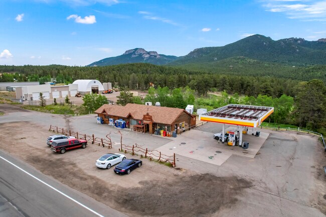


Property Detail
14936 Highway 119
R006385
S: 20 T: 2S R: 72W PARCEL IN NE1/4 DESC 248/458 & 269/431 & IMPS
Commercialnec
Gilpin
B and X Area of moderate flood hazard, usually the area between the limits of the 100-year and 500-year floods.
Colorado
2025
1 AC
2025
Southwest Outlying
013802
Denver
2,016 SF
Denver-Aurora-Centennial, CO
NEARBY LISTINGS FOR SALE OR LEASE
-
-
View all Black Hawk listings for sale on LoopNet.com
DEMOGRAPHICS near 14936 Highway 119
1 mile
3 mile
5 mile
2025 Total Population
918
3,252
5,389
2030 Population
938
3,333
5,509
Pop Growth 2025-2030
+ 2.18%
+ 2.49%
+ 2.23%
Average Age
44
46
46
2025 Total Households
401
1,440
2,394
HH Growth 2025-2030
+ 2.49%
+ 2.85%
+ 2.51%
Median Household Inc
$104,775
$101,610
$101,241
Avg Household Size
2.30
2.20
2.20
2025 Avg HH Vehicles
2.00
2.00
2.00
Median Home Value
$555,555
$608,911
$621,668
Median Year Built
1988
1989
1989
Nearby Places
Map Layers
Map Styles
 Street
 Aerial
Layers
 Traffic
 Biking
Places
Listings with unknown addresses are not visible on the map
- Restaurants
- Banks
- Shops
- Fitness
- Groceries
SALE & LEASE HISTORY
LISTING DATE
SALE/LEASE

Jun 30, 2022
For Sale
Nearby Properties
Address
Land Use
TOTAL SIZE
Lot Size
Zoning
Address
Land Use
TOTAL SIZE
Lot Size
Zoning
56,149 SF
2.40 AC
Address
Land Use
TOTAL SIZE
Lot Size
Zoning
1,680 SF
27.71 AC
Address
Land Use
TOTAL SIZE
Lot Size
Zoning
24,592 SF
17.98 AC
Address
Land Use
TOTAL SIZE
Lot Size
Zoning
1.84 AC
Address
Land Use
TOTAL SIZE
Lot Size
Zoning
4,260 SF
0.36 AC
Address
Land Use
TOTAL SIZE
Lot Size
Zoning
Address
Land Use
TOTAL SIZE
Lot Size
Zoning
24,532 SF
3.70 AC
Address
Land Use
TOTAL SIZE
Lot Size
Zoning
0.76 AC
Address
Land Use
TOTAL SIZE
Lot Size
Zoning
7,138 SF
1 AC
Address
Land Use
TOTAL SIZE
Lot Size
Zoning
7,157 SF
2.27 AC
Address
Land Use
TOTAL SIZE
Lot Size
Zoning
5,266 SF
14.23 AC
Address
Land Use
TOTAL SIZE
Lot Size
Zoning
7,144 SF
2 AC
Address
Land Use
TOTAL SIZE
Lot Size
Zoning
2,544 SF
1.56 AC
Address
Land Use
TOTAL SIZE
Lot Size
Zoning
3,880 SF
1.95 AC
Address
Land Use
TOTAL SIZE
Lot Size
Zoning
2,400 SF
21.46 AC
Address
Land Use
TOTAL SIZE
Lot Size
Zoning
3,456 SF
0.79 AC
Address
Land Use
TOTAL SIZE
Lot Size
Zoning
1,020 SF
0.94 AC
Address
Land Use
TOTAL SIZE
Lot Size
Zoning
5,339 SF
10 AC
Address
Land Use
TOTAL SIZE
Lot Size
Zoning
4,616 SF
3.43 AC
Address
Land Use
TOTAL SIZE
Lot Size
Zoning
9,170 SF
20 AC
Address
Land Use
TOTAL SIZE
Lot Size
Zoning
7,700 SF
1 AC
Address
Land Use
TOTAL SIZE
Lot Size
Zoning
Address
Land Use
TOTAL SIZE
Lot Size
Zoning
0.19 AC
Address
Land Use
TOTAL SIZE
Lot Size
Zoning
4,950 SF
2.70 AC
Address
Land Use
TOTAL SIZE
Lot Size
Zoning
2,400 SF
0.98 AC
Address
Land Use
TOTAL SIZE
Lot Size
Zoning
8.10 AC
Address
Land Use
TOTAL SIZE
Lot Size
Zoning
3.94 AC
The World's #1 Commercial Real Estate Marketplace
Connect with us
© 2026 CoStar Group
The information above has been obtained from sources believed reliable. While we do not doubt its accuracy we have not verified it and make no guarantee, warranty or representation about it. It is your responsibility to independently confirm its accuracy and completeness. Any projections, opinions, assumptions, or estimates used are for example only and do not represent the current or future performance of the property. The value of this transaction to you depends on tax and other factors which should be evaluated by your tax, financial, and legal advisors. You and your advisors should conduct a careful, independent investigation of the property to determine to your satisfaction the suitability of the property for your needs.