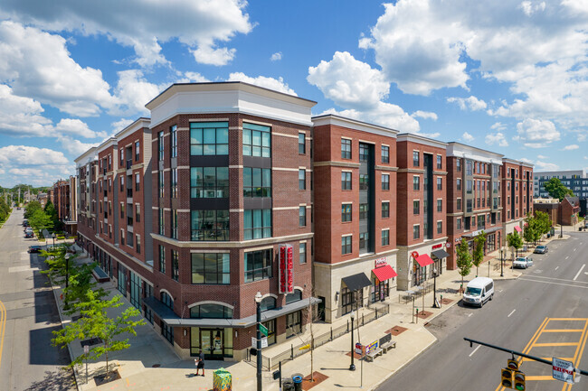
Property Record
1494 N High St, Columbus, OH 43201

Save to a Folder
{{folder.Name}}
{{folder.ListingIds.length}} Properties
{{folder.ListingIds.length}} Property
Create a New Folder
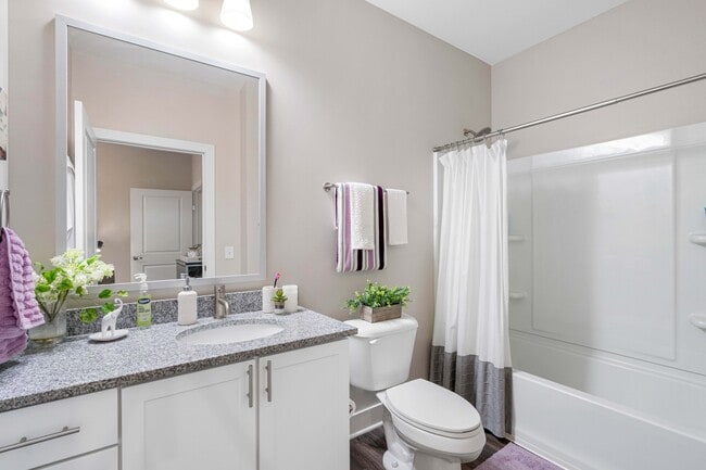
Current Lease Availabilities
Property Detail
1494 N High St
Columbus, OH
SOUTH OF GATEWAY LOT 1 EX IRR SW SEC
010-294232
Franklin
Apartment
Ohio
B and X Area of moderate flood hazard, usually the area between the limits of the 100-year and 500-year floods.
1
2024
2 AC
2025
Weinland Park
001700
Columbus
325,684 SF
NEARBY LISTINGS FOR SALE OR LEASE
DEMOGRAPHICS near 1494 N High St
1 mile
3 mile
5 mile
2025 Total Population
53,328
187,069
403,971
2030 Population
55,728
195,340
420,936
Pop Growth 2025-2030
+ 4.50%
+ 4.42%
+ 4.20%
Average Age
29
34
36
2025 Total Households
18,635
83,864
173,584
HH Growth 2025-2030
+ 5.46%
+ 4.69%
+ 4.40%
Median Household Inc
$50,176
$57,916
$60,362
Avg Household Size
2.00
2.00
2.10
2025 Avg HH Vehicles
2.00
1.00
2.00
Median Home Value
$465,719
$378,015
$335,350
Median Year Built
1981
1965
1959
Nearby Places
Map Layers
Map Styles
 Street
 Aerial
Layers
 Traffic
 Biking
Places
Listings with unknown addresses are not visible on the map
- Restaurants
- Banks
- Shops
- Fitness
- Groceries
PUBLIC TRANSPORTATION
AIRPORT
John Glenn Columbus International
Drive
Walk
Distance
John Glenn Columbus International
14 min
7.9 mi
Rickenbacker International
Drive
Walk
Distance
Rickenbacker International
27 min
17.0 mi
Freight Ports
Port of Toledo
Drive
Walk
Distance
Port of Toledo
183 min
142.9 mi
Nearby Properties
Address
Land Use
TOTAL SIZE
Lot Size
Zoning
Address
Land Use
TOTAL SIZE
Lot Size
Zoning
1,160,461 SF
328.10 AC
Address
Land Use
TOTAL SIZE
Lot Size
Zoning
3,462,019 SF
54.42 AC
Address
Land Use
TOTAL SIZE
Lot Size
Zoning
1,949,795 SF
20.56 AC
Address
Land Use
TOTAL SIZE
Lot Size
Zoning
344,620 SF
291.96 AC
Address
Land Use
TOTAL SIZE
Lot Size
Zoning
29,312 SF
10.72 AC
Address
Land Use
TOTAL SIZE
Lot Size
Zoning
717,666 SF
17.99 AC
Address
Land Use
TOTAL SIZE
Lot Size
Zoning
838,846 SF
3.73 AC
Address
Land Use
TOTAL SIZE
Lot Size
Zoning
13.50 AC
Address
Land Use
TOTAL SIZE
Lot Size
Zoning
382,270 SF
319.59 AC
Address
Land Use
TOTAL SIZE
Lot Size
Zoning
Address
Land Use
TOTAL SIZE
Lot Size
Zoning
304,340 SF
3.86 AC
Address
Land Use
TOTAL SIZE
Lot Size
Zoning
798,272 SF
9.94 AC
Address
Land Use
TOTAL SIZE
Lot Size
Zoning
832,673 SF
2.87 AC
Address
Land Use
TOTAL SIZE
Lot Size
Zoning
1,099,074 SF
39.47 AC
Address
Land Use
TOTAL SIZE
Lot Size
Zoning
972,594 SF
0.84 AC
Address
Land Use
TOTAL SIZE
Lot Size
Zoning
302,079 SF
77.95 AC
Address
Land Use
TOTAL SIZE
Lot Size
Zoning
385,225 SF
5.89 AC
Address
Land Use
TOTAL SIZE
Lot Size
Zoning
481,704 SF
0.92 AC
Address
Land Use
TOTAL SIZE
Lot Size
Zoning
479,979 SF
5.43 AC
Address
Land Use
TOTAL SIZE
Lot Size
Zoning
1,113,919 SF
1.63 AC
Address
Land Use
TOTAL SIZE
Lot Size
Zoning
1,462,053 SF
0.21 AC
Address
Land Use
TOTAL SIZE
Lot Size
Zoning
484,662 SF
2.28 AC
Address
Land Use
TOTAL SIZE
Lot Size
Zoning
501,624 SF
1.23 AC
Address
Land Use
TOTAL SIZE
Lot Size
Zoning
470,630 SF
0.57 AC
Address
Land Use
TOTAL SIZE
Lot Size
Zoning
1,013,906 SF
1 AC
Address
Land Use
TOTAL SIZE
Lot Size
Zoning
1,158,978 SF
5.02 AC
Address
Land Use
TOTAL SIZE
Lot Size
Zoning
669,626 SF
0.97 AC
Address
Land Use
TOTAL SIZE
Lot Size
Zoning
892,833 SF
5.27 AC
Address
Land Use
TOTAL SIZE
Lot Size
Zoning
388,082 SF
12.41 AC
Address
Land Use
TOTAL SIZE
Lot Size
Zoning
1.64 AC
The World's #1 Commercial Real Estate Marketplace
Connect with us
© 2026 CoStar Group
The information above has been obtained from sources believed reliable. While we do not doubt its accuracy we have not verified it and make no guarantee, warranty or representation about it. It is your responsibility to independently confirm its accuracy and completeness. Any projections, opinions, assumptions, or estimates used are for example only and do not represent the current or future performance of the property. The value of this transaction to you depends on tax and other factors which should be evaluated by your tax, financial, and legal advisors. You and your advisors should conduct a careful, independent investigation of the property to determine to your satisfaction the suitability of the property for your needs.