Property Record
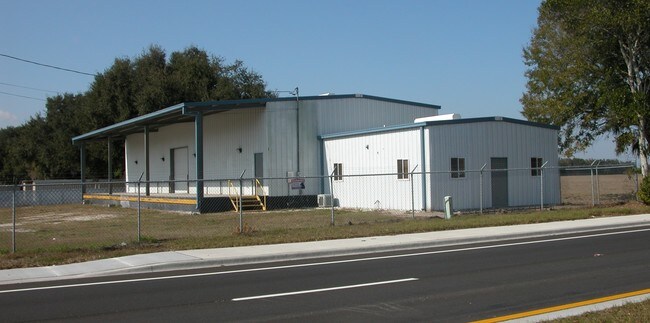
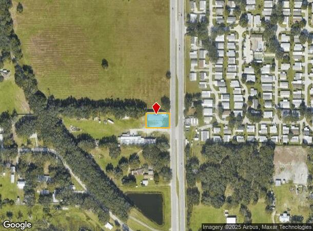
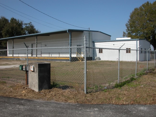
1495 Berkley Rd, Auburndale, FL 33823
NEARBY LISTINGS FOR SALE OR LEASE
Property Detail
1495 Berkley Rd
25-28-04-000000-032030
Bohannon Lane Props
Lightindustrial
N 100 FT OF E 233.25 FT OF S 225 FT N1/2 OF SE1/4 OF NW1/4 LESS ST RD S-655 & LESS ADDL R/W FOR BERKLEY RD R/W PCL 139 AS DESC IN OR 7630 PG 0324
X
Polk
12105C0330G
Florida
2024
0.37 AC
2025
Polk County
013102
Tampa/St Petersburg
4,020 SF
Lakeland-Winter Haven, FL
DEMOGRAPHICS near 1495 Berkley Rd
1 Mile
3 Mile
5 Mile
2024 Total Population
4,617
29,351
59,939
2029 Population
5,573
35,443
72,613
Pop Growth 2024-2029
+ 20.71%
+ 20.76%
+ 21.14%
Average Age
41
41
41
2024 Total Households
1,799
10,980
22,816
HH Growth 2024-2029
+ 20.62%
+ 20.64%
+ 21.06%
Median Household Inc
$58,210
$61,388
$57,629
Avg Household Size
2.60
2.60
2.60
2024 Avg HH Vehicles
2.00
2.00
2.00
Median Home Value
$233,473
$202,017
$195,871
Median Year Built
1985
1989
1988
Nearby Places
Map Layers
Map Styles
 Street
 Aerial
- Restaurants
- Banks
- Shops
- Fitness
- Groceries
PUBLIC TRANSPORTATION
COMMUTER RAIL
Winter Haven (Silver Meteor - Amtrak, Silver Star - Amtrak)
DRIVE
WALK
Distance
Winter Haven (Silver Meteor - Amtrak, Silver Star - Amtrak)
16 min
9.1 mi
Freight Ports
Port of Tampa Bay
DRIVE
WALK
Distance
Port of Tampa Bay
62 min
44.2 mi
Nearby Properties
Address
Land Use
TOTAL SIZE
Lot Size
Zoning
Address
Land Use
TOTAL SIZE
Lot Size
Zoning
831,600 SF
51.22 AC
Address
Land Use
TOTAL SIZE
Lot Size
Zoning
811,392 SF
47.70 AC
Address
Land Use
TOTAL SIZE
Lot Size
Zoning
942,646 SF
91.30 AC
R3
Address
Land Use
TOTAL SIZE
Lot Size
Zoning
275,220 SF
94.53 AC
Address
Land Use
TOTAL SIZE
Lot Size
Zoning
238,721 SF
11.66 AC
GI
Address
Land Use
TOTAL SIZE
Lot Size
Zoning
136,724 SF
4.62 AC
GI
Address
Land Use
TOTAL SIZE
Lot Size
Zoning
108,360 SF
4.23 AC
GI
Address
Land Use
TOTAL SIZE
Lot Size
Zoning
188,553 SF
29.12 AC
Address
Land Use
TOTAL SIZE
Lot Size
Zoning
178,899 SF
10.09 AC
GI
Address
Land Use
TOTAL SIZE
Lot Size
Zoning
291,428 SF
59.34 AC
Address
Land Use
TOTAL SIZE
Lot Size
Zoning
129,567 SF
11.72 AC
C3
Address
Land Use
TOTAL SIZE
Lot Size
Zoning
135,247 SF
22.49 AC
C4
Address
Land Use
TOTAL SIZE
Lot Size
Zoning
91,962 SF
19.46 AC
R4
Address
Land Use
TOTAL SIZE
Lot Size
Zoning
191,975 SF
14.28 AC
HI
Address
Land Use
TOTAL SIZE
Lot Size
Zoning
126,384 SF
4.67 AC
CH
Address
Land Use
TOTAL SIZE
Lot Size
Zoning
160,755 SF
9.94 AC
Address
Land Use
TOTAL SIZE
Lot Size
Zoning
320,765 SF
14.93 AC
GI
Address
Land Use
TOTAL SIZE
Lot Size
Zoning
42,400 SF
121.06 AC
RC
Address
Land Use
TOTAL SIZE
Lot Size
Zoning
106,376 SF
18.36 AC
Address
Land Use
TOTAL SIZE
Lot Size
Zoning
122,260 SF
4.77 AC
Address
Land Use
TOTAL SIZE
Lot Size
Zoning
90,077 SF
12.41 AC
Address
Land Use
TOTAL SIZE
Lot Size
Zoning
84,312 SF
13.64 AC
Address
Land Use
TOTAL SIZE
Lot Size
Zoning
30,568 SF
60.79 AC
RC
Address
Land Use
TOTAL SIZE
Lot Size
Zoning
80,100 SF
4.68 AC
GI
Address
Land Use
TOTAL SIZE
Lot Size
Zoning
30,638 SF
4.22 AC
R3
Address
Land Use
TOTAL SIZE
Lot Size
Zoning
77,279 SF
12.12 AC
Address
Land Use
TOTAL SIZE
Lot Size
Zoning
113,410 SF
19.78 AC
C4
Address
Land Use
TOTAL SIZE
Lot Size
Zoning
58,918 SF
2.44 AC
LI
Address
Land Use
TOTAL SIZE
Lot Size
Zoning
192,825 SF
9.65 AC
LI
Address
Land Use
TOTAL SIZE
Lot Size
Zoning
151,567 SF
6.34 AC
GI
The World's #1 Commercial Real Estate Marketplace
Connect with us
© 2025 CoStar Group
The information above has been obtained from sources believed reliable. While we do not doubt its accuracy we have not verified it and make no guarantee, warranty or representation about it. It is your responsibility to independently confirm its accuracy and completeness. Any projections, opinions, assumptions, or estimates used are for example only and do not represent the current or future performance of the property. The value of this transaction to you depends on tax and other factors which should be evaluated by your tax, financial, and legal advisors. You and your advisors should conduct a careful, independent investigation of the property to determine to your satisfaction the suitability of the property for your needs.