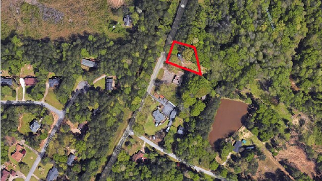
Property Record
1495 Fayetteville Rd W, Jonesboro, GA 30238
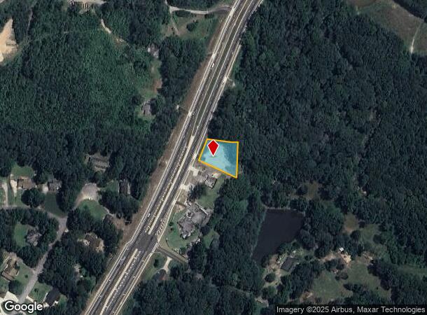
NEARBY LISTINGS FOR SALE OR LEASE
Property Detail
1495 Fayetteville Rd W
05-39-00-001
HWY 54
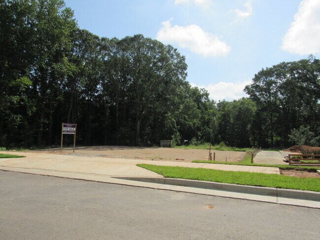
Residentialacreage
Fayette
X
Georgia
13063C0131F
170
2024
0.50 AC
2024
Fayette/Coweta County
140406
Atlanta
1,100 SF
Atlanta-Sandy Springs-Roswell, GA
DEMOGRAPHICS near 1495 Fayetteville Rd W
1 Mile
3 Mile
5 Mile
2024 Total Population
1,880
36,250
121,210
2029 Population
2,002
37,046
123,156
Pop Growth 2024-2029
+ 6.49%
+ 2.20%
+ 1.61%
Average Age
43
39
38
2024 Total Households
679
12,783
42,538
HH Growth 2024-2029
+ 6.48%
+ 2.39%
+ 1.69%
Median Household Inc
$66,542
$61,195
$66,323
Avg Household Size
2.70
2.80
2.80
2024 Avg HH Vehicles
2.00
2.00
2.00
Median Home Value
$265,869
$223,068
$222,901
Median Year Built
1985
1990
1991
Nearby Places
Map Layers
Map Styles
 Street
 Aerial
- Restaurants
- Banks
- Shops
- Fitness
- Groceries
PUBLIC TRANSPORTATION
AIRPORT
Hartsfield - Jackson Atlanta International
DRIVE
WALK
Distance
Hartsfield - Jackson Atlanta International
26 min
14.2 mi
SALE & LEASE HISTORY
LISTING DATE
SALE/LEASE

Aug 24, 2020
For Sale
Aug 09, 2018
For Sale
Nearby Properties
Address
Land Use
TOTAL SIZE
Lot Size
Zoning
Address
Land Use
TOTAL SIZE
Lot Size
Zoning
7,851 SF
94.84 AC
RS180
Address
Land Use
TOTAL SIZE
Lot Size
Zoning
88,509 SF
31.54 AC
C C3
Address
Land Use
TOTAL SIZE
Lot Size
Zoning
80,942 SF
44.16 AC
C CH
Address
Land Use
TOTAL SIZE
Lot Size
Zoning
256 SF
25 AC
PUD
Address
Land Use
TOTAL SIZE
Lot Size
Zoning
232,852 SF
35.39 AC
C C3
Address
Land Use
TOTAL SIZE
Lot Size
Zoning
260,883 SF
21.30 AC
C C3
Address
Land Use
TOTAL SIZE
Lot Size
Zoning
160 SF
19.95 AC
RM
Address
Land Use
TOTAL SIZE
Lot Size
Zoning
112,650 SF
22.78 AC
C RMF15
Address
Land Use
TOTAL SIZE
Lot Size
Zoning
132,197 SF
18 AC
C RMF15
Address
Land Use
TOTAL SIZE
Lot Size
Zoning
210,122 SF
16.77 AC
C C3
Address
Land Use
TOTAL SIZE
Lot Size
Zoning
184,862 SF
21.90 AC
C C3
Address
Land Use
TOTAL SIZE
Lot Size
Zoning
102,653 SF
5.50 AC
ER
Address
Land Use
TOTAL SIZE
Lot Size
Zoning
127,836 SF
14.33 AC
C CH
Address
Land Use
TOTAL SIZE
Lot Size
Zoning
199,132 SF
19.59 AC
C PUD
Address
Land Use
TOTAL SIZE
Lot Size
Zoning
136,320 SF
19.51 AC
C C3
Address
Land Use
TOTAL SIZE
Lot Size
Zoning
19.35 AC
ER
Address
Land Use
TOTAL SIZE
Lot Size
Zoning
65,951 SF
6.70 AC
C C3
Address
Land Use
TOTAL SIZE
Lot Size
Zoning
75,750 SF
10.43 AC
C C3
Address
Land Use
TOTAL SIZE
Lot Size
Zoning
67,801 SF
14 AC
TR
Address
Land Use
TOTAL SIZE
Lot Size
Zoning
73,040 SF
6.01 AC
C RMF15
Address
Land Use
TOTAL SIZE
Lot Size
Zoning
25,980 SF
199.40 AC
Address
Land Use
TOTAL SIZE
Lot Size
Zoning
63,428 SF
7.92 AC
C OI
Address
Land Use
TOTAL SIZE
Lot Size
Zoning
71,768 SF
8.58 AC
C C3
Address
Land Use
TOTAL SIZE
Lot Size
Zoning
67,000 SF
6.39 AC
I M1
Address
Land Use
TOTAL SIZE
Lot Size
Zoning
35,672 SF
3.33 AC
C CH
Address
Land Use
TOTAL SIZE
Lot Size
Zoning
114,926 SF
9.30 AC
C C3
Address
Land Use
TOTAL SIZE
Lot Size
Zoning
100,800 SF
10.56 AC
C C3
Address
Land Use
TOTAL SIZE
Lot Size
Zoning
29,184 SF
7.23 AC
C RMF15
Address
Land Use
TOTAL SIZE
Lot Size
Zoning
96,400 SF
6.67 AC
C CH
Address
Land Use
TOTAL SIZE
Lot Size
Zoning
86,674 SF
8.75 AC
C CH
The World's #1 Commercial Real Estate Marketplace
Connect with us
© 2025 CoStar Group
The information above has been obtained from sources believed reliable. While we do not doubt its accuracy we have not verified it and make no guarantee, warranty or representation about it. It is your responsibility to independently confirm its accuracy and completeness. Any projections, opinions, assumptions, or estimates used are for example only and do not represent the current or future performance of the property. The value of this transaction to you depends on tax and other factors which should be evaluated by your tax, financial, and legal advisors. You and your advisors should conduct a careful, independent investigation of the property to determine to your satisfaction the suitability of the property for your needs.