Property Record
14975 Sw Ns # Ns Ln, Tigard, OR 97224

Property Detail
14975 Sw Ns # Ns Ln
R0481972
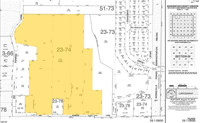
ACRES 19.43
Municipalproperty
WASHINGTON
PR
Oregon
B and X Area of moderate flood hazard, usually the area between the limits of the 100-year and 500-year floods.
19.43 AC
0
Westside Outlying
2026
Portland
15,856 SF
Portland-Vancouver-Hillsboro, OR-WA
NEARBY LISTINGS FOR SALE OR LEASE
DEMOGRAPHICS near 14975 Sw Ns # Ns Ln
1 mile
3 mile
5 mile
2025 Total Population
17,781
101,424
245,498
2030 Population
18,027
102,661
248,237
Pop Growth 2025-2030
+ 1.38%
+ 1.22%
+ 1.12%
Average Age
39
41
41
2025 Total Households
6,443
39,989
95,317
HH Growth 2025-2030
+ 1.49%
+ 1.26%
+ 1.21%
Median Household Inc
$125,629
$108,506
$102,337
Avg Household Size
2.70
2.50
2.50
2025 Avg HH Vehicles
2.00
2.00
2.00
Median Home Value
$699,971
$655,755
$641,359
Median Year Built
1998
1991
1987
Nearby Places
Map Layers
Map Styles
 Street
 Aerial
Transit
 Traffic
 Biking
Places
Listings with unknown addresses are not visible on the map
- Restaurants
- Banks
- Shops
- Fitness
- Groceries
PUBLIC TRANSPORTATION
COMMUTER RAIL
Tigard Transit Center (Westside Express Service - Tri-County Metropolitan Transportation District of Oregon Rail (TriMet Rail))
Drive
Walk
Distance
Tigard Transit Center (Westside Express Service - Tri-County Metropolitan Transportation District of Oregon Rail (TriMet Rail))
10 min
4.2 mi
Hall/Nimbus (Westside Express Service - Tri-County Metropolitan Transportation District of Oregon Rail (TriMet Rail))
Drive
Walk
Distance
Hall/Nimbus (Westside Express Service - Tri-County Metropolitan Transportation District of Oregon Rail (TriMet Rail))
13 min
5.1 mi
AIRPORT
Portland International
Drive
Walk
Distance
Portland International
42 min
24.6 mi
Freight Ports
Port of Portland
Drive
Walk
Distance
Port of Portland
29 min
15.8 mi
Nearby Properties
Address
Land Use
TOTAL SIZE
Lot Size
Zoning
Address
Land Use
TOTAL SIZE
Lot Size
Zoning
354,000 SF
15.82 AC
R1
Address
Land Use
TOTAL SIZE
Lot Size
Zoning
213,947 SF
14.45 AC
TC-MU
Address
Land Use
TOTAL SIZE
Lot Size
Zoning
27.23 AC
MP
Address
Land Use
TOTAL SIZE
Lot Size
Zoning
88,000 SF
15.49 AC
R-4.5
Address
Land Use
TOTAL SIZE
Lot Size
Zoning
256,070 SF
32.39 AC
R7
Address
Land Use
TOTAL SIZE
Lot Size
Zoning
9.12 AC
R-7
Address
Land Use
TOTAL SIZE
Lot Size
Zoning
43,537 SF
3.59 AC
MUC
Address
Land Use
TOTAL SIZE
Lot Size
Zoning
183,133 SF
8.17 AC
R-25
Address
Land Use
TOTAL SIZE
Lot Size
Zoning
158,824 SF
20.71 AC
CC
Address
Land Use
TOTAL SIZE
Lot Size
Zoning
88,000 SF
12.62 AC
R-4.5
Address
Land Use
TOTAL SIZE
Lot Size
Zoning
128,176 SF
25.06 AC
R7
Address
Land Use
TOTAL SIZE
Lot Size
Zoning
20.98 AC
R5
Address
Land Use
TOTAL SIZE
Lot Size
Zoning
301,940 SF
15.04 AC
MU-CBD
Address
Land Use
TOTAL SIZE
Lot Size
Zoning
7.80 AC
R1
Address
Land Use
TOTAL SIZE
Lot Size
Zoning
11.49 AC
R1
Address
Land Use
TOTAL SIZE
Lot Size
Zoning
227,772 SF
17.32 AC
R5
Address
Land Use
TOTAL SIZE
Lot Size
Zoning
157,885 SF
9.88 AC
R-25
Address
Land Use
TOTAL SIZE
Lot Size
Zoning
121,664 SF
11.65 AC
C-G
Address
Land Use
TOTAL SIZE
Lot Size
Zoning
0.09 AC
OI-WS
Address
Land Use
TOTAL SIZE
Lot Size
Zoning
15.11 AC
TC-HDR
Address
Land Use
TOTAL SIZE
Lot Size
Zoning
14.51 AC
R-25
Address
Land Use
TOTAL SIZE
Lot Size
Zoning
22.05 AC
MP
Address
Land Use
TOTAL SIZE
Lot Size
Zoning
15.60 AC
R2
Address
Land Use
TOTAL SIZE
Lot Size
Zoning
225,780 SF
10.01 AC
R-24
Address
Land Use
TOTAL SIZE
Lot Size
Zoning
185,000 SF
5.29 AC
R2
Address
Land Use
TOTAL SIZE
Lot Size
Zoning
13.76 AC
RMH
Address
Land Use
TOTAL SIZE
Lot Size
Zoning
154,155 SF
15.05 AC
TC-HDR
Address
Land Use
TOTAL SIZE
Lot Size
Zoning
54,150 SF
6.54 AC
R-12
The World's #1 Commercial Real Estate Marketplace
Connect with us
© 2026 CoStar Group
The information above has been obtained from sources believed reliable. While we do not doubt its accuracy we have not verified it and make no guarantee, warranty or representation about it. It is your responsibility to independently confirm its accuracy and completeness. Any projections, opinions, assumptions, or estimates used are for example only and do not represent the current or future performance of the property. The value of this transaction to you depends on tax and other factors which should be evaluated by your tax, financial, and legal advisors. You and your advisors should conduct a careful, independent investigation of the property to determine to your satisfaction the suitability of the property for your needs.