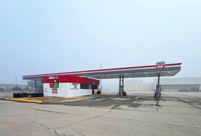
Property Record
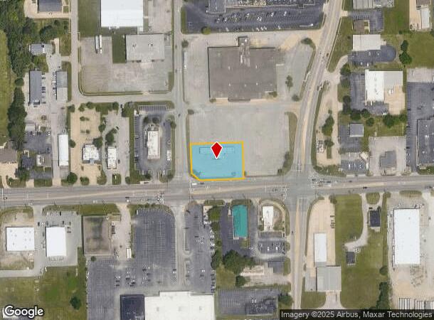
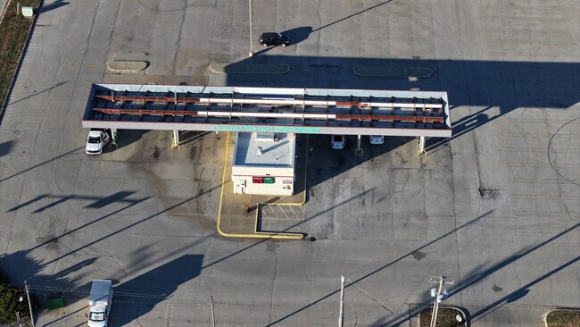
1420 E Pershing Rd, Decatur, IL 62526
Current Lease Availabilities
NEARBY LISTINGS FOR SALE OR LEASE
Property Detail
1420 E Pershing Rd
Decatur, IL
Robert C Johnston Add
07-07-35-480-017
ROBERT C JOHNSTON ADD ~LT 2
Commercialnec
Macon
X
Illinois
17115C0189E
2
2024
0.77 AC
2024
Springfield/Decatur
002906
Other Market Areas
DEMOGRAPHICS near 1420 E Pershing Rd
1 Mile
3 Mile
5 Mile
2024 Total Population
4,012
43,716
73,438
2029 Population
3,892
42,914
71,699
Pop Growth 2024-2029
(2.99%)
(1.83%)
(2.37%)
Average Age
40
40
41
2024 Total Households
2,084
19,290
31,944
HH Growth 2024-2029
(2.98%)
(1.95%)
(2.46%)
Median Household Inc
$27,519
$37,093
$42,887
Avg Household Size
1.90
2.10
2.10
2024 Avg HH Vehicles
1.00
1.00
2.00
Median Home Value
$68,060
$76,459
$92,591
Median Year Built
1973
1960
1961
Nearby Places
Map Layers
Map Styles
 Street
 Aerial
- Restaurants
- Banks
- Shops
- Fitness
- Groceries
PUBLIC TRANSPORTATION
AIRPORT
University of Illinois/Willard
DRIVE
WALK
Distance
University of Illinois/Willard
61 min
47.6 mi
Nearby Properties
Address
Land Use
TOTAL SIZE
Lot Size
Zoning
Address
Land Use
TOTAL SIZE
Lot Size
Zoning
10 AC
MUNICIPAL
Address
Land Use
TOTAL SIZE
Lot Size
Zoning
38.36 AC
MUNICIPAL
Address
Land Use
TOTAL SIZE
Lot Size
Zoning
87.31 AC
MUNICIPAL
Address
Land Use
TOTAL SIZE
Lot Size
Zoning
107.54 AC
MUNICIPAL
Address
Land Use
TOTAL SIZE
Lot Size
Zoning
76.02 AC
MUNICIPAL
Address
Land Use
TOTAL SIZE
Lot Size
Zoning
68.23 AC
MUNICIPAL
Address
Land Use
TOTAL SIZE
Lot Size
Zoning
12.21 AC
MUNICIPAL
Address
Land Use
TOTAL SIZE
Lot Size
Zoning
1.03 AC
MUNICIPAL
Address
Land Use
TOTAL SIZE
Lot Size
Zoning
13.75 AC
MUNICIPAL
Address
Land Use
TOTAL SIZE
Lot Size
Zoning
207,420 SF
12.41 AC
MUNICIPAL
Address
Land Use
TOTAL SIZE
Lot Size
Zoning
1.40 AC
MUNICIPAL
Address
Land Use
TOTAL SIZE
Lot Size
Zoning
6.60 AC
MUNICIPAL
Address
Land Use
TOTAL SIZE
Lot Size
Zoning
1,604 SF
12.80 AC
MUNICIPAL
Address
Land Use
TOTAL SIZE
Lot Size
Zoning
3.88 AC
MUNICIPAL
Address
Land Use
TOTAL SIZE
Lot Size
Zoning
17.82 AC
MUNICIPAL
Address
Land Use
TOTAL SIZE
Lot Size
Zoning
13.92 AC
MUNICIPAL
Address
Land Use
TOTAL SIZE
Lot Size
Zoning
12.24 AC
MUNICIPAL
Address
Land Use
TOTAL SIZE
Lot Size
Zoning
6.68 AC
MUNICIPAL
Address
Land Use
TOTAL SIZE
Lot Size
Zoning
23.56 AC
MUNICIPAL
Address
Land Use
TOTAL SIZE
Lot Size
Zoning
18.50 AC
MUNICIPAL
Address
Land Use
TOTAL SIZE
Lot Size
Zoning
6.89 AC
MUNICIPAL
Address
Land Use
TOTAL SIZE
Lot Size
Zoning
19.95 AC
MUNICIPAL
Address
Land Use
TOTAL SIZE
Lot Size
Zoning
7.82 AC
MUNICIPAL
Address
Land Use
TOTAL SIZE
Lot Size
Zoning
3.35 AC
MUNICIPAL
Address
Land Use
TOTAL SIZE
Lot Size
Zoning
3.55 AC
MUNICIPAL
Address
Land Use
TOTAL SIZE
Lot Size
Zoning
14.66 AC
MUNICIPAL
Address
Land Use
TOTAL SIZE
Lot Size
Zoning
13.04 AC
MUNICIPAL
Address
Land Use
TOTAL SIZE
Lot Size
Zoning
20 AC
MUNICIPAL
Address
Land Use
TOTAL SIZE
Lot Size
Zoning
25.59 AC
MUNICIPAL
The World's #1 Commercial Real Estate Marketplace
Connect with us
© 2026 CoStar Group
The information above has been obtained from sources believed reliable. While we do not doubt its accuracy we have not verified it and make no guarantee, warranty or representation about it. It is your responsibility to independently confirm its accuracy and completeness. Any projections, opinions, assumptions, or estimates used are for example only and do not represent the current or future performance of the property. The value of this transaction to you depends on tax and other factors which should be evaluated by your tax, financial, and legal advisors. You and your advisors should conduct a careful, independent investigation of the property to determine to your satisfaction the suitability of the property for your needs.