Property Record
1499 E Mccart St, Krum, TX 76249


Property Detail
1499 E Mccart St
Dallas-Fort Worth-Arlington, TX
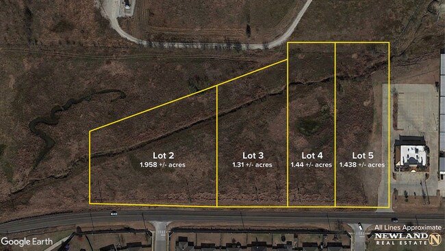
HOPKINS BUSINESS PARK LOT 5 (PT)
R307351
DENTON
Commercialnec
Texas
A Areas with a 1% annual chance of flooding and a 26% chance of flooding over the life of a 30-year mortgage.
5
2024
1.26 AC
2025
Denton
020405
Dallas/Ft Worth
5,000 SF
NEARBY LISTINGS FOR SALE OR LEASE
DEMOGRAPHICS near 1499 E Mccart St
1 mile
3 mile
5 mile
2024 Total Population
5,644
10,973
36,389
2029 Population
6,379
12,491
41,600
Pop Growth 2024-2029
+ 13.02%
+ 13.83%
+ 14.32%
Average Age
37
39
37
2024 Total Households
1,840
3,701
14,806
HH Growth 2024-2029
+ 13.21%
+ 14.05%
+ 14.64%
Median Household Inc
$118,881
$113,402
$74,423
Avg Household Size
3.00
2.90
2.40
2024 Avg HH Vehicles
2.00
2.00
2.00
Median Home Value
$379,324
$382,873
$351,652
Median Year Built
2006
2004
1995
Nearby Places
Map Layers
Map Styles
 Street
 Aerial
Transit
 Traffic
 Biking
Places
Listings with unknown addresses are not visible on the map
- Restaurants
- Banks
- Shops
- Fitness
- Groceries
PUBLIC TRANSPORTATION
COMMUTER RAIL
Downtown Denton Transit Center (A-train - Denton County Transportation Authority)
Drive
Walk
Distance
Downtown Denton Transit Center (A-train - Denton County Transportation Authority)
14 min
8.0 mi
AIRPORT
Dallas-Fort Worth International
Drive
Walk
Distance
Dallas-Fort Worth International
41 min
33.4 mi
Freight Ports
Port of Shreveport
Drive
Walk
Distance
Port of Shreveport
260 min
240.0 mi
SALE & LEASE HISTORY
LISTING DATE
SALE/LEASE

Oct 28, 2016
For Sale
Nearby Properties
Address
Land Use
TOTAL SIZE
Lot Size
Zoning
Address
Land Use
TOTAL SIZE
Lot Size
Zoning
1,121,760 SF
73.87 AC
Address
Land Use
TOTAL SIZE
Lot Size
Zoning
368,434 SF
16.39 AC
Address
Land Use
TOTAL SIZE
Lot Size
Zoning
702,810 SF
37.91 AC
Address
Land Use
TOTAL SIZE
Lot Size
Zoning
374,520 SF
23.62 AC
Address
Land Use
TOTAL SIZE
Lot Size
Zoning
167,850 SF
48.14 AC
Address
Land Use
TOTAL SIZE
Lot Size
Zoning
452,000 SF
23.94 AC
Address
Land Use
TOTAL SIZE
Lot Size
Zoning
367,488 SF
22.80 AC
Address
Land Use
TOTAL SIZE
Lot Size
Zoning
141,468 SF
24.72 AC
Address
Land Use
TOTAL SIZE
Lot Size
Zoning
269,400 SF
22.20 AC
Address
Land Use
TOTAL SIZE
Lot Size
Zoning
164,211 SF
11.95 AC
Address
Land Use
TOTAL SIZE
Lot Size
Zoning
126,126 SF
9.45 AC
Address
Land Use
TOTAL SIZE
Lot Size
Zoning
86,702 SF
15.16 AC
Address
Land Use
TOTAL SIZE
Lot Size
Zoning
247,171 SF
20.30 AC
Address
Land Use
TOTAL SIZE
Lot Size
Zoning
200,794 SF
37.89 AC
Address
Land Use
TOTAL SIZE
Lot Size
Zoning
170,300 SF
19.66 AC
Address
Land Use
TOTAL SIZE
Lot Size
Zoning
337,607 SF
27.76 AC
Address
Land Use
TOTAL SIZE
Lot Size
Zoning
166,705 SF
6.21 AC
Address
Land Use
TOTAL SIZE
Lot Size
Zoning
66,330 SF
30 AC
Address
Land Use
TOTAL SIZE
Lot Size
Zoning
169,320 SF
9.62 AC
Address
Land Use
TOTAL SIZE
Lot Size
Zoning
169,520 SF
8.35 AC
Address
Land Use
TOTAL SIZE
Lot Size
Zoning
123,830 SF
12.26 AC
Address
Land Use
TOTAL SIZE
Lot Size
Zoning
1,094 SF
104.42 AC
Address
Land Use
TOTAL SIZE
Lot Size
Zoning
79,390 SF
3.52 AC
Address
Land Use
TOTAL SIZE
Lot Size
Zoning
58,832 SF
2.18 AC
Address
Land Use
TOTAL SIZE
Lot Size
Zoning
49,891 SF
2.05 AC
Address
Land Use
TOTAL SIZE
Lot Size
Zoning
14,220 SF
14.47 AC
Address
Land Use
TOTAL SIZE
Lot Size
Zoning
75.95 AC
Address
Land Use
TOTAL SIZE
Lot Size
Zoning
13,152 SF
15 AC
Address
Land Use
TOTAL SIZE
Lot Size
Zoning
18,198 SF
16.98 AC
Address
Land Use
TOTAL SIZE
Lot Size
Zoning
66.67 AC
The World's #1 Commercial Real Estate Marketplace
Connect with us
© 2026 CoStar Group
The information above has been obtained from sources believed reliable. While we do not doubt its accuracy we have not verified it and make no guarantee, warranty or representation about it. It is your responsibility to independently confirm its accuracy and completeness. Any projections, opinions, assumptions, or estimates used are for example only and do not represent the current or future performance of the property. The value of this transaction to you depends on tax and other factors which should be evaluated by your tax, financial, and legal advisors. You and your advisors should conduct a careful, independent investigation of the property to determine to your satisfaction the suitability of the property for your needs.