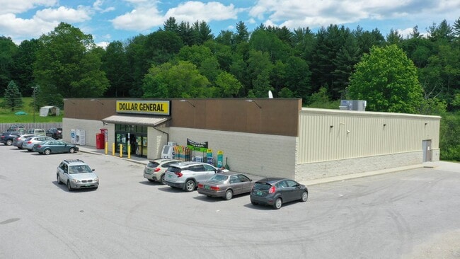
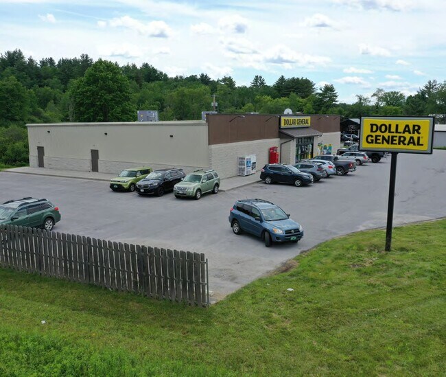
Property Record
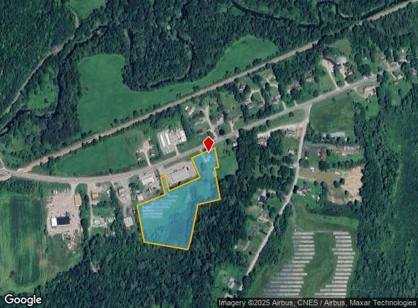
1429 Main St, Castleton, VT 05735
NEARBY LISTINGS FOR SALE OR LEASE
Property Detail
1429 Main St
129-040-10937
HSE/6.39 ACRES; ROUTE 4A LOTS1&3
Multifamilydwelling
Rutland
X
Vermont
50021C0352D
6.39 AC
2024
Vermont South Area
2024
Other Market Areas
963600
Rutland, VT
1,064 SF
DEMOGRAPHICS near 1429 Main St
1 Mile
3 Mile
5 Mile
2024 Total Population
966
3,389
7,439
2029 Population
940
3,322
7,345
Pop Growth 2024-2029
(2.69%)
(1.98%)
(1.26%)
Average Age
38
41
42
2024 Total Households
301
1,184
2,939
HH Growth 2024-2029
(3.32%)
(2.28%)
(1.29%)
Median Household Inc
$39,317
$46,500
$60,223
Avg Household Size
2.10
2.10
2.20
2024 Avg HH Vehicles
2.00
2.00
2.00
Median Home Value
$168,382
$196,456
$181,753
Median Year Built
1966
1971
1968
Nearby Places
Map Layers
Map Styles
 Street
 Aerial
- Restaurants
- Banks
- Shops
- Fitness
- Groceries
PUBLIC TRANSPORTATION
COMMUTER RAIL
Castleton Amtrak Station (Ethan Allen Express - Amtrak)
DRIVE
WALK
Distance
Castleton Amtrak Station (Ethan Allen Express - Amtrak)
2 min
1.2 mi
Freight Ports
Albany, NY Port
DRIVE
WALK
Distance
Albany, NY Port
126 min
90.2 mi
SALE & LEASE HISTORY
LISTING DATE
SALE/LEASE

Nov 29, 2017
For Lease
Nov 27, 2017
For Sale
Jun 29, 2021
For Sale
Nearby Properties
Address
Land Use
TOTAL SIZE
Lot Size
Zoning
Address
Land Use
TOTAL SIZE
Lot Size
Zoning
67.94 AC
CC
Address
Land Use
TOTAL SIZE
Lot Size
Zoning
14.12 AC
CC
Address
Land Use
TOTAL SIZE
Lot Size
Zoning
3.67 AC
Address
Land Use
TOTAL SIZE
Lot Size
Zoning
64,506 SF
42.30 AC
R2A
Address
Land Use
TOTAL SIZE
Lot Size
Zoning
116,820 SF
12.95 AC
I
Address
Land Use
TOTAL SIZE
Lot Size
Zoning
18,175 SF
5.65 AC
R4
Address
Land Use
TOTAL SIZE
Lot Size
Zoning
23,112 SF
4.55 AC
NC
Address
Land Use
TOTAL SIZE
Lot Size
Zoning
14.39 AC
RC
Address
Land Use
TOTAL SIZE
Lot Size
Zoning
4,020 SF
5.09 AC
R4
Address
Land Use
TOTAL SIZE
Lot Size
Zoning
60.28 AC
RC
Address
Land Use
TOTAL SIZE
Lot Size
Zoning
274.20 AC
Address
Land Use
TOTAL SIZE
Lot Size
Zoning
Address
Land Use
TOTAL SIZE
Lot Size
Zoning
47.24 AC
CC
Address
Land Use
TOTAL SIZE
Lot Size
Zoning
5.30 AC
R2A
Address
Land Use
TOTAL SIZE
Lot Size
Zoning
4,875 SF
3.30 AC
VC
Address
Land Use
TOTAL SIZE
Lot Size
Zoning
2.76 AC
R2
Address
Land Use
TOTAL SIZE
Lot Size
Zoning
6.20 AC
RC
Address
Land Use
TOTAL SIZE
Lot Size
Zoning
7.90 AC
Address
Land Use
TOTAL SIZE
Lot Size
Zoning
7 AC
R2A
Address
Land Use
TOTAL SIZE
Lot Size
Zoning
26,400 SF
14 AC
I
Address
Land Use
TOTAL SIZE
Lot Size
Zoning
4,900 SF
0.40 AC
R2
Address
Land Use
TOTAL SIZE
Lot Size
Zoning
9,228 SF
1.13 AC
R2
Address
Land Use
TOTAL SIZE
Lot Size
Zoning
7,805 SF
2.12 AC
RC
Address
Land Use
TOTAL SIZE
Lot Size
Zoning
1.60 AC
R2A
Address
Land Use
TOTAL SIZE
Lot Size
Zoning
5,160 SF
1 AC
VC
Address
Land Use
TOTAL SIZE
Lot Size
Zoning
8.60 AC
VC
Address
Land Use
TOTAL SIZE
Lot Size
Zoning
5.35 AC
R4
Address
Land Use
TOTAL SIZE
Lot Size
Zoning
4,825 SF
20.10 AC
VC
Address
Land Use
TOTAL SIZE
Lot Size
Zoning
9.74 AC
I
Address
Land Use
TOTAL SIZE
Lot Size
Zoning
65.50 AC
The World's #1 Commercial Real Estate Marketplace
Connect with us
© 2026 CoStar Group
The information above has been obtained from sources believed reliable. While we do not doubt its accuracy we have not verified it and make no guarantee, warranty or representation about it. It is your responsibility to independently confirm its accuracy and completeness. Any projections, opinions, assumptions, or estimates used are for example only and do not represent the current or future performance of the property. The value of this transaction to you depends on tax and other factors which should be evaluated by your tax, financial, and legal advisors. You and your advisors should conduct a careful, independent investigation of the property to determine to your satisfaction the suitability of the property for your needs.