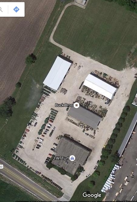
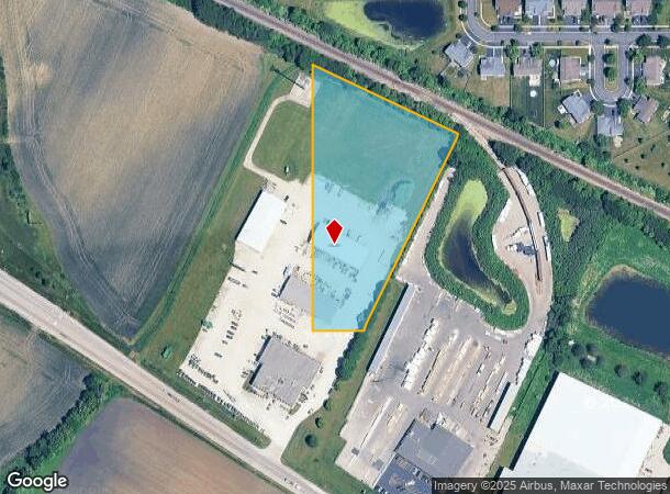
Property Record
14N937 Us Highway 20, Hampshire, IL 60140
NEARBY LISTINGS FOR SALE OR LEASE
Property Detail
14N937 Us Highway 20
02-29-300-004
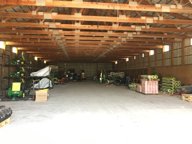
MODEL: 2 POLE SHEDS
Commercialnec
Kane
X
Illinois
17089C0130J
4
2024
4.62 AC
2024
North Kane/I-90
850705
Chicago
18,000 SF
Chicago-Naperville-Elgin, IL-IN-WI
DEMOGRAPHICS near 14N937 Us Highway 20
1 Mile
3 Mile
5 Mile
2024 Total Population
5,381
13,717
37,994
2029 Population
5,306
13,549
37,768
Pop Growth 2024-2029
(1.39%)
(1.22%)
(0.59%)
Average Age
34
37
44
2024 Total Households
1,757
4,634
14,458
HH Growth 2024-2029
(1.48%)
(1.38%)
(0.68%)
Median Household Inc
$113,070
$110,631
$99,357
Avg Household Size
3.10
2.90
2.60
2024 Avg HH Vehicles
2.00
2.00
2.00
Median Home Value
$287,872
$311,549
$319,306
Median Year Built
2007
2005
2003
Nearby Places
Map Layers
Map Styles
 Street
 Aerial
- Restaurants
- Banks
- Shops
- Fitness
- Groceries
PUBLIC TRANSPORTATION
COMMUTER RAIL
Big Timber Road Station (Milwaukee District West Line - Northeast Illinois Regional Commuter Railroad (Metra))
DRIVE
WALK
Distance
Big Timber Road Station (Milwaukee District West Line - Northeast Illinois Regional Commuter Railroad (Metra))
15 min
8.7 mi
AIRPORT
Chicago O'Hare International
DRIVE
WALK
Distance
Chicago O'Hare International
47 min
37.4 mi
Freight Ports
Port Milwaukee
DRIVE
WALK
Distance
Port Milwaukee
123 min
91.1 mi
SALE & LEASE HISTORY
LISTING DATE
SALE/LEASE

Sep 28, 2016
For Lease
Nearby Properties
Address
Land Use
TOTAL SIZE
Lot Size
Zoning
Address
Land Use
TOTAL SIZE
Lot Size
Zoning
Address
Land Use
TOTAL SIZE
Lot Size
Zoning
101,250 SF
17.98 AC
Address
Land Use
TOTAL SIZE
Lot Size
Zoning
Address
Land Use
TOTAL SIZE
Lot Size
Zoning
Address
Land Use
TOTAL SIZE
Lot Size
Zoning
Address
Land Use
TOTAL SIZE
Lot Size
Zoning
Address
Land Use
TOTAL SIZE
Lot Size
Zoning
2,127 SF
5.79 AC
Address
Land Use
TOTAL SIZE
Lot Size
Zoning
16.90 AC
Address
Land Use
TOTAL SIZE
Lot Size
Zoning
1.22 AC
Address
Land Use
TOTAL SIZE
Lot Size
Zoning
20,040 SF
3.96 AC
Address
Land Use
TOTAL SIZE
Lot Size
Zoning
1.51 AC
Address
Land Use
TOTAL SIZE
Lot Size
Zoning
2.01 AC
Address
Land Use
TOTAL SIZE
Lot Size
Zoning
26,420 SF
4.45 AC
Address
Land Use
TOTAL SIZE
Lot Size
Zoning
220 SF
4.36 AC
Address
Land Use
TOTAL SIZE
Lot Size
Zoning
1,955 SF
80 AC
Address
Land Use
TOTAL SIZE
Lot Size
Zoning
11,164 SF
1.70 AC
B3 DISTRIC
Address
Land Use
TOTAL SIZE
Lot Size
Zoning
6,116 SF
0.93 AC
B3 DISTRIC
Address
Land Use
TOTAL SIZE
Lot Size
Zoning
12,000 SF
10.49 AC
B3 DISTRIC
Address
Land Use
TOTAL SIZE
Lot Size
Zoning
7,482 SF
1.12 AC
B1 DISTRIC
Address
Land Use
TOTAL SIZE
Lot Size
Zoning
7,459 SF
1.85 AC
Address
Land Use
TOTAL SIZE
Lot Size
Zoning
Address
Land Use
TOTAL SIZE
Lot Size
Zoning
12,000 SF
2.80 AC
B3 DISTRIC
Address
Land Use
TOTAL SIZE
Lot Size
Zoning
5,120 SF
0.80 AC
B3 DISTRIC
Address
Land Use
TOTAL SIZE
Lot Size
Zoning
495 SF
0.03 AC
Address
Land Use
TOTAL SIZE
Lot Size
Zoning
1,170 SF
5.26 AC
Address
Land Use
TOTAL SIZE
Lot Size
Zoning
13.36 AC
Address
Land Use
TOTAL SIZE
Lot Size
Zoning
1,856 SF
160 AC
Address
Land Use
TOTAL SIZE
Lot Size
Zoning
4,336 SF
0.67 AC
B3 DISTRIC
The World's #1 Commercial Real Estate Marketplace
Connect with us
© 2026 CoStar Group
The information above has been obtained from sources believed reliable. While we do not doubt its accuracy we have not verified it and make no guarantee, warranty or representation about it. It is your responsibility to independently confirm its accuracy and completeness. Any projections, opinions, assumptions, or estimates used are for example only and do not represent the current or future performance of the property. The value of this transaction to you depends on tax and other factors which should be evaluated by your tax, financial, and legal advisors. You and your advisors should conduct a careful, independent investigation of the property to determine to your satisfaction the suitability of the property for your needs.