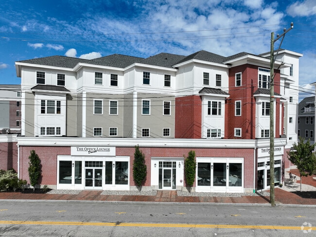
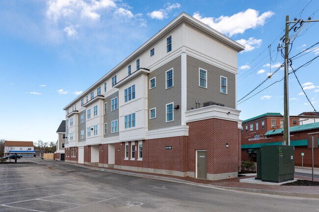
Property Record
15 3Rd St, Dover, NH 03820
NEARBY LISTINGS FOR SALE OR LEASE
Property Detail
15 3Rd St
06054-A00001
Strafford
Commercialnec
New Hampshire
X
1
33017C0310E
0.39 AC
2024
Downtown Dover
2024
Boston
081400
Boston-Cambridge-Newton, MA-NH
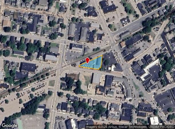
DEMOGRAPHICS near 15 3Rd St
1 Mile
3 Mile
5 Mile
2024 Total Population
13,142
33,148
63,139
2029 Population
13,881
34,754
66,122
Pop Growth 2024-2029
+ 5.62%
+ 4.84%
+ 4.72%
Average Age
38
40
40
2024 Total Households
6,448
15,012
26,448
HH Growth 2024-2029
+ 5.77%
+ 5.02%
+ 4.92%
Median Household Inc
$82,177
$100,618
$95,089
Avg Household Size
2.00
2.10
2.30
2024 Avg HH Vehicles
2.00
2.00
2.00
Median Home Value
$369,751
$366,119
$351,091
Median Year Built
1955
1974
1974
Nearby Places
Map Layers
Map Styles
 Street
 Aerial
- Restaurants
- Banks
- Shops
- Fitness
- Groceries
PUBLIC TRANSPORTATION
COMMUTER RAIL
DRIVE
WALK
Distance
1 min
3 min
0.1 mi
DRIVE
WALK
Distance
15 min
6.9 mi
AIRPORT
Portsmouth International at Pease
DRIVE
WALK
Distance
Portsmouth International at Pease
19 min
10.3 mi
Manchester Boston Regional
DRIVE
WALK
Distance
Manchester Boston Regional
69 min
44.5 mi
Portland International Jetport
DRIVE
WALK
Distance
Portland International Jetport
67 min
46.5 mi
Freight Ports
Portland, ME
DRIVE
WALK
Distance
Portland, ME
68 min
49.1 mi
SALE & LEASE HISTORY
LISTING DATE
SALE/LEASE

Jan 29, 2021
For Lease
Jan 07, 2025
For Lease
Jan 05, 2023
For Lease
Nearby Properties
Address
Land Use
TOTAL SIZE
Lot Size
Zoning
Address
Land Use
TOTAL SIZE
Lot Size
Zoning
24.83 AC
R-20
Address
Land Use
TOTAL SIZE
Lot Size
Zoning
1.26 AC
CBD-G
Address
Land Use
TOTAL SIZE
Lot Size
Zoning
220.20 AC
IT
Address
Land Use
TOTAL SIZE
Lot Size
Zoning
20.03 AC
R-20
Address
Land Use
TOTAL SIZE
Lot Size
Zoning
7.84 AC
C
Address
Land Use
TOTAL SIZE
Lot Size
Zoning
3.66 AC
IT
Address
Land Use
TOTAL SIZE
Lot Size
Zoning
50.52 AC
RM-SU*
Address
Land Use
TOTAL SIZE
Lot Size
Zoning
18.65 AC
B
Address
Land Use
TOTAL SIZE
Lot Size
Zoning
3.40 AC
CBD-M
Address
Land Use
TOTAL SIZE
Lot Size
Zoning
15.46 AC
C
Address
Land Use
TOTAL SIZE
Lot Size
Zoning
19.55 AC
B
Address
Land Use
TOTAL SIZE
Lot Size
Zoning
11.80 AC
R-12*
Address
Land Use
TOTAL SIZE
Lot Size
Zoning
26.40 AC
IT*
Address
Land Use
TOTAL SIZE
Lot Size
Zoning
46.90 AC
R-40
Address
Land Use
TOTAL SIZE
Lot Size
Zoning
77,721 SF
22.63 AC
R1
Address
Land Use
TOTAL SIZE
Lot Size
Zoning
3.35 AC
CBD-G
Address
Land Use
TOTAL SIZE
Lot Size
Zoning
3.66 AC
C
Address
Land Use
TOTAL SIZE
Lot Size
Zoning
7.92 AC
R-12
Address
Land Use
TOTAL SIZE
Lot Size
Zoning
15.46 AC
G
Address
Land Use
TOTAL SIZE
Lot Size
Zoning
0.22 AC
CBD-G
Address
Land Use
TOTAL SIZE
Lot Size
Zoning
4.15 AC
R-12
Address
Land Use
TOTAL SIZE
Lot Size
Zoning
11.08 AC
RM-U
Address
Land Use
TOTAL SIZE
Lot Size
Zoning
112,173 SF
21 AC
CI
Address
Land Use
TOTAL SIZE
Lot Size
Zoning
11.47 AC
IT
Address
Land Use
TOTAL SIZE
Lot Size
Zoning
197,921 SF
RC
Address
Land Use
TOTAL SIZE
Lot Size
Zoning
7.33 AC
G
Address
Land Use
TOTAL SIZE
Lot Size
Zoning
4.15 AC
RM-U
Address
Land Use
TOTAL SIZE
Lot Size
Zoning
12.60 AC
IT
Address
Land Use
TOTAL SIZE
Lot Size
Zoning
9.29 AC
R-12*
Address
Land Use
TOTAL SIZE
Lot Size
Zoning
104,186 SF
21.50 AC
CI
The World's #1 Commercial Real Estate Marketplace
Connect with us
© 2025 CoStar Group
The information above has been obtained from sources believed reliable. While we do not doubt its accuracy we have not verified it and make no guarantee, warranty or representation about it. It is your responsibility to independently confirm its accuracy and completeness. Any projections, opinions, assumptions, or estimates used are for example only and do not represent the current or future performance of the property. The value of this transaction to you depends on tax and other factors which should be evaluated by your tax, financial, and legal advisors. You and your advisors should conduct a careful, independent investigation of the property to determine to your satisfaction the suitability of the property for your needs.