Property Record
15 Amflex Dr, Cranston, RI 02921
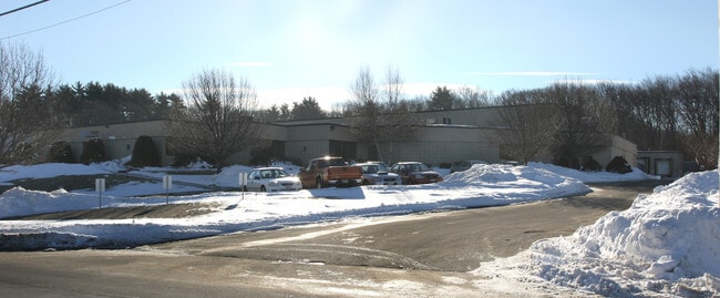

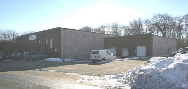
Property Detail
15 Amflex Dr
CRAN-000036-000002-000102
Providence
Industrialgeneral
Rhode Island
M2
102
B and X Area of moderate flood hazard, usually the area between the limits of the 100-year and 500-year floods.
2.01 AC
2025
Cranston
2025
Providence
014600
Providence-Warwick, RI-MA
30,498 SF
NEARBY LISTINGS FOR SALE OR LEASE
DEMOGRAPHICS near 15 Amflex Dr
1 mile
3 mile
5 mile
2025 Total Population
5,110
43,437
208,470
2030 Population
5,333
45,258
214,061
Pop Growth 2025-2030
+ 4.36%
+ 4.19%
+ 2.68%
Average Age
44
44
40
2025 Total Households
1,939
17,932
79,834
HH Growth 2025-2030
+ 4.28%
+ 4.18%
+ 2.74%
Median Household Inc
$114,653
$92,312
$78,643
Avg Household Size
2.60
2.40
2.50
2025 Avg HH Vehicles
2.00
2.00
2.00
Median Home Value
$530,321
$420,003
$365,881
Median Year Built
1987
1975
1956
Nearby Places
Map Layers
Map Styles
 Street
 Aerial
Transit
 Traffic
 Biking
Places
Listings with unknown addresses are not visible on the map
- Restaurants
- Banks
- Shops
- Fitness
- Groceries
PUBLIC TRANSPORTATION
COMMUTER RAIL
Providence (Providence/Stoughton Line - Massachusetts Bay Transportation Authority Commuter Rail (Purple Line))
Drive
Walk
Distance
Providence (Providence/Stoughton Line - Massachusetts Bay Transportation Authority Commuter Rail (Purple Line))
13 min
6.9 mi
Drive
Walk
Distance
14 min
8.5 mi
AIRPORT
Rhode Island Tf Green International
Drive
Walk
Distance
Rhode Island Tf Green International
18 min
9.3 mi
Worcester Regional
Drive
Walk
Distance
Worcester Regional
66 min
48.3 mi
Freight Ports
Port of Davisville, RI
Drive
Walk
Distance
Port of Davisville, RI
29 min
18.6 mi
Nearby Properties
Address
Land Use
TOTAL SIZE
Lot Size
Zoning
Address
Land Use
TOTAL SIZE
Lot Size
Zoning
91.15 AC
PUD
Address
Land Use
TOTAL SIZE
Lot Size
Zoning
4,954 SF
11.22 AC
C5
Address
Land Use
TOTAL SIZE
Lot Size
Zoning
333,161 SF
25.85 AC
B1
Address
Land Use
TOTAL SIZE
Lot Size
Zoning
32.30 AC
I
Address
Land Use
TOTAL SIZE
Lot Size
Zoning
27.47 AC
S1
Address
Land Use
TOTAL SIZE
Lot Size
Zoning
13,542 SF
95.26 AC
R10
Address
Land Use
TOTAL SIZE
Lot Size
Zoning
15.35 AC
MPD
Address
Land Use
TOTAL SIZE
Lot Size
Zoning
12.81 AC
A8
Address
Land Use
TOTAL SIZE
Lot Size
Zoning
11.17 AC
A20
Address
Land Use
TOTAL SIZE
Lot Size
Zoning
105,054 SF
18.73 AC
A6
Address
Land Use
TOTAL SIZE
Lot Size
Zoning
0.97 AC
A12
Address
Land Use
TOTAL SIZE
Lot Size
Zoning
5 AC
A8
Address
Land Use
TOTAL SIZE
Lot Size
Zoning
7.06 AC
R20
Address
Land Use
TOTAL SIZE
Lot Size
Zoning
96.12 AC
I
Address
Land Use
TOTAL SIZE
Lot Size
Zoning
122,836 SF
15.10 AC
R40
Address
Land Use
TOTAL SIZE
Lot Size
Zoning
18,660 SF
7.33 AC
S1
Address
Land Use
TOTAL SIZE
Lot Size
Zoning
8.33 AC
R10
Address
Land Use
TOTAL SIZE
Lot Size
Zoning
98,793 SF
10.34 AC
B1
Address
Land Use
TOTAL SIZE
Lot Size
Zoning
130,899 SF
3.83 AC
C2
Address
Land Use
TOTAL SIZE
Lot Size
Zoning
4.55 AC
M1
Address
Land Use
TOTAL SIZE
Lot Size
Zoning
60,039 SF
18.41 AC
A80
Address
Land Use
TOTAL SIZE
Lot Size
Zoning
8,742 SF
16.26 AC
R40
Address
Land Use
TOTAL SIZE
Lot Size
Zoning
21.86 AC
I
Address
Land Use
TOTAL SIZE
Lot Size
Zoning
80,602 SF
20.30 AC
B2
Address
Land Use
TOTAL SIZE
Lot Size
Zoning
133,311 SF
3.21 AC
R7
Address
Land Use
TOTAL SIZE
Lot Size
Zoning
133.14 AC
R10
Address
Land Use
TOTAL SIZE
Lot Size
Zoning
93,878 SF
14.15 AC
B2
Address
Land Use
TOTAL SIZE
Lot Size
Zoning
153,214 SF
14.37 AC
C4
Address
Land Use
TOTAL SIZE
Lot Size
Zoning
43,809 SF
75.59 AC
S1
Address
Land Use
TOTAL SIZE
Lot Size
Zoning
10.50 AC
B2
The World's #1 Commercial Real Estate Marketplace
Connect with us
© 2026 CoStar Group
The information above has been obtained from sources believed reliable. While we do not doubt its accuracy we have not verified it and make no guarantee, warranty or representation about it. It is your responsibility to independently confirm its accuracy and completeness. Any projections, opinions, assumptions, or estimates used are for example only and do not represent the current or future performance of the property. The value of this transaction to you depends on tax and other factors which should be evaluated by your tax, financial, and legal advisors. You and your advisors should conduct a careful, independent investigation of the property to determine to your satisfaction the suitability of the property for your needs.