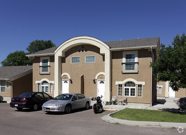
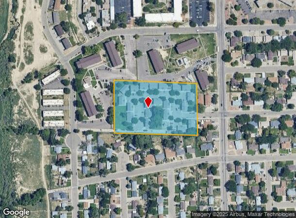
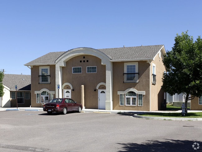
Property Record
15 Calhoun Rd, Pueblo, CO 81001
NEARBY LISTINGS FOR SALE OR LEASE
Property Detail
15 Calhoun Rd
Pueblo, CO
Com-Belmont
0-4-18-3-17-001
LOT 1 BLK 1 HUNTER CREEK SUB FORMERLY 04-183-00-001 +,-002
Charitableorganization
Pueblo
X
Colorado
08101C0511D
1
0
4 AC
2024
Colorado East Area
000905
Other Market Areas
44,544 SF
DEMOGRAPHICS near 15 Calhoun Rd
1 Mile
3 Mile
5 Mile
2024 Total Population
9,680
57,930
89,564
2029 Population
9,987
59,530
91,966
Pop Growth 2024-2029
+ 3.17%
+ 2.76%
+ 2.68%
Average Age
41
39
40
2024 Total Households
4,263
23,338
36,928
HH Growth 2024-2029
+ 3.40%
+ 2.94%
+ 2.82%
Median Household Inc
$50,222
$43,859
$45,450
Avg Household Size
2.20
2.30
2.30
2024 Avg HH Vehicles
2.00
2.00
2.00
Median Home Value
$276,272
$214,911
$213,556
Median Year Built
1971
1970
1962
Nearby Places
Map Layers
Map Styles
 Street
 Aerial
- Restaurants
- Banks
- Shops
- Fitness
- Groceries
Nearby Properties
Address
Land Use
TOTAL SIZE
Lot Size
Zoning
Address
Land Use
TOTAL SIZE
Lot Size
Zoning
486,484 SF
3.75 AC
R5:RES/MUL
Address
Land Use
TOTAL SIZE
Lot Size
Zoning
168,237 SF
3.69 AC
S-1
Address
Land Use
TOTAL SIZE
Lot Size
Zoning
53,269 SF
4.51 AC
Address
Land Use
TOTAL SIZE
Lot Size
Zoning
65,508 SF
3.18 AC
Address
Land Use
TOTAL SIZE
Lot Size
Zoning
122,704 SF
2.72 AC
B4:COMM/RE
Address
Land Use
TOTAL SIZE
Lot Size
Zoning
54,250 SF
2.06 AC
B4:COMM/RE
Address
Land Use
TOTAL SIZE
Lot Size
Zoning
71,345 SF
5.17 AC
Address
Land Use
TOTAL SIZE
Lot Size
Zoning
71,936 SF
3.43 AC
R4:RES/MUL
Address
Land Use
TOTAL SIZE
Lot Size
Zoning
42,289 SF
0.54 AC
B4:COMM/RE
Address
Land Use
TOTAL SIZE
Lot Size
Zoning
61,095 SF
5.58 AC
B3:COMM/H&
Address
Land Use
TOTAL SIZE
Lot Size
Zoning
26,255 SF
2.08 AC
Address
Land Use
TOTAL SIZE
Lot Size
Zoning
94,278 SF
2.11 AC
R-5
Address
Land Use
TOTAL SIZE
Lot Size
Zoning
200,121 SF
21.03 AC
B4:COMM/RE
Address
Land Use
TOTAL SIZE
Lot Size
Zoning
16,888 SF
5.31 AC
A-1
Address
Land Use
TOTAL SIZE
Lot Size
Zoning
25,172 SF
1.42 AC
R5:RES/MUL
Address
Land Use
TOTAL SIZE
Lot Size
Zoning
17,906 SF
0.86 AC
PUD
Address
Land Use
TOTAL SIZE
Lot Size
Zoning
23,025 SF
1.21 AC
R5:RES/MUL
Address
Land Use
TOTAL SIZE
Lot Size
Zoning
13,060 SF
11.06 AC
S-1
Address
Land Use
TOTAL SIZE
Lot Size
Zoning
13,178 SF
1.10 AC
R2:RES/1 F
Address
Land Use
TOTAL SIZE
Lot Size
Zoning
84,872 SF
0.76 AC
B4:COMM/RE
Address
Land Use
TOTAL SIZE
Lot Size
Zoning
15,741 SF
24.16 AC
R5:RES/MUL
Address
Land Use
TOTAL SIZE
Lot Size
Zoning
35,530 SF
0.54 AC
S1:SPC/PUB
Address
Land Use
TOTAL SIZE
Lot Size
Zoning
117,715 SF
3.58 AC
Address
Land Use
TOTAL SIZE
Lot Size
Zoning
22,611 SF
6.85 AC
S1:SPC/PUB
Address
Land Use
TOTAL SIZE
Lot Size
Zoning
13,216 SF
0.55 AC
B4:COMM/RE
Address
Land Use
TOTAL SIZE
Lot Size
Zoning
91,409 SF
12.23 AC
B-3
Address
Land Use
TOTAL SIZE
Lot Size
Zoning
25,983 SF
0.97 AC
B4:COMM/RE
Address
Land Use
TOTAL SIZE
Lot Size
Zoning
113,152 SF
5.84 AC
R4:RES/MUL
Address
Land Use
TOTAL SIZE
Lot Size
Zoning
62,718 SF
4.76 AC
I3:IND/HEA
The World's #1 Commercial Real Estate Marketplace
Connect with us
© 2026 CoStar Group
The information above has been obtained from sources believed reliable. While we do not doubt its accuracy we have not verified it and make no guarantee, warranty or representation about it. It is your responsibility to independently confirm its accuracy and completeness. Any projections, opinions, assumptions, or estimates used are for example only and do not represent the current or future performance of the property. The value of this transaction to you depends on tax and other factors which should be evaluated by your tax, financial, and legal advisors. You and your advisors should conduct a careful, independent investigation of the property to determine to your satisfaction the suitability of the property for your needs.