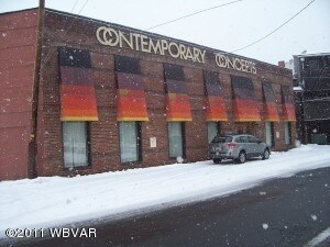
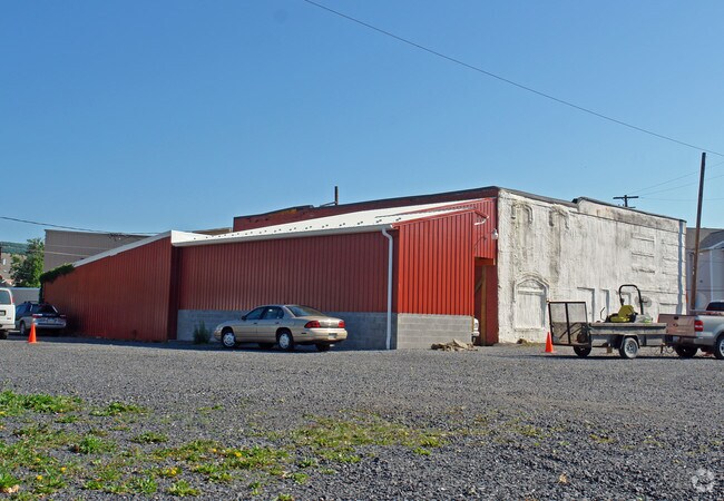
Property Record
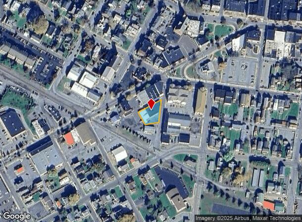
15 Corning St, Lock Haven, PA 17745
NEARBY LISTINGS FOR SALE OR LEASE
Property Detail
15 Corning St
021-10188
15 CORNING ST 15 CORNING ST
Storebuilding
Clinton
X
Pennsylvania
42035C0389E
0.27 AC
2025
Pennsylvania Central Area
2025
Other Market Areas
030701
Lock Haven, PA
18,406 SF
DEMOGRAPHICS near 15 Corning St
1 Mile
3 Mile
5 Mile
2024 Total Population
8,052
15,244
20,558
2029 Population
7,982
15,148
20,381
Pop Growth 2024-2029
(0.87%)
(0.63%)
(0.86%)
Average Age
36
40
41
2024 Total Households
3,088
6,150
8,205
HH Growth 2024-2029
(0.78%)
(0.57%)
(0.83%)
Median Household Inc
$38,428
$47,271
$51,722
Avg Household Size
2.10
2.20
2.30
2024 Avg HH Vehicles
2.00
2.00
2.00
Median Home Value
$160,721
$159,660
$166,630
Median Year Built
1964
1964
1966
Nearby Places
Map Layers
Map Styles
 Street
 Aerial
- Restaurants
- Banks
- Shops
- Fitness
- Groceries
PUBLIC TRANSPORTATION
AIRPORT
State College Regional
DRIVE
WALK
Distance
State College Regional
54 min
33.9 mi
Freight Ports
Port of Baltimore
DRIVE
WALK
Distance
Port of Baltimore
253 min
191.1 mi
Nearby Properties
Address
Land Use
TOTAL SIZE
Lot Size
Zoning
Address
Land Use
TOTAL SIZE
Lot Size
Zoning
277.71 AC
Address
Land Use
TOTAL SIZE
Lot Size
Zoning
12,048 SF
4.75 AC
PI
Address
Land Use
TOTAL SIZE
Lot Size
Zoning
80,760 SF
4.37 AC
PI
Address
Land Use
TOTAL SIZE
Lot Size
Zoning
10.48 AC
Address
Land Use
TOTAL SIZE
Lot Size
Zoning
364,870 SF
20.87 AC
HI
Address
Land Use
TOTAL SIZE
Lot Size
Zoning
85,160 SF
1.48 AC
PI
Address
Land Use
TOTAL SIZE
Lot Size
Zoning
339,124 SF
17.01 AC
Address
Land Use
TOTAL SIZE
Lot Size
Zoning
64,140 SF
3.45 AC
Address
Land Use
TOTAL SIZE
Lot Size
Zoning
10,659 SF
12.85 AC
RM
Address
Land Use
TOTAL SIZE
Lot Size
Zoning
75,172 SF
0.28 AC
PI
Address
Land Use
TOTAL SIZE
Lot Size
Zoning
45,914 SF
13.21 AC
IND
Address
Land Use
TOTAL SIZE
Lot Size
Zoning
52,120 SF
1.98 AC
PI
Address
Land Use
TOTAL SIZE
Lot Size
Zoning
2,440 SF
8.02 AC
RM
Address
Land Use
TOTAL SIZE
Lot Size
Zoning
108,536 SF
1.59 AC
Address
Land Use
TOTAL SIZE
Lot Size
Zoning
33,240 SF
4.49 AC
Address
Land Use
TOTAL SIZE
Lot Size
Zoning
1,896 SF
2.19 AC
Address
Land Use
TOTAL SIZE
Lot Size
Zoning
242,674 SF
12.67 AC
HI
Address
Land Use
TOTAL SIZE
Lot Size
Zoning
54,138 SF
2.92 AC
Address
Land Use
TOTAL SIZE
Lot Size
Zoning
68,560 SF
1.47 AC
Address
Land Use
TOTAL SIZE
Lot Size
Zoning
76,398 SF
4.10 AC
RH
Address
Land Use
TOTAL SIZE
Lot Size
Zoning
27,540 SF
102.11 AC
AI
Address
Land Use
TOTAL SIZE
Lot Size
Zoning
57,893 SF
0.75 AC
Address
Land Use
TOTAL SIZE
Lot Size
Zoning
26,784 SF
1.97 AC
GC
Address
Land Use
TOTAL SIZE
Lot Size
Zoning
31,063 SF
1.20 AC
GC
Address
Land Use
TOTAL SIZE
Lot Size
Zoning
963,220 SF
16.93 AC
Address
Land Use
TOTAL SIZE
Lot Size
Zoning
60,026 SF
5.29 AC
GC
Address
Land Use
TOTAL SIZE
Lot Size
Zoning
20,348 SF
5.22 AC
I
Address
Land Use
TOTAL SIZE
Lot Size
Zoning
11,050 SF
15.25 AC
IND
Address
Land Use
TOTAL SIZE
Lot Size
Zoning
37,750 SF
5.06 AC
HI
Address
Land Use
TOTAL SIZE
Lot Size
Zoning
20,050 SF
42.38 AC
The World's #1 Commercial Real Estate Marketplace
Connect with us
© 2026 CoStar Group
The information above has been obtained from sources believed reliable. While we do not doubt its accuracy we have not verified it and make no guarantee, warranty or representation about it. It is your responsibility to independently confirm its accuracy and completeness. Any projections, opinions, assumptions, or estimates used are for example only and do not represent the current or future performance of the property. The value of this transaction to you depends on tax and other factors which should be evaluated by your tax, financial, and legal advisors. You and your advisors should conduct a careful, independent investigation of the property to determine to your satisfaction the suitability of the property for your needs.