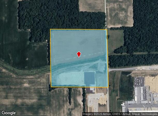
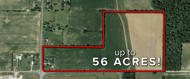
Property Record
15 Cr, Auburn, IN 46706

NEARBY LISTINGS FOR SALE OR LEASE
Property Detail
15 Cr
17-05-27-426-001.000-011
NE1/4 SE1/4 SECTION 27 TWP 34 RANGE 12 ACRES 40.0000
Agriculturalland
Dekalb
A
Indiana
18033C0226E
40 AC
2024
Fort Wayne
2024
Other Market Areas
020400
Auburn, IN
DEMOGRAPHICS near 15 Cr
1 Mile
3 Mile
5 Mile
2024 Total Population
811
10,760
25,548
2029 Population
833
11,056
26,275
Pop Growth 2024-2029
+ 2.71%
+ 2.75%
+ 2.85%
Average Age
34
39
40
2024 Total Households
298
4,215
10,297
HH Growth 2024-2029
+ 2.68%
+ 2.78%
+ 2.86%
Median Household Inc
$59,564
$53,257
$57,950
Avg Household Size
2.70
2.50
2.40
2024 Avg HH Vehicles
2.00
2.00
2.00
Median Home Value
$94,166
$134,961
$153,656
Median Year Built
1990
1971
1977
Nearby Places
Map Layers
Map Styles
 Street
 Aerial
- Restaurants
- Banks
- Shops
- Fitness
- Groceries
PUBLIC TRANSPORTATION
COMMUTER RAIL
Waterloo Amtrak Station (Capitol Limited - Amtrak, Lake Shore Limited - Amtrak)
DRIVE
WALK
Distance
Waterloo Amtrak Station (Capitol Limited - Amtrak, Lake Shore Limited - Amtrak)
13 min
9.3 mi
AIRPORT
Fort Wayne International
DRIVE
WALK
Distance
Fort Wayne International
49 min
37.0 mi
Freight Ports
Port of Toledo
DRIVE
WALK
Distance
Port of Toledo
140 min
109.1 mi
SALE & LEASE HISTORY
LISTING DATE
SALE/LEASE

Sep 24, 2016
For Sale
Oct 03, 2019
For Sale
Feb 27, 2017
For Sale
Nearby Properties
Address
Land Use
TOTAL SIZE
Lot Size
Zoning
Address
Land Use
TOTAL SIZE
Lot Size
Zoning
406,797 SF
158.80 AC
Address
Land Use
TOTAL SIZE
Lot Size
Zoning
320,870 SF
106.40 AC
Address
Land Use
TOTAL SIZE
Lot Size
Zoning
59,049 SF
12.73 AC
Address
Land Use
TOTAL SIZE
Lot Size
Zoning
180,835 SF
18.82 AC
Address
Land Use
TOTAL SIZE
Lot Size
Zoning
186,496 SF
29.28 AC
Address
Land Use
TOTAL SIZE
Lot Size
Zoning
15,960 SF
3.09 AC
Address
Land Use
TOTAL SIZE
Lot Size
Zoning
123,126 SF
15 AC
Address
Land Use
TOTAL SIZE
Lot Size
Zoning
26,488 SF
12.12 AC
Address
Land Use
TOTAL SIZE
Lot Size
Zoning
130,185 SF
34.82 AC
Address
Land Use
TOTAL SIZE
Lot Size
Zoning
18,976 SF
4.13 AC
Address
Land Use
TOTAL SIZE
Lot Size
Zoning
50,876 SF
4.04 AC
Address
Land Use
TOTAL SIZE
Lot Size
Zoning
95,148 SF
14.02 AC
Address
Land Use
TOTAL SIZE
Lot Size
Zoning
14,760 SF
6.54 AC
Address
Land Use
TOTAL SIZE
Lot Size
Zoning
103,888 SF
30 AC
Address
Land Use
TOTAL SIZE
Lot Size
Zoning
4,048 SF
14.92 AC
Address
Land Use
TOTAL SIZE
Lot Size
Zoning
75,878 SF
1.05 AC
Address
Land Use
TOTAL SIZE
Lot Size
Zoning
20,420 SF
4.70 AC
Address
Land Use
TOTAL SIZE
Lot Size
Zoning
38,708 SF
1.55 AC
Address
Land Use
TOTAL SIZE
Lot Size
Zoning
22,000 SF
7.90 AC
Address
Land Use
TOTAL SIZE
Lot Size
Zoning
19,936 SF
10.47 AC
Address
Land Use
TOTAL SIZE
Lot Size
Zoning
57,886 SF
19.56 AC
Address
Land Use
TOTAL SIZE
Lot Size
Zoning
62,856 SF
1.80 AC
Address
Land Use
TOTAL SIZE
Lot Size
Zoning
46,800 SF
1.20 AC
Address
Land Use
TOTAL SIZE
Lot Size
Zoning
48,000 SF
5.29 AC
Address
Land Use
TOTAL SIZE
Lot Size
Zoning
58,800 SF
7.33 AC
Address
Land Use
TOTAL SIZE
Lot Size
Zoning
10,200 SF
13.13 AC
Address
Land Use
TOTAL SIZE
Lot Size
Zoning
35,407 SF
2.14 AC
Address
Land Use
TOTAL SIZE
Lot Size
Zoning
5,805 SF
8.10 AC
Address
Land Use
TOTAL SIZE
Lot Size
Zoning
146,310 SF
11.80 AC
Address
Land Use
TOTAL SIZE
Lot Size
Zoning
39,000 SF
8.49 AC
The World's #1 Commercial Real Estate Marketplace
Connect with us
© 2025 CoStar Group
The information above has been obtained from sources believed reliable. While we do not doubt its accuracy we have not verified it and make no guarantee, warranty or representation about it. It is your responsibility to independently confirm its accuracy and completeness. Any projections, opinions, assumptions, or estimates used are for example only and do not represent the current or future performance of the property. The value of this transaction to you depends on tax and other factors which should be evaluated by your tax, financial, and legal advisors. You and your advisors should conduct a careful, independent investigation of the property to determine to your satisfaction the suitability of the property for your needs.