Property Record
15 Dana Way, Ludlow, MA 01056


NEARBY LISTINGS FOR SALE OR LEASE
Property Detail
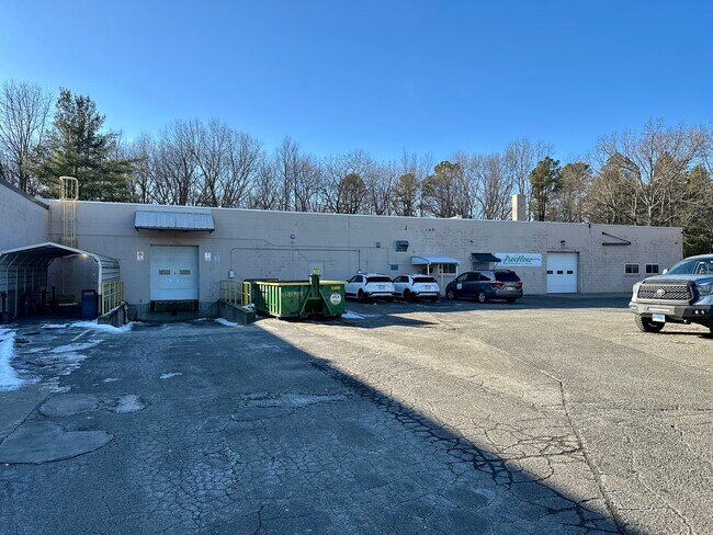
15 Dana Way
Manufacturinglight
Hampden
X
Massachusetts
25013C0217E
6.60 AC
2025
Hampden County
2025
Hartford
810414
Springfield, MA
53,393 SF
LUDL-304670-000000-000008
DEMOGRAPHICS near 15 Dana Way
1 Mile
3 Mile
5 Mile
2024 Total Population
3,948
34,996
129,117
2029 Population
3,956
34,470
125,617
Pop Growth 2024-2029
+ 0.20%
(1.50%)
(2.71%)
Average Age
45
42
41
2024 Total Households
1,343
14,186
52,248
HH Growth 2024-2029
+ 0.52%
(1.56%)
(2.90%)
Median Household Inc
$85,848
$62,913
$60,250
Avg Household Size
2.40
2.30
2.40
2024 Avg HH Vehicles
2.00
2.00
2.00
Median Home Value
$276,075
$243,078
$234,736
Median Year Built
1973
1961
1958
Nearby Places
Map Layers
Map Styles
 Street
 Aerial
- Restaurants
- Banks
- Shops
- Fitness
- Groceries
PUBLIC TRANSPORTATION
COMMUTER RAIL
DRIVE
WALK
Distance
11 min
7.4 mi
DRIVE
WALK
Distance
16 min
8.4 mi
AIRPORT
Bradley International
DRIVE
WALK
Distance
Bradley International
43 min
21.4 mi
Worcester Regional
DRIVE
WALK
Distance
Worcester Regional
66 min
46.4 mi
SALE & LEASE HISTORY
LISTING DATE
SALE/LEASE

Nov 22, 2023
For Lease
Nov 20, 2023
For Lease
Feb 18, 2025
For Lease
Nearby Properties
Address
Land Use
TOTAL SIZE
Lot Size
Zoning
Address
Land Use
TOTAL SIZE
Lot Size
Zoning
7.41 AC
I2
Address
Land Use
TOTAL SIZE
Lot Size
Zoning
45,444 SF
13.80 AC
Address
Land Use
TOTAL SIZE
Lot Size
Zoning
131,942 SF
40.30 AC
R1
Address
Land Use
TOTAL SIZE
Lot Size
Zoning
60.25 AC
Address
Land Use
TOTAL SIZE
Lot Size
Zoning
39,776 SF
8.16 AC
R2
Address
Land Use
TOTAL SIZE
Lot Size
Zoning
22.77 AC
111A
Address
Land Use
TOTAL SIZE
Lot Size
Zoning
71,911 SF
9.19 AC
Address
Land Use
TOTAL SIZE
Lot Size
Zoning
762,340 SF
76.18 AC
SR1R2I
Address
Land Use
TOTAL SIZE
Lot Size
Zoning
99,792 SF
123.26 AC
S
Address
Land Use
TOTAL SIZE
Lot Size
Zoning
26.68 AC
110
Address
Land Use
TOTAL SIZE
Lot Size
Zoning
136,326 SF
65.19 AC
Address
Land Use
TOTAL SIZE
Lot Size
Zoning
257,179 SF
22.84 AC
110
Address
Land Use
TOTAL SIZE
Lot Size
Zoning
6.81 AC
S
Address
Land Use
TOTAL SIZE
Lot Size
Zoning
34 AC
Address
Land Use
TOTAL SIZE
Lot Size
Zoning
139,292 SF
12.54 AC
SB1I2
Address
Land Use
TOTAL SIZE
Lot Size
Zoning
81.65 AC
110
Address
Land Use
TOTAL SIZE
Lot Size
Zoning
13.02 AC
Address
Land Use
TOTAL SIZE
Lot Size
Zoning
320,639 SF
14.16 AC
110
Address
Land Use
TOTAL SIZE
Lot Size
Zoning
133,600 SF
23.27 AC
R3
Address
Land Use
TOTAL SIZE
Lot Size
Zoning
199,007 SF
50.95 AC
S
Address
Land Use
TOTAL SIZE
Lot Size
Zoning
88,440 SF
6.74 AC
102
Address
Land Use
TOTAL SIZE
Lot Size
Zoning
491.50 AC
108
Address
Land Use
TOTAL SIZE
Lot Size
Zoning
243.13 AC
109
Address
Land Use
TOTAL SIZE
Lot Size
Zoning
95,022 SF
11.91 AC
SR1B1
Address
Land Use
TOTAL SIZE
Lot Size
Zoning
3.73 AC
I2
Address
Land Use
TOTAL SIZE
Lot Size
Zoning
3.73 AC
I2
Address
Land Use
TOTAL SIZE
Lot Size
Zoning
121,689 SF
14 AC
I2
Address
Land Use
TOTAL SIZE
Lot Size
Zoning
14.47 AC
110
Address
Land Use
TOTAL SIZE
Lot Size
Zoning
1,292 SF
8.92 AC
B1
Address
Land Use
TOTAL SIZE
Lot Size
Zoning
217,640 SF
12.21 AC
110
The World's #1 Commercial Real Estate Marketplace
Connect with us
© 2025 CoStar Group
The information above has been obtained from sources believed reliable. While we do not doubt its accuracy we have not verified it and make no guarantee, warranty or representation about it. It is your responsibility to independently confirm its accuracy and completeness. Any projections, opinions, assumptions, or estimates used are for example only and do not represent the current or future performance of the property. The value of this transaction to you depends on tax and other factors which should be evaluated by your tax, financial, and legal advisors. You and your advisors should conduct a careful, independent investigation of the property to determine to your satisfaction the suitability of the property for your needs.