Property Record
15 Darin Dr, Augusta, ME 04330
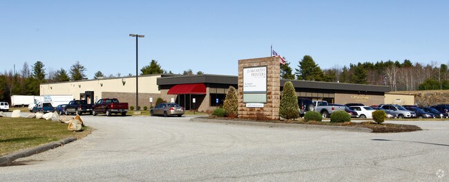

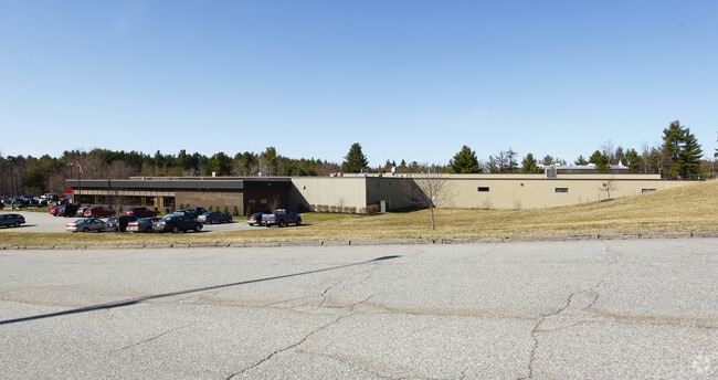
Property Detail
15 Darin Dr
AUGU-000005A-000053
Kennebec
Manufacturinglight
Maine
B and X Area of moderate flood hazard, usually the area between the limits of the 100-year and 500-year floods.
12.03 AC
2025
Maine South & Augusta
2025
Other Market Areas
010200
Augusta-Waterville, ME
138,585 SF
NEARBY LISTINGS FOR SALE OR LEASE
DEMOGRAPHICS near 15 Darin Dr
1 mile
3 mile
5 mile
2025 Total Population
335
12,702
24,482
2030 Population
341
12,948
24,987
Pop Growth 2025-2030
+ 1.79%
+ 1.94%
+ 2.06%
Average Age
45
44
44
2025 Total Households
153
6,177
11,352
HH Growth 2025-2030
+ 1.96%
+ 2.10%
+ 2.13%
Median Household Inc
$76,923
$50,079
$54,866
Avg Household Size
2.10
1.90
2.00
2025 Avg HH Vehicles
2.00
1.00
1.00
Median Home Value
$175,489
$200,674
$232,717
Median Year Built
1978
1966
1968
Nearby Places
Map Layers
Map Styles
 Street
 Aerial
Layers
 Traffic
 Biking
Places
Listings with unknown addresses are not visible on the map
- Restaurants
- Banks
- Shops
- Fitness
- Groceries
Nearby Properties
Address
Land Use
TOTAL SIZE
Lot Size
Zoning
Address
Land Use
TOTAL SIZE
Lot Size
Zoning
188,134 SF
53.10 AC
Address
Land Use
TOTAL SIZE
Lot Size
Zoning
34,330 SF
16.19 AC
Address
Land Use
TOTAL SIZE
Lot Size
Zoning
88,451 SF
24.41 AC
Address
Land Use
TOTAL SIZE
Lot Size
Zoning
302,400 SF
24.18 AC
Address
Land Use
TOTAL SIZE
Lot Size
Zoning
99,295 SF
7.25 AC
Address
Land Use
TOTAL SIZE
Lot Size
Zoning
102,445 SF
43.40 AC
Address
Land Use
TOTAL SIZE
Lot Size
Zoning
150.24 AC
Address
Land Use
TOTAL SIZE
Lot Size
Zoning
103,168 SF
3.36 AC
Address
Land Use
TOTAL SIZE
Lot Size
Zoning
231,884 SF
14.50 AC
Address
Land Use
TOTAL SIZE
Lot Size
Zoning
1,414 SF
144 AC
Address
Land Use
TOTAL SIZE
Lot Size
Zoning
203,962 SF
18.60 AC
Address
Land Use
TOTAL SIZE
Lot Size
Zoning
124,422 SF
6.30 AC
Address
Land Use
TOTAL SIZE
Lot Size
Zoning
20,700 SF
14.46 AC
Address
Land Use
TOTAL SIZE
Lot Size
Zoning
139,383 SF
18.32 AC
Address
Land Use
TOTAL SIZE
Lot Size
Zoning
127,056 SF
14.44 AC
Address
Land Use
TOTAL SIZE
Lot Size
Zoning
116,149 SF
11.62 AC
Address
Land Use
TOTAL SIZE
Lot Size
Zoning
8,572 SF
13.92 AC
Address
Land Use
TOTAL SIZE
Lot Size
Zoning
109,880 SF
4.11 AC
Address
Land Use
TOTAL SIZE
Lot Size
Zoning
51,000 SF
3.68 AC
Address
Land Use
TOTAL SIZE
Lot Size
Zoning
54,000 SF
13.91 AC
Address
Land Use
TOTAL SIZE
Lot Size
Zoning
90,092 SF
10.23 AC
Address
Land Use
TOTAL SIZE
Lot Size
Zoning
9,881 SF
21 AC
Address
Land Use
TOTAL SIZE
Lot Size
Zoning
Address
Land Use
TOTAL SIZE
Lot Size
Zoning
193,877 SF
Address
Land Use
TOTAL SIZE
Lot Size
Zoning
94,766 SF
3.37 AC
Address
Land Use
TOTAL SIZE
Lot Size
Zoning
66,148 SF
15.26 AC
Address
Land Use
TOTAL SIZE
Lot Size
Zoning
24.08 AC
Address
Land Use
TOTAL SIZE
Lot Size
Zoning
13,336 SF
13.40 AC
Address
Land Use
TOTAL SIZE
Lot Size
Zoning
4,656 SF
7.24 AC
Address
Land Use
TOTAL SIZE
Lot Size
Zoning
150,670 SF
23.77 AC
The World's #1 Commercial Real Estate Marketplace
Connect with us
© 2026 CoStar Group
The information above has been obtained from sources believed reliable. While we do not doubt its accuracy we have not verified it and make no guarantee, warranty or representation about it. It is your responsibility to independently confirm its accuracy and completeness. Any projections, opinions, assumptions, or estimates used are for example only and do not represent the current or future performance of the property. The value of this transaction to you depends on tax and other factors which should be evaluated by your tax, financial, and legal advisors. You and your advisors should conduct a careful, independent investigation of the property to determine to your satisfaction the suitability of the property for your needs.