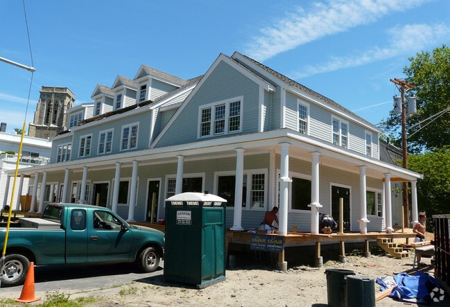
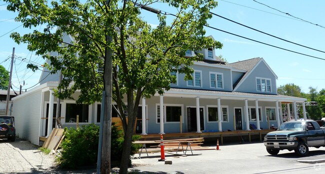
Property Record
15 Depot Ct, Cohasset, MA 02025
NEARBY LISTINGS FOR SALE OR LEASE
-
-
View all Cohasset listings for sale on LoopNet.com
Property Detail
15 Depot Ct
COHA-000005E-000018-000012
Cohasset
Officebuilding
Norfolk
X
Massachusetts
25021C0256F
12
2025
0.14 AC
2025
Route 3 Corridor
423101
Boston
7,360 SF
Boston-Cambridge-Newton, MA-NH
DEMOGRAPHICS near 15 Depot Ct
1 Mile
3 Mile
5 Mile
2024 Total Population
4,097
16,478
44,734
2029 Population
4,103
16,597
45,271
Pop Growth 2024-2029
+ 0.15%
+ 0.72%
+ 1.20%
Average Age
41
43
43
2024 Total Households
1,494
6,329
16,993
HH Growth 2024-2029
+ 0.20%
+ 0.76%
+ 1.25%
Median Household Inc
$159,000
$173,567
$151,392
Avg Household Size
2.70
2.60
2.60
2024 Avg HH Vehicles
2.00
2.00
2.00
Median Home Value
$1,033,022
$861,601
$799,155
Median Year Built
1953
1960
1959
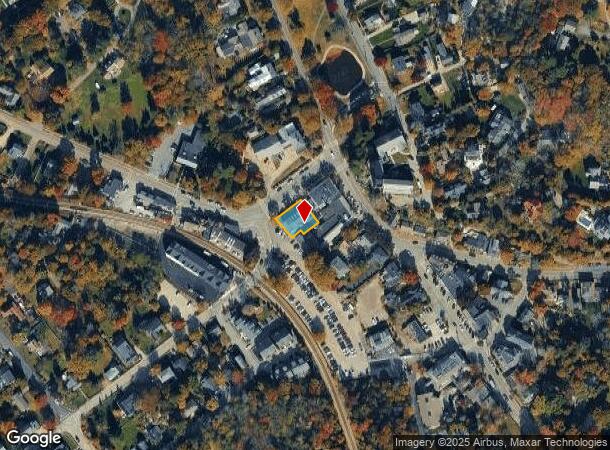
Nearby Places
Map Layers
Map Styles
 Street
 Aerial
- Restaurants
- Banks
- Shops
- Fitness
- Groceries
PUBLIC TRANSPORTATION
COMMUTER RAIL
North Scituate Station (Greenbush Line - Massachusetts Bay Transportation Authority Commuter Rail (Purple Line))
DRIVE
WALK
Distance
North Scituate Station (Greenbush Line - Massachusetts Bay Transportation Authority Commuter Rail (Purple Line))
4 min
1.9 mi
Cohasset (Greenbush Line - Massachusetts Bay Transportation Authority Commuter Rail (Purple Line))
DRIVE
WALK
Distance
Cohasset (Greenbush Line - Massachusetts Bay Transportation Authority Commuter Rail (Purple Line))
3 min
2.1 mi
AIRPORT
General Edward Lawrence Logan International
DRIVE
WALK
Distance
General Edward Lawrence Logan International
41 min
22.3 mi
Freight Ports
Port of Boston
DRIVE
WALK
Distance
Port of Boston
38 min
20.1 mi
Nearby Properties
Address
Land Use
TOTAL SIZE
Lot Size
Zoning
Address
Land Use
TOTAL SIZE
Lot Size
Zoning
94,532 SF
42.93 AC
TECH
Address
Land Use
TOTAL SIZE
Lot Size
Zoning
193,216 SF
11.98 AC
MFA
Address
Land Use
TOTAL SIZE
Lot Size
Zoning
80.40 AC
N/A
Address
Land Use
TOTAL SIZE
Lot Size
Zoning
205,836 SF
18 AC
RB
Address
Land Use
TOTAL SIZE
Lot Size
Zoning
43,690 SF
18.75 AC
Address
Land Use
TOTAL SIZE
Lot Size
Zoning
527 AC
RC
Address
Land Use
TOTAL SIZE
Lot Size
Zoning
7.93 AC
RC
Address
Land Use
TOTAL SIZE
Lot Size
Zoning
89,648 SF
14.88 AC
RB
Address
Land Use
TOTAL SIZE
Lot Size
Zoning
5,072 SF
85.02 AC
Address
Land Use
TOTAL SIZE
Lot Size
Zoning
13.46 AC
TECH
Address
Land Use
TOTAL SIZE
Lot Size
Zoning
68,507 SF
2.90 AC
TECH
Address
Land Use
TOTAL SIZE
Lot Size
Zoning
32,108 SF
1.23 AC
RB
Address
Land Use
TOTAL SIZE
Lot Size
Zoning
861 AC
OS
Address
Land Use
TOTAL SIZE
Lot Size
Zoning
63,372 SF
5.02 AC
LI
Address
Land Use
TOTAL SIZE
Lot Size
Zoning
11,621 SF
9.25 AC
RB
Address
Land Use
TOTAL SIZE
Lot Size
Zoning
19,146 SF
122.83 AC
RC
Address
Land Use
TOTAL SIZE
Lot Size
Zoning
625.05 AC
Address
Land Use
TOTAL SIZE
Lot Size
Zoning
7.68 AC
HB
Address
Land Use
TOTAL SIZE
Lot Size
Zoning
36,446 SF
5.49 AC
TECH
Address
Land Use
TOTAL SIZE
Lot Size
Zoning
71,924 SF
15.41 AC
RB
Address
Land Use
TOTAL SIZE
Lot Size
Zoning
5.40 AC
RC
Address
Land Use
TOTAL SIZE
Lot Size
Zoning
45,023 SF
4.60 AC
TECH
Address
Land Use
TOTAL SIZE
Lot Size
Zoning
27,434 SF
6.02 AC
Address
Land Use
TOTAL SIZE
Lot Size
Zoning
61,416 SF
4.63 AC
HB
Address
Land Use
TOTAL SIZE
Lot Size
Zoning
5.78 AC
RC
Address
Land Use
TOTAL SIZE
Lot Size
Zoning
11,405 SF
7.90 AC
RC
Address
Land Use
TOTAL SIZE
Lot Size
Zoning
11,056 SF
9.57 AC
HB
Address
Land Use
TOTAL SIZE
Lot Size
Zoning
49,098 SF
7.06 AC
HB
Address
Land Use
TOTAL SIZE
Lot Size
Zoning
5.38 AC
RC
Address
Land Use
TOTAL SIZE
Lot Size
Zoning
1,175 SF
2.90 AC
RC
The World's #1 Commercial Real Estate Marketplace
Connect with us
© 2025 CoStar Group
The information above has been obtained from sources believed reliable. While we do not doubt its accuracy we have not verified it and make no guarantee, warranty or representation about it. It is your responsibility to independently confirm its accuracy and completeness. Any projections, opinions, assumptions, or estimates used are for example only and do not represent the current or future performance of the property. The value of this transaction to you depends on tax and other factors which should be evaluated by your tax, financial, and legal advisors. You and your advisors should conduct a careful, independent investigation of the property to determine to your satisfaction the suitability of the property for your needs.