Property Record
15 Dwight St, North Haven, CT 06473

Property Detail
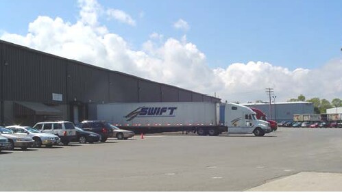
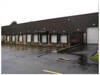
15 Dwight St
NRHV-000100-000000-000001
NEW HAVEN
Warehouse
Connecticut
IL80
1
AE The base floodplain where base flood elevations are provided. AE Zones are now used on new format FIRMs instead of A1-A30 Zones.
11.99 AC
2025
North Haven
2025
Westchester/So Connecticut
167202
New Haven, CT
171,660 SF
NEARBY LISTINGS FOR SALE OR LEASE
DEMOGRAPHICS near 15 Dwight St
1 mile
3 mile
5 mile
2025 Total Population
1,983
38,256
96,023
2030 Population
2,028
38,679
97,397
Pop Growth 2025-2030
+ 2.27%
+ 1.11%
+ 1.43%
Average Age
45
43
43
2025 Total Households
794
14,675
37,372
HH Growth 2025-2030
+ 2.27%
+ 1.06%
+ 1.38%
Median Household Inc
$103,846
$96,323
$102,479
Avg Household Size
2.50
2.30
2.40
2025 Avg HH Vehicles
2.00
2.00
2.00
Median Home Value
$354,212
$351,452
$358,085
Median Year Built
1969
1968
1970
Nearby Places
Map Layers
Map Styles
 Street
 Aerial
Layers
 Traffic
 Biking
Places
Listings with unknown addresses are not visible on the map
- Restaurants
- Banks
- Shops
- Fitness
- Groceries
PUBLIC TRANSPORTATION
COMMUTER RAIL
Wallingford Amtrak (Amtrak Hartford Line - Amtrak, Northeast Regional - Amtrak, Valley Flyer - Amtrak)
Drive
Walk
Distance
Wallingford Amtrak (Amtrak Hartford Line - Amtrak, Northeast Regional - Amtrak, Valley Flyer - Amtrak)
6 min
3.3 mi
Wallingford (Hartford Line - CONN DOT)
Drive
Walk
Distance
Wallingford (Hartford Line - CONN DOT)
8 min
3.7 mi
AIRPORT
Tweed/New Haven
Drive
Walk
Distance
Tweed/New Haven
23 min
13.4 mi
Freight Ports
Port of New Haven
Drive
Walk
Distance
Port of New Haven
19 min
11.1 mi
SALE & LEASE HISTORY
LISTING DATE
SALE/LEASE

Sep 25, 2016
For Lease
Nearby Properties
Address
Land Use
TOTAL SIZE
Lot Size
Zoning
Address
Land Use
TOTAL SIZE
Lot Size
Zoning
100 AC
LO15
Address
Land Use
TOTAL SIZE
Lot Size
Zoning
855,000 SF
142.06 AC
IL80
Address
Land Use
TOTAL SIZE
Lot Size
Zoning
52 AC
R18
Address
Land Use
TOTAL SIZE
Lot Size
Zoning
32.85 AC
RU40
Address
Land Use
TOTAL SIZE
Lot Size
Zoning
36,520 SF
4.64 AC
IL30
Address
Land Use
TOTAL SIZE
Lot Size
Zoning
85.08 AC
I40
Address
Land Use
TOTAL SIZE
Lot Size
Zoning
97,898 SF
11.40 AC
R20
Address
Land Use
TOTAL SIZE
Lot Size
Zoning
10.70 AC
IL30
Address
Land Use
TOTAL SIZE
Lot Size
Zoning
128,346 SF
15 AC
R18
Address
Land Use
TOTAL SIZE
Lot Size
Zoning
3.84 AC
CB40
Address
Land Use
TOTAL SIZE
Lot Size
Zoning
9.80 AC
CA20
Address
Land Use
TOTAL SIZE
Lot Size
Zoning
15,432 SF
5.67 AC
CB40
Address
Land Use
TOTAL SIZE
Lot Size
Zoning
20.01 AC
R20
Address
Land Use
TOTAL SIZE
Lot Size
Zoning
8.90 AC
CB40
Address
Land Use
TOTAL SIZE
Lot Size
Zoning
91,455 SF
14.20 AC
RU-2
Address
Land Use
TOTAL SIZE
Lot Size
Zoning
7.21 AC
IL30
Address
Land Use
TOTAL SIZE
Lot Size
Zoning
12.36 AC
I40
Address
Land Use
TOTAL SIZE
Lot Size
Zoning
64,827 SF
24.94 AC
R40
Address
Land Use
TOTAL SIZE
Lot Size
Zoning
60,834 SF
3.61 AC
CLB
Address
Land Use
TOTAL SIZE
Lot Size
Zoning
6.64 AC
CB40
Address
Land Use
TOTAL SIZE
Lot Size
Zoning
60,678 SF
21.50 AC
R40
Address
Land Use
TOTAL SIZE
Lot Size
Zoning
12,876 SF
12.24 AC
CB40
Address
Land Use
TOTAL SIZE
Lot Size
Zoning
88,351 SF
5.77 AC
IL30
Address
Land Use
TOTAL SIZE
Lot Size
Zoning
65,713 SF
15.66 AC
R40
Address
Land Use
TOTAL SIZE
Lot Size
Zoning
56,211 SF
7.15 AC
R20
Address
Land Use
TOTAL SIZE
Lot Size
Zoning
5.56 AC
RM6
Address
Land Use
TOTAL SIZE
Lot Size
Zoning
5 AC
RU40
Address
Land Use
TOTAL SIZE
Lot Size
Zoning
11.09 AC
CA20
Address
Land Use
TOTAL SIZE
Lot Size
Zoning
28.58 AC
DD40
Address
Land Use
TOTAL SIZE
Lot Size
Zoning
53,901 SF
5.76 AC
R12
The World's #1 Commercial Real Estate Marketplace
Connect with us
© 2026 CoStar Group
The information above has been obtained from sources believed reliable. While we do not doubt its accuracy we have not verified it and make no guarantee, warranty or representation about it. It is your responsibility to independently confirm its accuracy and completeness. Any projections, opinions, assumptions, or estimates used are for example only and do not represent the current or future performance of the property. The value of this transaction to you depends on tax and other factors which should be evaluated by your tax, financial, and legal advisors. You and your advisors should conduct a careful, independent investigation of the property to determine to your satisfaction the suitability of the property for your needs.