Property Record
15 E 15Th St, Edmond, OK 73013


Property Detail
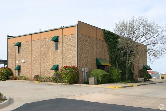
15 E 15Th St
182695510
UNPLTD PT SEC 35 14N 3W 000 000 PT SE4 SEC 35 14N 3W & PT OF BLK 1 BROADWAY SQUARE ADDN DESCRIBED AS BEG 1488.05FT W OF SE/C SE4 TH NLY277.23FT ELY161.35FT N163.91FT E81.52FT NLY166.96FT E200FT SLY591.287FT W443..05FT TO BEG EX S50FT FOR RD SUBJ TO E
Financialbuilding
OKLAHOMA
B and X Area of moderate flood hazard, usually the area between the limits of the 100-year and 500-year floods.
Oklahoma
2024
6.94 AC
2025
Edmond
108201
Oklahoma City
30,575 SF
Oklahoma City, OK
NEARBY LISTINGS FOR SALE OR LEASE
DEMOGRAPHICS near 15 E 15Th St
1 mile
3 mile
5 mile
2025 Total Population
9,847
77,126
153,488
2030 Population
9,967
77,884
156,291
Pop Growth 2025-2030
+ 1.22%
+ 0.98%
+ 1.83%
Average Age
37
38
38
2025 Total Households
4,169
30,891
61,135
HH Growth 2025-2030
+ 1.34%
+ 1.15%
+ 2.04%
Median Household Inc
$61,447
$88,306
$91,877
Avg Household Size
2.30
2.40
2.40
2025 Avg HH Vehicles
2.00
2.00
2.00
Median Home Value
$222,154
$286,749
$323,007
Median Year Built
1975
1988
1995
Nearby Places
Map Layers
Map Styles
 Street
 Aerial
Transit
 Traffic
 Biking
Places
Listings with unknown addresses are not visible on the map
- Restaurants
- Banks
- Shops
- Fitness
- Groceries
PUBLIC TRANSPORTATION
AIRPORT
Will Rogers World
Drive
Walk
Distance
Will Rogers World
31 min
21.9 mi
Nearby Properties
Address
Land Use
TOTAL SIZE
Lot Size
Zoning
Address
Land Use
TOTAL SIZE
Lot Size
Zoning
280,581 SF
28.90 AC
Address
Land Use
TOTAL SIZE
Lot Size
Zoning
268,796 SF
45.68 AC
I-2
Address
Land Use
TOTAL SIZE
Lot Size
Zoning
304,744 SF
21.61 AC
Address
Land Use
TOTAL SIZE
Lot Size
Zoning
371,968 SF
30.50 AC
Address
Land Use
TOTAL SIZE
Lot Size
Zoning
285,136 SF
13.04 AC
PUD
Address
Land Use
TOTAL SIZE
Lot Size
Zoning
470,139 SF
80.39 AC
I-2
Address
Land Use
TOTAL SIZE
Lot Size
Zoning
225,492 SF
11.86 AC
R-4
Address
Land Use
TOTAL SIZE
Lot Size
Zoning
402,880 SF
15.39 AC
Address
Land Use
TOTAL SIZE
Lot Size
Zoning
13,101 SF
1.22 AC
PUD
Address
Land Use
TOTAL SIZE
Lot Size
Zoning
164,940 SF
27.04 AC
Address
Land Use
TOTAL SIZE
Lot Size
Zoning
43,489 SF
14.86 AC
PUD
Address
Land Use
TOTAL SIZE
Lot Size
Zoning
574,062 SF
53.69 AC
I-2
Address
Land Use
TOTAL SIZE
Lot Size
Zoning
242,196 SF
14.07 AC
Address
Land Use
TOTAL SIZE
Lot Size
Zoning
265,194 SF
13.67 AC
Address
Land Use
TOTAL SIZE
Lot Size
Zoning
234,208 SF
8.61 AC
PUD
Address
Land Use
TOTAL SIZE
Lot Size
Zoning
221,364 SF
12.09 AC
Address
Land Use
TOTAL SIZE
Lot Size
Zoning
147,080 SF
10.38 AC
Address
Land Use
TOTAL SIZE
Lot Size
Zoning
82,162 SF
6.13 AC
Address
Land Use
TOTAL SIZE
Lot Size
Zoning
167,664 SF
14.14 AC
Address
Land Use
TOTAL SIZE
Lot Size
Zoning
173,384 SF
5.51 AC
Address
Land Use
TOTAL SIZE
Lot Size
Zoning
570,717 SF
44 AC
I-2
Address
Land Use
TOTAL SIZE
Lot Size
Zoning
8,976 SF
1.14 AC
Address
Land Use
TOTAL SIZE
Lot Size
Zoning
6,636 SF
0.18 AC
Address
Land Use
TOTAL SIZE
Lot Size
Zoning
51,176 SF
23.24 AC
PUD
Address
Land Use
TOTAL SIZE
Lot Size
Zoning
68,548 SF
6.90 AC
I-2
Address
Land Use
TOTAL SIZE
Lot Size
Zoning
59,307 SF
3.75 AC
PUD
Address
Land Use
TOTAL SIZE
Lot Size
Zoning
113,781 SF
14.06 AC
PUD
Address
Land Use
TOTAL SIZE
Lot Size
Zoning
132,226 SF
11.89 AC
Address
Land Use
TOTAL SIZE
Lot Size
Zoning
64,296 SF
8.43 AC
Address
Land Use
TOTAL SIZE
Lot Size
Zoning
72,273 SF
6.58 AC
The World's #1 Commercial Real Estate Marketplace
Connect with us
© 2026 CoStar Group
The information above has been obtained from sources believed reliable. While we do not doubt its accuracy we have not verified it and make no guarantee, warranty or representation about it. It is your responsibility to independently confirm its accuracy and completeness. Any projections, opinions, assumptions, or estimates used are for example only and do not represent the current or future performance of the property. The value of this transaction to you depends on tax and other factors which should be evaluated by your tax, financial, and legal advisors. You and your advisors should conduct a careful, independent investigation of the property to determine to your satisfaction the suitability of the property for your needs.