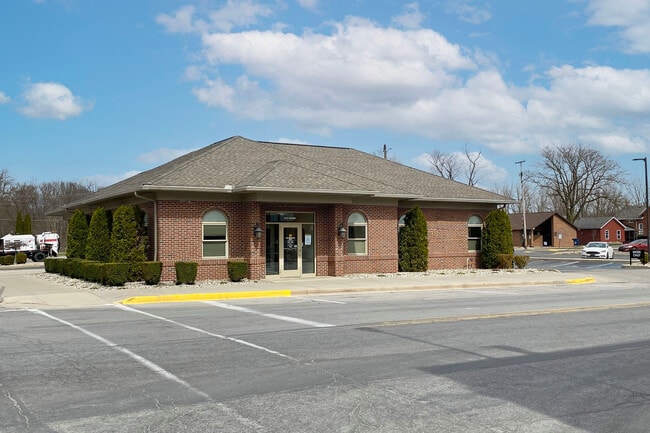
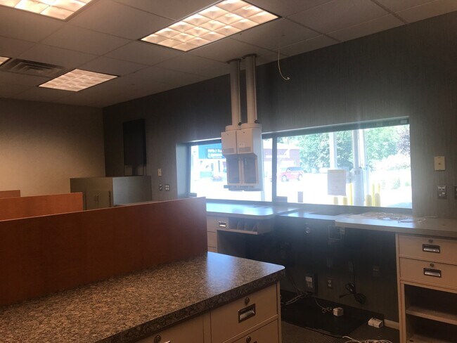
Property Record
15 E 8Th St, Monroe, MI 48161

Property Detail
15 E 8Th St
57-025-099-00
CP-BLK-21 11C-2B PLAT OF THE VILLAGE OF PETERSBURG BLK 21 W 9 FT OF LOT 10 & ALL OF LOTS 11 & 12 12/30/07 COMINED PIN 57 025
Centrallyassessed
MONROE
R1
Michigan
B and X Area of moderate flood hazard, usually the area between the limits of the 100-year and 500-year floods.
1,10-12
2024
0.43 AC
2025
Monroe County
832200
Detroit
2,378 SF
Monroe, MI
NEARBY LISTINGS FOR SALE OR LEASE
-
-
View all Monroe listings for sale on LoopNet.com
DEMOGRAPHICS near 15 E 8Th St
1 mile
3 mile
5 mile
2025 Total Population
1,531
3,156
11,069
2030 Population
1,538
3,141
11,130
Pop Growth 2025-2030
+ 0.46%
(0.48%)
+ 0.55%
Average Age
41
42
41
2025 Total Households
597
1,217
4,413
HH Growth 2025-2030
+ 0.50%
(0.41%)
+ 0.63%
Median Household Inc
$80,523
$85,969
$80,320
Avg Household Size
2.60
2.60
2.50
2025 Avg HH Vehicles
2.00
2.00
2.00
Median Home Value
$218,974
$248,410
$263,244
Median Year Built
1954
1958
1974
Nearby Places
Map Layers
Map Styles
 Street
 Aerial
Layers
 Traffic
 Biking
Places
Listings with unknown addresses are not visible on the map
- Restaurants
- Banks
- Shops
- Fitness
- Groceries
PUBLIC TRANSPORTATION
AIRPORT
Eugene F Kranz Toledo Express
Drive
Walk
Distance
Eugene F Kranz Toledo Express
53 min
32.1 mi
Detroit Metro Wayne County
Drive
Walk
Distance
Detroit Metro Wayne County
55 min
45.0 mi
Freight Ports
Port of Toledo
Drive
Walk
Distance
Port of Toledo
50 min
31.3 mi
SALE & LEASE HISTORY
LISTING DATE
SALE/LEASE

Sep 27, 2023
For Sale
Mar 16, 2021
For Sale
Nearby Properties
Address
Land Use
TOTAL SIZE
Lot Size
Zoning
Address
Land Use
TOTAL SIZE
Lot Size
Zoning
124,686 SF
27.50 AC
Address
Land Use
TOTAL SIZE
Lot Size
Zoning
27,900 SF
25.28 AC
Address
Land Use
TOTAL SIZE
Lot Size
Zoning
1,861 SF
192.94 AC
Address
Land Use
TOTAL SIZE
Lot Size
Zoning
185.48 AC
Address
Land Use
TOTAL SIZE
Lot Size
Zoning
2,432 SF
55.46 AC
Address
Land Use
TOTAL SIZE
Lot Size
Zoning
36,303 SF
56.54 AC
Address
Land Use
TOTAL SIZE
Lot Size
Zoning
12,600 SF
106 AC
Address
Land Use
TOTAL SIZE
Lot Size
Zoning
2,048 SF
77.68 AC
Address
Land Use
TOTAL SIZE
Lot Size
Zoning
2,486 SF
113.73 AC
Address
Land Use
TOTAL SIZE
Lot Size
Zoning
2,380 SF
63.30 AC
Address
Land Use
TOTAL SIZE
Lot Size
Zoning
158.76 AC
Address
Land Use
TOTAL SIZE
Lot Size
Zoning
Address
Land Use
TOTAL SIZE
Lot Size
Zoning
1,344 SF
80 AC
Address
Land Use
TOTAL SIZE
Lot Size
Zoning
2,229 SF
120 AC
Address
Land Use
TOTAL SIZE
Lot Size
Zoning
20,968 SF
4.40 AC
R1
Address
Land Use
TOTAL SIZE
Lot Size
Zoning
1,838 SF
75.61 AC
Address
Land Use
TOTAL SIZE
Lot Size
Zoning
141.50 AC
Address
Land Use
TOTAL SIZE
Lot Size
Zoning
17,630 SF
5.25 AC
Address
Land Use
TOTAL SIZE
Lot Size
Zoning
2,496 SF
54.01 AC
Address
Land Use
TOTAL SIZE
Lot Size
Zoning
2,268 SF
70 AC
Address
Land Use
TOTAL SIZE
Lot Size
Zoning
39.31 AC
Address
Land Use
TOTAL SIZE
Lot Size
Zoning
2,081 SF
58.79 AC
Address
Land Use
TOTAL SIZE
Lot Size
Zoning
121.10 AC
Address
Land Use
TOTAL SIZE
Lot Size
Zoning
1,603 SF
96.69 AC
Address
Land Use
TOTAL SIZE
Lot Size
Zoning
1,680 SF
80 AC
Address
Land Use
TOTAL SIZE
Lot Size
Zoning
1,788 SF
110 AC
Address
Land Use
TOTAL SIZE
Lot Size
Zoning
2,888 SF
36.50 AC
Address
Land Use
TOTAL SIZE
Lot Size
Zoning
1,128 SF
80 AC
Address
Land Use
TOTAL SIZE
Lot Size
Zoning
1,232 SF
77.49 AC
The World's #1 Commercial Real Estate Marketplace
Connect with us
© 2026 CoStar Group
The information above has been obtained from sources believed reliable. While we do not doubt its accuracy we have not verified it and make no guarantee, warranty or representation about it. It is your responsibility to independently confirm its accuracy and completeness. Any projections, opinions, assumptions, or estimates used are for example only and do not represent the current or future performance of the property. The value of this transaction to you depends on tax and other factors which should be evaluated by your tax, financial, and legal advisors. You and your advisors should conduct a careful, independent investigation of the property to determine to your satisfaction the suitability of the property for your needs.