Property Record
15 E Kirby St, Detroit, MI 48202

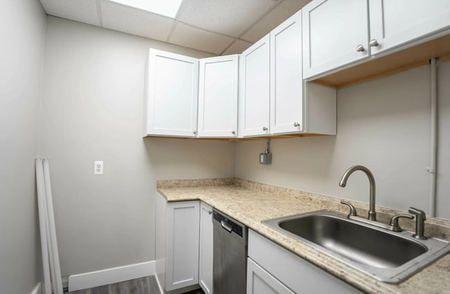
Current Lease Availabilities
NEARBY LISTINGS FOR SALE OR LEASE
Property Detail
15 E Kirby St
23-00-200-50-445
Wayne County Condominium Sub Plan No 793
Highriseapartments
E WOODWARD UNIT 61 WAYNE COUNTY CONDOMINIUM SUB PLAN NO 793 PARK SHELTON CONDOMINIUM RECORDED L41015 P1-21 DEEDS, WCR 1/81704 SF NEZ REH CERT N2005-0469 RELATED 01004235.061
X
Wayne
26163C0280E
Michigan
2025
704 AC
2025
Midtown Detroit
518000
Detroit
704 SF
Detroit-Warren-Dearborn, MI
DEMOGRAPHICS near 15 E Kirby St
1 Mile
3 Mile
5 Mile
2024 Total Population
17,982
130,020
312,753
2029 Population
17,558
129,151
313,196
Pop Growth 2024-2029
(2.36%)
(0.67%)
+ 0.14%
Average Age
35
38
38
2024 Total Households
9,043
59,112
129,898
HH Growth 2024-2029
(2.20%)
(0.53%)
+ 0.29%
Median Household Inc
$31,848
$35,594
$34,300
Avg Household Size
1.60
2.00
2.30
2024 Avg HH Vehicles
1.00
1.00
1.00
Median Home Value
$317,248
$127,028
$87,641
Median Year Built
1969
1949
1948
Nearby Places
Map Layers
Map Styles
 Street
 Aerial
- Restaurants
- Banks
- Shops
- Fitness
- Groceries
PUBLIC TRANSPORTATION
TRANSIT/SUBWAY
Ferry St - Southbound (QLINE - Qline Detroit)
DRIVE
WALK
Distance
Ferry St - Southbound (QLINE - Qline Detroit)
0 min
2 min
0.1 mi
Warren Ave - Southbound (QLINE - Qline Detroit)
DRIVE
WALK
Distance
Warren Ave - Southbound (QLINE - Qline Detroit)
1 min
8 min
0.4 mi
Amsterdam St - Northbound (QLINE - Qline Detroit)
DRIVE
WALK
Distance
Amsterdam St - Northbound (QLINE - Qline Detroit)
1 min
9 min
0.5 mi
Baltimore St - Northbound (QLINE - Qline Detroit)
DRIVE
WALK
Distance
Baltimore St - Northbound (QLINE - Qline Detroit)
3 min
13 min
0.7 mi
Canfield St - Southbound (QLINE - Qline Detroit)
DRIVE
WALK
Distance
Canfield St - Southbound (QLINE - Qline Detroit)
2 min
14 min
0.8 mi
COMMUTER RAIL
Detroit (Wolverine - Amtrak)
DRIVE
WALK
Distance
Detroit (Wolverine - Amtrak)
2 min
13 min
0.7 mi
Windsor (Toronto - Windsor - VIA Rail)
DRIVE
WALK
Distance
Windsor (Toronto - Windsor - VIA Rail)
16 min
6.8 mi
AIRPORT
Windsor International
DRIVE
WALK
Distance
Windsor International
29 min
12.6 mi
Detroit Metro Wayne County
DRIVE
WALK
Distance
Detroit Metro Wayne County
33 min
22.1 mi
Freight Ports
Port of Toledo
DRIVE
WALK
Distance
Port of Toledo
79 min
62.9 mi
Nearby Properties
Address
Land Use
TOTAL SIZE
Lot Size
Zoning
Address
Land Use
TOTAL SIZE
Lot Size
Zoning
3,032,363 SF
24.24 AC
SD5
Address
Land Use
TOTAL SIZE
Lot Size
Zoning
6,112,830 SF
13.67 AC
PD
Address
Land Use
TOTAL SIZE
Lot Size
Zoning
409,438 SF
0.83 AC
B6
Address
Land Use
TOTAL SIZE
Lot Size
Zoning
1,409,416 SF
13.53 AC
R6
Address
Land Use
TOTAL SIZE
Lot Size
Zoning
1,553,311 SF
3.05 AC
SD5
Address
Land Use
TOTAL SIZE
Lot Size
Zoning
1,994,989 SF
4.97 AC
B5
Address
Land Use
TOTAL SIZE
Lot Size
Zoning
873,048 SF
7.70 AC
R6
Address
Land Use
TOTAL SIZE
Lot Size
Zoning
1,478,866 SF
2.88 AC
PCA
Address
Land Use
TOTAL SIZE
Lot Size
Zoning
1,017,009 SF
1.35 AC
R6
Address
Land Use
TOTAL SIZE
Lot Size
Zoning
848,598 SF
8.78 AC
SD5
Address
Land Use
TOTAL SIZE
Lot Size
Zoning
252,150 SF
2.46 AC
SD5
Address
Land Use
TOTAL SIZE
Lot Size
Zoning
185,300 SF
3.36 AC
SD5
Address
Land Use
TOTAL SIZE
Lot Size
Zoning
1,847,449 SF
13.85 AC
PD
Address
Land Use
TOTAL SIZE
Lot Size
Zoning
6,620 SF
9.43 AC
B6
Address
Land Use
TOTAL SIZE
Lot Size
Zoning
1,004,872 SF
1.05 AC
PCA
Address
Land Use
TOTAL SIZE
Lot Size
Zoning
720,653 SF
1.53 AC
PCA
Address
Land Use
TOTAL SIZE
Lot Size
Zoning
3,793,609 SF
265.70 AC
M4
Address
Land Use
TOTAL SIZE
Lot Size
Zoning
895,279 SF
3.58 AC
PCA
Address
Land Use
TOTAL SIZE
Lot Size
Zoning
1,149,710 SF
1.07 AC
B5
Address
Land Use
TOTAL SIZE
Lot Size
Zoning
503,688 SF
Address
Land Use
TOTAL SIZE
Lot Size
Zoning
919,213 SF
B5
Address
Land Use
TOTAL SIZE
Lot Size
Zoning
568,546 SF
B5
Address
Land Use
TOTAL SIZE
Lot Size
Zoning
874,160 SF
9.91 AC
R6
Address
Land Use
TOTAL SIZE
Lot Size
Zoning
520,897 SF
0.85 AC
Address
Land Use
TOTAL SIZE
Lot Size
Zoning
306,496 SF
1.91 AC
R6
Address
Land Use
TOTAL SIZE
Lot Size
Zoning
430,286 SF
1.14 AC
PCA
Address
Land Use
TOTAL SIZE
Lot Size
Zoning
437,558 SF
0.72 AC
Address
Land Use
TOTAL SIZE
Lot Size
Zoning
187,652 SF
Address
Land Use
TOTAL SIZE
Lot Size
Zoning
268,746 SF
B5
Address
Land Use
TOTAL SIZE
Lot Size
Zoning
576,286 SF
1.66 AC
B4
The World's #1 Commercial Real Estate Marketplace
Connect with us
© 2025 CoStar Group
The information above has been obtained from sources believed reliable. While we do not doubt its accuracy we have not verified it and make no guarantee, warranty or representation about it. It is your responsibility to independently confirm its accuracy and completeness. Any projections, opinions, assumptions, or estimates used are for example only and do not represent the current or future performance of the property. The value of this transaction to you depends on tax and other factors which should be evaluated by your tax, financial, and legal advisors. You and your advisors should conduct a careful, independent investigation of the property to determine to your satisfaction the suitability of the property for your needs.