Property Record
15 E Weis St, Topton, PA 19562


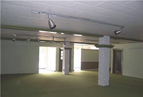
Property Detail
15 E Weis St
85-5473-17-01-1850
Berks
Storemultistory
Pennsylvania
B and X Area of moderate flood hazard, usually the area between the limits of the 100-year and 500-year floods.
0.20 AC
2025
Berks County
2025
Philadelphia
014201
Reading, PA
10,204 SF
NEARBY LISTINGS FOR SALE OR LEASE
DEMOGRAPHICS near 15 E Weis St
1 mile
3 mile
5 mile
2025 Total Population
3,463
7,562
31,796
2030 Population
3,572
7,749
33,193
Pop Growth 2025-2030
+ 3.15%
+ 2.47%
+ 4.39%
Average Age
46
45
41
2025 Total Households
1,340
2,996
12,314
HH Growth 2025-2030
+ 3.21%
+ 2.50%
+ 4.65%
Median Household Inc
$81,001
$86,526
$85,415
Avg Household Size
2.30
2.40
2.50
2025 Avg HH Vehicles
2.00
2.00
2.00
Median Home Value
$239,513
$262,319
$315,760
Median Year Built
1959
1963
1979
Nearby Places
Map Layers
Map Styles
 Street
 Aerial
Transit
 Traffic
 Biking
Places
Listings with unknown addresses are not visible on the map
- Restaurants
- Banks
- Shops
- Fitness
- Groceries
PUBLIC TRANSPORTATION
AIRPORT
Lehigh Valley International
Drive
Walk
Distance
Lehigh Valley International
37 min
21.8 mi
Freight Ports
Port of Philadelphia
Drive
Walk
Distance
Port of Philadelphia
96 min
69.7 mi
Nearby Properties
Address
Land Use
TOTAL SIZE
Lot Size
Zoning
Address
Land Use
TOTAL SIZE
Lot Size
Zoning
176,443 SF
16.98 AC
Address
Land Use
TOTAL SIZE
Lot Size
Zoning
57,179 SF
2 AC
Address
Land Use
TOTAL SIZE
Lot Size
Zoning
120,973 SF
7.31 AC
Address
Land Use
TOTAL SIZE
Lot Size
Zoning
128,933 SF
57.89 AC
Address
Land Use
TOTAL SIZE
Lot Size
Zoning
164,064 SF
13 AC
Address
Land Use
TOTAL SIZE
Lot Size
Zoning
33,070 SF
1.49 AC
Address
Land Use
TOTAL SIZE
Lot Size
Zoning
10,080 SF
1.48 AC
Address
Land Use
TOTAL SIZE
Lot Size
Zoning
31,114 SF
2.05 AC
Address
Land Use
TOTAL SIZE
Lot Size
Zoning
38,864 SF
19.82 AC
Address
Land Use
TOTAL SIZE
Lot Size
Zoning
20,640 SF
4.01 AC
Address
Land Use
TOTAL SIZE
Lot Size
Zoning
80,345 SF
50.97 AC
Address
Land Use
TOTAL SIZE
Lot Size
Zoning
122,994 SF
30.01 AC
Address
Land Use
TOTAL SIZE
Lot Size
Zoning
15,911 SF
149.74 AC
Address
Land Use
TOTAL SIZE
Lot Size
Zoning
18,896 SF
3.28 AC
Address
Land Use
TOTAL SIZE
Lot Size
Zoning
13,730 SF
3.44 AC
Address
Land Use
TOTAL SIZE
Lot Size
Zoning
14,560 SF
13.76 AC
Address
Land Use
TOTAL SIZE
Lot Size
Zoning
13,610 SF
2.44 AC
Address
Land Use
TOTAL SIZE
Lot Size
Zoning
14,400 SF
2.78 AC
Address
Land Use
TOTAL SIZE
Lot Size
Zoning
7,751 SF
30.80 AC
Address
Land Use
TOTAL SIZE
Lot Size
Zoning
1,400 SF
90.67 AC
Address
Land Use
TOTAL SIZE
Lot Size
Zoning
11,970 SF
0.76 AC
Address
Land Use
TOTAL SIZE
Lot Size
Zoning
33,450 SF
6.14 AC
Address
Land Use
TOTAL SIZE
Lot Size
Zoning
3,130 SF
Address
Land Use
TOTAL SIZE
Lot Size
Zoning
32,400 SF
2.50 AC
Address
Land Use
TOTAL SIZE
Lot Size
Zoning
3,961 SF
139.50 AC
Address
Land Use
TOTAL SIZE
Lot Size
Zoning
9,693 SF
0.41 AC
Address
Land Use
TOTAL SIZE
Lot Size
Zoning
5,600 SF
1.27 AC
Address
Land Use
TOTAL SIZE
Lot Size
Zoning
1,440 SF
5.53 AC
Address
Land Use
TOTAL SIZE
Lot Size
Zoning
24.45 AC
RU15
Address
Land Use
TOTAL SIZE
Lot Size
Zoning
12,780 SF
7.27 AC
The World's #1 Commercial Real Estate Marketplace
Connect with us
© 2026 CoStar Group
The information above has been obtained from sources believed reliable. While we do not doubt its accuracy we have not verified it and make no guarantee, warranty or representation about it. It is your responsibility to independently confirm its accuracy and completeness. Any projections, opinions, assumptions, or estimates used are for example only and do not represent the current or future performance of the property. The value of this transaction to you depends on tax and other factors which should be evaluated by your tax, financial, and legal advisors. You and your advisors should conduct a careful, independent investigation of the property to determine to your satisfaction the suitability of the property for your needs.