Property Record
15 Executive Dr, Stoneham, MA 02180
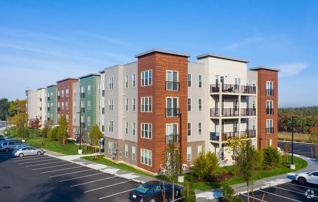


Property Detail
15 Executive Dr
STON-27-0-3D
MIDDLESEX
Apartment
Massachusetts
M
3d
B and X Area of moderate flood hazard, usually the area between the limits of the 100-year and 500-year floods.
0.47 AC
2025
Stoneham
2025
Boston
337102
Boston-Cambridge-Newton, MA-NH
NEARBY LISTINGS FOR SALE OR LEASE
DEMOGRAPHICS near 15 Executive Dr
1 mile
3 mile
5 mile
2025 Total Population
11,552
178,162
539,063
2030 Population
11,951
182,758
551,491
Pop Growth 2025-2030
+ 3.45%
+ 2.58%
+ 2.31%
Average Age
42
41
40
2025 Total Households
5,049
70,390
213,802
HH Growth 2025-2030
+ 3.74%
+ 2.79%
+ 2.50%
Median Household Inc
$112,784
$112,540
$113,434
Avg Household Size
2.20
2.40
2.40
2025 Avg HH Vehicles
1.00
2.00
1.00
Median Home Value
$698,827
$757,165
$770,973
Median Year Built
1956
1949
1950
Nearby Places
Map Layers
Map Styles
 Street
 Aerial
Layers
 Traffic
 Biking
Places
Listings with unknown addresses are not visible on the map
- Restaurants
- Banks
- Shops
- Fitness
- Groceries
PUBLIC TRANSPORTATION
COMMUTER RAIL
Wyoming Hill (Haverhill Line - Massachusetts Bay Transportation Authority Commuter Rail (Purple Line))
Drive
Walk
Distance
Wyoming Hill (Haverhill Line - Massachusetts Bay Transportation Authority Commuter Rail (Purple Line))
6 min
1.9 mi
Melrose/Cedar Park (Haverhill Line - Massachusetts Bay Transportation Authority Commuter Rail (Purple Line))
Drive
Walk
Distance
Melrose/Cedar Park (Haverhill Line - Massachusetts Bay Transportation Authority Commuter Rail (Purple Line))
6 min
2.2 mi
AIRPORT
General Edward Lawrence Logan International
Drive
Walk
Distance
General Edward Lawrence Logan International
19 min
10.5 mi
Freight Ports
Port of Boston
Drive
Walk
Distance
Port of Boston
20 min
10.3 mi
Nearby Properties
Address
Land Use
TOTAL SIZE
Lot Size
Zoning
Address
Land Use
TOTAL SIZE
Lot Size
Zoning
43.90 AC
Address
Land Use
TOTAL SIZE
Lot Size
Zoning
297,396 SF
2.79 AC
CTED
Address
Land Use
TOTAL SIZE
Lot Size
Zoning
Address
Land Use
TOTAL SIZE
Lot Size
Zoning
530,113 SF
29.43 AC
Address
Land Use
TOTAL SIZE
Lot Size
Zoning
19,308 SF
82.36 AC
NA
Address
Land Use
TOTAL SIZE
Lot Size
Zoning
254,075 SF
3.70 AC
Address
Land Use
TOTAL SIZE
Lot Size
Zoning
21,024 SF
18.19 AC
Address
Land Use
TOTAL SIZE
Lot Size
Zoning
14.97 AC
C
Address
Land Use
TOTAL SIZE
Lot Size
Zoning
454,752 SF
6.22 AC
Address
Land Use
TOTAL SIZE
Lot Size
Zoning
Address
Land Use
TOTAL SIZE
Lot Size
Zoning
153,732 SF
12.50 AC
SCI
Address
Land Use
TOTAL SIZE
Lot Size
Zoning
292,515 SF
21.61 AC
Address
Land Use
TOTAL SIZE
Lot Size
Zoning
70,134 SF
2.25 AC
CB
Address
Land Use
TOTAL SIZE
Lot Size
Zoning
11.72 AC
Address
Land Use
TOTAL SIZE
Lot Size
Zoning
319,472 SF
2.34 AC
CB
Address
Land Use
TOTAL SIZE
Lot Size
Zoning
181,417 SF
2.15 AC
Address
Land Use
TOTAL SIZE
Lot Size
Zoning
362,970 SF
8.36 AC
BH
Address
Land Use
TOTAL SIZE
Lot Size
Zoning
214,337 SF
1.42 AC
CB
Address
Land Use
TOTAL SIZE
Lot Size
Zoning
236,853 SF
0.86 AC
CB
Address
Land Use
TOTAL SIZE
Lot Size
Zoning
14.69 AC
RESC
Address
Land Use
TOTAL SIZE
Lot Size
Zoning
194,250 SF
2.48 AC
Address
Land Use
TOTAL SIZE
Lot Size
Zoning
11.80 AC
Address
Land Use
TOTAL SIZE
Lot Size
Zoning
720 SF
632 AC
SA8
Address
Land Use
TOTAL SIZE
Lot Size
Zoning
191,050 SF
3.15 AC
Address
Land Use
TOTAL SIZE
Lot Size
Zoning
14.52 AC
RESC
Address
Land Use
TOTAL SIZE
Lot Size
Zoning
213,000 SF
2.97 AC
RESA
Address
Land Use
TOTAL SIZE
Lot Size
Zoning
4.58 AC
HB
Address
Land Use
TOTAL SIZE
Lot Size
Zoning
264,580 SF
3.05 AC
CB
Address
Land Use
TOTAL SIZE
Lot Size
Zoning
165,920 SF
The World's #1 Commercial Real Estate Marketplace
Connect with us
© 2026 CoStar Group
The information above has been obtained from sources believed reliable. While we do not doubt its accuracy we have not verified it and make no guarantee, warranty or representation about it. It is your responsibility to independently confirm its accuracy and completeness. Any projections, opinions, assumptions, or estimates used are for example only and do not represent the current or future performance of the property. The value of this transaction to you depends on tax and other factors which should be evaluated by your tax, financial, and legal advisors. You and your advisors should conduct a careful, independent investigation of the property to determine to your satisfaction the suitability of the property for your needs.