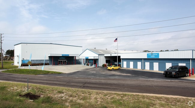
Property Record
15 Mcclure Dr, Gulf Breeze, FL 32561
Current Lease Availabilities
NEARBY LISTINGS FOR SALE OR LEASE
-
-
View all Gulf Breeze listings for lease on LoopNet.com
Property Detail
15 Mcclure Dr
04-3S-29-0000-02400-0000
COM NE CORN OF LOT 3 THN S3*9 16W 1700 FT THN N86*5642W 160 FT TO POB THN S3*916W 422.26 FT TO PT ON N R/W OF HWY 98 THN SW ALNG CURV (R=330 ANG=23*1515) 133.93 FT THN N55*032W 47.21 FT THN N3*9 16E 424.62 FT THN S86*5642E 170 FT TO POB (PARCEL 2) LE
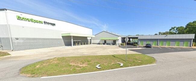
Publicstorage
Santa Rosa
X
Florida
12113C0606H
3
2024
1.61 AC
2025
Gulf Breeze
010900
Pensacola
70,426 SF
Pensacola-Ferry Pass-Brent, FL
DEMOGRAPHICS near 15 Mcclure Dr
1 Mile
3 Mile
5 Mile
2024 Total Population
3,235
10,710
24,565
2029 Population
3,724
12,110
27,527
Pop Growth 2024-2029
+ 15.12%
+ 13.07%
+ 12.06%
Average Age
46
46
45
2024 Total Households
1,398
4,602
10,752
HH Growth 2024-2029
+ 15.38%
+ 13.17%
+ 11.94%
Median Household Inc
$128,898
$115,310
$97,017
Avg Household Size
2.30
2.30
2.30
2024 Avg HH Vehicles
2.00
2.00
2.00
Median Home Value
$625,242
$521,143
$471,394
Median Year Built
1975
1978
1982
Nearby Places
Map Layers
Map Styles
 Street
 Aerial
- Restaurants
- Banks
- Shops
- Fitness
- Groceries
PUBLIC TRANSPORTATION
AIRPORT
Pensacola International
DRIVE
WALK
Distance
Pensacola International
22 min
11.4 mi
Freight Ports
Port of Mobile
DRIVE
WALK
Distance
Port of Mobile
79 min
65.2 mi
Nearby Properties
Address
Land Use
TOTAL SIZE
Lot Size
Zoning
Address
Land Use
TOTAL SIZE
Lot Size
Zoning
3,476 SF
540 AC
Address
Land Use
TOTAL SIZE
Lot Size
Zoning
10,134 SF
308 AC
Address
Land Use
TOTAL SIZE
Lot Size
Zoning
83,895 SF
149.82 AC
P
Address
Land Use
TOTAL SIZE
Lot Size
Zoning
341,192 SF
5.33 AC
CH-PB
Address
Land Use
TOTAL SIZE
Lot Size
Zoning
186,964 SF
21.30 AC
M
Address
Land Use
TOTAL SIZE
Lot Size
Zoning
130,923 SF
25.06 AC
CH-PB,GR-P
Address
Land Use
TOTAL SIZE
Lot Size
Zoning
5,410 SF
72 AC
P
Address
Land Use
TOTAL SIZE
Lot Size
Zoning
142,141 SF
3.92 AC
HDR/C-PB
Address
Land Use
TOTAL SIZE
Lot Size
Zoning
120,500 SF
11.11 AC
C1
Address
Land Use
TOTAL SIZE
Lot Size
Zoning
142,717 SF
5.25 AC
R1A
Address
Land Use
TOTAL SIZE
Lot Size
Zoning
132,772 SF
3.65 AC
CH-PB
Address
Land Use
TOTAL SIZE
Lot Size
Zoning
135,461 SF
9.54 AC
C1
Address
Land Use
TOTAL SIZE
Lot Size
Zoning
109,120 SF
4.65 AC
HDR/C-PB
Address
Land Use
TOTAL SIZE
Lot Size
Zoning
77,250 SF
10 AC
G/C-PB
Address
Land Use
TOTAL SIZE
Lot Size
Zoning
116,896 SF
8.12 AC
C1
Address
Land Use
TOTAL SIZE
Lot Size
Zoning
84,933 SF
4.09 AC
C1
Address
Land Use
TOTAL SIZE
Lot Size
Zoning
73,354 SF
0.96 AC
C1
Address
Land Use
TOTAL SIZE
Lot Size
Zoning
106,998 SF
2.82 AC
MDR/C-PB
Address
Land Use
TOTAL SIZE
Lot Size
Zoning
65,959 SF
5.28 AC
C1
Address
Land Use
TOTAL SIZE
Lot Size
Zoning
56,031 SF
2.93 AC
C1
Address
Land Use
TOTAL SIZE
Lot Size
Zoning
73,396 SF
6.31 AC
C1
Address
Land Use
TOTAL SIZE
Lot Size
Zoning
57,926 SF
1.58 AC
C1
Address
Land Use
TOTAL SIZE
Lot Size
Zoning
1,566 SF
16.74 AC
CON/REC-PB
Address
Land Use
TOTAL SIZE
Lot Size
Zoning
38,717 SF
2.95 AC
C1
Address
Land Use
TOTAL SIZE
Lot Size
Zoning
57,128 SF
3.66 AC
CH-PB
Address
Land Use
TOTAL SIZE
Lot Size
Zoning
50,259 SF
3.52 AC
C1
Address
Land Use
TOTAL SIZE
Lot Size
Zoning
62,335 SF
8.76 AC
R1A
Address
Land Use
TOTAL SIZE
Lot Size
Zoning
43,495 SF
2.89 AC
C1
Address
Land Use
TOTAL SIZE
Lot Size
Zoning
28,913 SF
2.04 AC
C1
The World's #1 Commercial Real Estate Marketplace
Connect with us
© 2026 CoStar Group
The information above has been obtained from sources believed reliable. While we do not doubt its accuracy we have not verified it and make no guarantee, warranty or representation about it. It is your responsibility to independently confirm its accuracy and completeness. Any projections, opinions, assumptions, or estimates used are for example only and do not represent the current or future performance of the property. The value of this transaction to you depends on tax and other factors which should be evaluated by your tax, financial, and legal advisors. You and your advisors should conduct a careful, independent investigation of the property to determine to your satisfaction the suitability of the property for your needs.