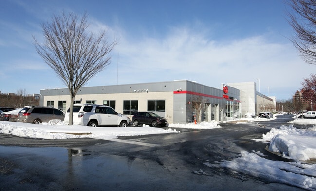
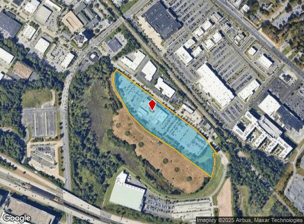
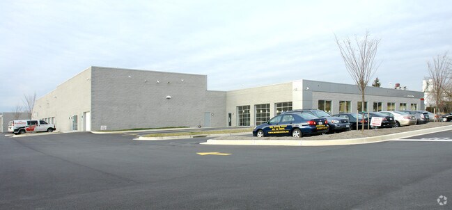
Property Record
15 Music Fair Rd, Owings Mills, MD 21117
NEARBY LISTINGS FOR SALE OR LEASE
Property Detail
15 Music Fair Rd
Baltimore-Columbia-Towson, MD
Wwlg Property
03-2500001427
11.6274 AC WWLG PROPERTY
Vehiclerentalsvehiclesales
Baltimore
AE
Maryland
24013C0350D
1
2024
11.63 AC
2025
Reisterstown Rd Corridor
403702
Baltimore
63,976 SF
DEMOGRAPHICS near 15 Music Fair Rd
1 Mile
3 Mile
5 Mile
2024 Total Population
9,573
82,883
177,534
2029 Population
9,640
82,074
174,976
Pop Growth 2024-2029
+ 0.70%
(0.98%)
(1.44%)
Average Age
34
40
41
2024 Total Households
3,379
32,749
69,410
HH Growth 2024-2029
+ 1.04%
(1.02%)
(1.49%)
Median Household Inc
$74,440
$90,721
$86,695
Avg Household Size
2.30
2.40
2.50
2024 Avg HH Vehicles
2.00
2.00
2.00
Median Home Value
$281,800
$297,942
$316,065
Median Year Built
1986
1990
1981
Nearby Places
Map Layers
Map Styles
 Street
 Aerial
- Restaurants
- Banks
- Shops
- Fitness
- Groceries
PUBLIC TRANSPORTATION
TRANSIT/SUBWAY
Owings Mills (Metro Subway - Maryland Transit Administration Metro Subway (Baltimore Metro))
DRIVE
WALK
Distance
Owings Mills (Metro Subway - Maryland Transit Administration Metro Subway (Baltimore Metro))
13 min
11 min
0.6 mi
AIRPORT
Baltimore/Washington International Thurgood Marshall
DRIVE
WALK
Distance
Baltimore/Washington International Thurgood Marshall
33 min
19.9 mi
Freight Ports
Port of Baltimore
DRIVE
WALK
Distance
Port of Baltimore
34 min
20.4 mi
Nearby Properties
Address
Land Use
TOTAL SIZE
Lot Size
Zoning
Address
Land Use
TOTAL SIZE
Lot Size
Zoning
408,321 SF
39.16 AC
BM
Address
Land Use
TOTAL SIZE
Lot Size
Zoning
630,367 SF
470.44 AC
DR1
Address
Land Use
TOTAL SIZE
Lot Size
Zoning
569,200 SF
8.82 AC
BM
Address
Land Use
TOTAL SIZE
Lot Size
Zoning
250,000 SF
1.61 AC
BMCT
Address
Land Use
TOTAL SIZE
Lot Size
Zoning
Address
Land Use
TOTAL SIZE
Lot Size
Zoning
452,042 SF
17.18 AC
RAE2
Address
Land Use
TOTAL SIZE
Lot Size
Zoning
709,328 SF
25.59 AC
OT
Address
Land Use
TOTAL SIZE
Lot Size
Zoning
12 AC
DR10
Address
Land Use
TOTAL SIZE
Lot Size
Zoning
23.07 AC
DR16
Address
Land Use
TOTAL SIZE
Lot Size
Zoning
4.31 AC
BM-CT
Address
Land Use
TOTAL SIZE
Lot Size
Zoning
300,838 SF
33.27 AC
DR105
Address
Land Use
TOTAL SIZE
Lot Size
Zoning
336,539 SF
12.38 AC
DR16
Address
Land Use
TOTAL SIZE
Lot Size
Zoning
Address
Land Use
TOTAL SIZE
Lot Size
Zoning
159.90 AC
Address
Land Use
TOTAL SIZE
Lot Size
Zoning
464,593 SF
6.38 AC
BM
Address
Land Use
TOTAL SIZE
Lot Size
Zoning
333,600 SF
8.39 AC
ML
Address
Land Use
TOTAL SIZE
Lot Size
Zoning
281,620 SF
8.58 AC
Address
Land Use
TOTAL SIZE
Lot Size
Zoning
756,000 SF
2.63 AC
Address
Land Use
TOTAL SIZE
Lot Size
Zoning
224,204 SF
7.64 AC
RAE2
Address
Land Use
TOTAL SIZE
Lot Size
Zoning
589,225 SF
1.96 AC
Address
Land Use
TOTAL SIZE
Lot Size
Zoning
99,153 SF
9.41 AC
OR2
Address
Land Use
TOTAL SIZE
Lot Size
Zoning
13.82 AC
DR16
Address
Land Use
TOTAL SIZE
Lot Size
Zoning
146,149 SF
1.08 AC
BM-CT
Address
Land Use
TOTAL SIZE
Lot Size
Zoning
285,044 SF
15.16 AC
MLIM
Address
Land Use
TOTAL SIZE
Lot Size
Zoning
Address
Land Use
TOTAL SIZE
Lot Size
Zoning
7.05 AC
BM
Address
Land Use
TOTAL SIZE
Lot Size
Zoning
252,674 SF
11.49 AC
DR16
Address
Land Use
TOTAL SIZE
Lot Size
Zoning
91,160 SF
2.53 AC
Address
Land Use
TOTAL SIZE
Lot Size
Zoning
190,068 SF
8.40 AC
RAE2
Address
Land Use
TOTAL SIZE
Lot Size
Zoning
186,708 SF
10.92 AC
DR3.5
The World's #1 Commercial Real Estate Marketplace
Connect with us
© 2025 CoStar Group
The information above has been obtained from sources believed reliable. While we do not doubt its accuracy we have not verified it and make no guarantee, warranty or representation about it. It is your responsibility to independently confirm its accuracy and completeness. Any projections, opinions, assumptions, or estimates used are for example only and do not represent the current or future performance of the property. The value of this transaction to you depends on tax and other factors which should be evaluated by your tax, financial, and legal advisors. You and your advisors should conduct a careful, independent investigation of the property to determine to your satisfaction the suitability of the property for your needs.