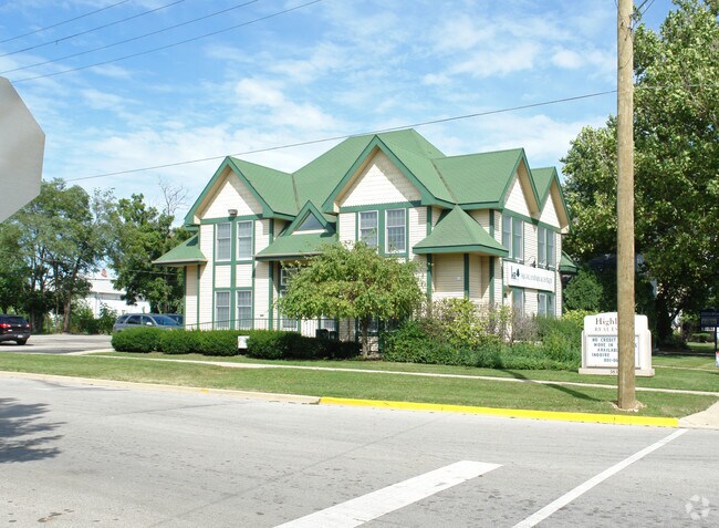
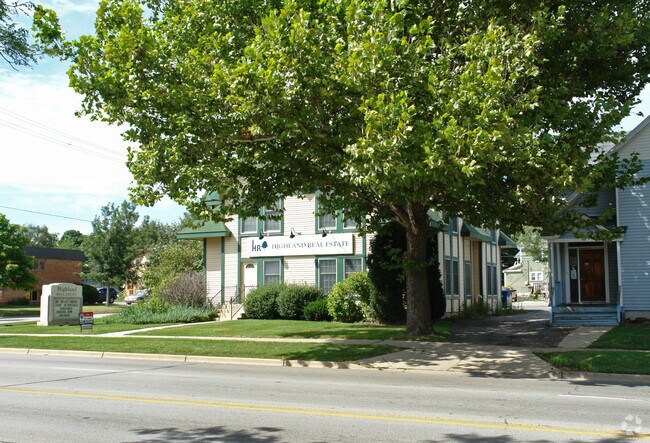
Property Record
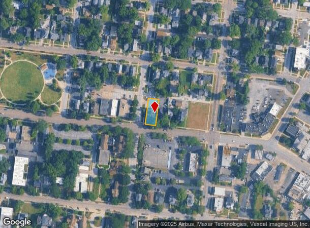
15 N Chestnut St, Aurora, IL 60506

NEARBY LISTINGS FOR SALE OR LEASE
Property Detail
15 N Chestnut St
Chicago-Naperville-Elgin, IL-IN-WI
Gales Addn
15-21-282-009
GALES ADDN LOT 7 BLK 17
Commercialnec
Kane
X
Illinois
17089C0339H
7
2024
0.21 AC
2024
Western East/West Corr
853100
Chicago
6,062 SF
DEMOGRAPHICS near 15 N Chestnut St
1 Mile
3 Mile
5 Mile
2024 Total Population
20,300
114,977
234,365
2029 Population
20,266
114,598
236,901
Pop Growth 2024-2029
(0.17%)
(0.33%)
+ 1.08%
Average Age
36
37
37
2024 Total Households
6,611
37,305
79,060
HH Growth 2024-2029
(0.12%)
(0.25%)
+ 1.13%
Median Household Inc
$55,833
$66,966
$81,924
Avg Household Size
2.90
2.90
2.90
2024 Avg HH Vehicles
2.00
2.00
2.00
Median Home Value
$169,866
$184,130
$235,369
Median Year Built
1948
1964
1985
Nearby Places
Map Layers
Map Styles
 Street
 Aerial
- Restaurants
- Banks
- Shops
- Fitness
- Groceries
PUBLIC TRANSPORTATION
COMMUTER RAIL
Aurora Station (Burlington Northern-Santa Fe Railway Line - Northeast Illinois Regional Commuter Railroad (Metra))
DRIVE
WALK
Distance
Aurora Station (Burlington Northern-Santa Fe Railway Line - Northeast Illinois Regional Commuter Railroad (Metra))
3 min
18 min
0.9 mi
Route 59 Station (Burlington Northern-Santa Fe Railway Line - Northeast Illinois Regional Commuter Railroad (Metra))
DRIVE
WALK
Distance
Route 59 Station (Burlington Northern-Santa Fe Railway Line - Northeast Illinois Regional Commuter Railroad (Metra))
15 min
7.8 mi
AIRPORT
Chicago O'Hare International
DRIVE
WALK
Distance
Chicago O'Hare International
69 min
37.4 mi
Chicago Midway International
DRIVE
WALK
Distance
Chicago Midway International
61 min
38.8 mi
Nearby Properties
Address
Land Use
TOTAL SIZE
Lot Size
Zoning
Address
Land Use
TOTAL SIZE
Lot Size
Zoning
19.80 AC
Address
Land Use
TOTAL SIZE
Lot Size
Zoning
Address
Land Use
TOTAL SIZE
Lot Size
Zoning
18.48 AC
Address
Land Use
TOTAL SIZE
Lot Size
Zoning
Address
Land Use
TOTAL SIZE
Lot Size
Zoning
394,560 SF
19.34 AC
Address
Land Use
TOTAL SIZE
Lot Size
Zoning
840,912 SF
49.56 AC
Address
Land Use
TOTAL SIZE
Lot Size
Zoning
Address
Land Use
TOTAL SIZE
Lot Size
Zoning
20.56 AC
Address
Land Use
TOTAL SIZE
Lot Size
Zoning
622,072 SF
6.04 AC
Address
Land Use
TOTAL SIZE
Lot Size
Zoning
255,500 SF
17.64 AC
Address
Land Use
TOTAL SIZE
Lot Size
Zoning
320,874 SF
1.49 AC
Address
Land Use
TOTAL SIZE
Lot Size
Zoning
989,724 SF
49.41 AC
Address
Land Use
TOTAL SIZE
Lot Size
Zoning
Address
Land Use
TOTAL SIZE
Lot Size
Zoning
169,918 SF
20 AC
Address
Land Use
TOTAL SIZE
Lot Size
Zoning
15.58 AC
Address
Land Use
TOTAL SIZE
Lot Size
Zoning
100,340 SF
1.80 AC
Address
Land Use
TOTAL SIZE
Lot Size
Zoning
73,880 SF
0.75 AC
Address
Land Use
TOTAL SIZE
Lot Size
Zoning
Address
Land Use
TOTAL SIZE
Lot Size
Zoning
181,268 SF
7.62 AC
Address
Land Use
TOTAL SIZE
Lot Size
Zoning
366,503 SF
11.88 AC
Address
Land Use
TOTAL SIZE
Lot Size
Zoning
28.95 AC
Address
Land Use
TOTAL SIZE
Lot Size
Zoning
136,900 SF
3.63 AC
Address
Land Use
TOTAL SIZE
Lot Size
Zoning
21.80 AC
Address
Land Use
TOTAL SIZE
Lot Size
Zoning
2.73 AC
Address
Land Use
TOTAL SIZE
Lot Size
Zoning
89,188 SF
3.70 AC
Address
Land Use
TOTAL SIZE
Lot Size
Zoning
217,505 SF
17.50 AC
Address
Land Use
TOTAL SIZE
Lot Size
Zoning
3.85 AC
Address
Land Use
TOTAL SIZE
Lot Size
Zoning
70,780 SF
10.91 AC
Address
Land Use
TOTAL SIZE
Lot Size
Zoning
34,822 SF
136.74 AC
Address
Land Use
TOTAL SIZE
Lot Size
Zoning
41,013 SF
The World's #1 Commercial Real Estate Marketplace
Connect with us
© 2025 CoStar Group
The information above has been obtained from sources believed reliable. While we do not doubt its accuracy we have not verified it and make no guarantee, warranty or representation about it. It is your responsibility to independently confirm its accuracy and completeness. Any projections, opinions, assumptions, or estimates used are for example only and do not represent the current or future performance of the property. The value of this transaction to you depends on tax and other factors which should be evaluated by your tax, financial, and legal advisors. You and your advisors should conduct a careful, independent investigation of the property to determine to your satisfaction the suitability of the property for your needs.