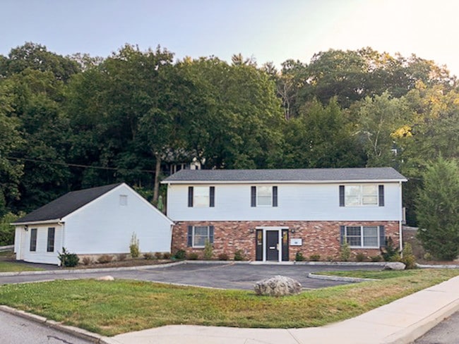
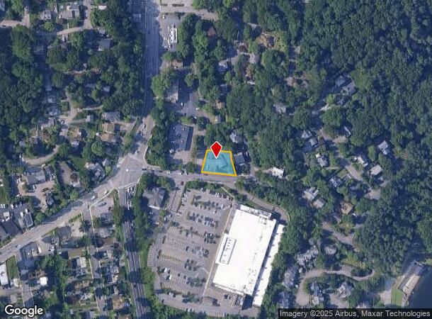
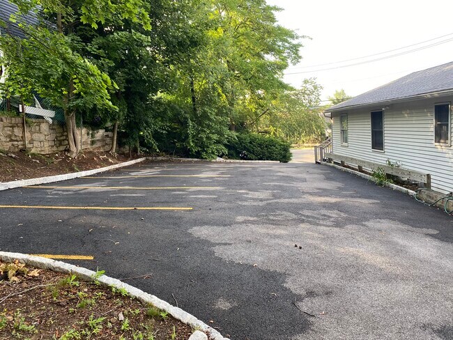
Property Record
15 Revere Rd, Scarsdale, NY 10583
NEARBY LISTINGS FOR SALE OR LEASE
Property Detail
15 Revere Rd
3800-122-000-00016-000-0003-023-0000
Westchester
Officebuilding
New York
X
23.000
36119C0267F
0.23 AC
2025
East I-287 Corridor
2024
Westchester/So Connecticut
010100
New York-Jersey City-White Plains, NY-NJ
DEMOGRAPHICS near 15 Revere Rd
1 Mile
3 Mile
5 Mile
2024 Total Population
10,119
95,254
171,534
2029 Population
9,848
93,815
169,015
Pop Growth 2024-2029
(2.68%)
(1.51%)
(1.47%)
Average Age
42
42
42
2024 Total Households
3,679
37,037
63,403
HH Growth 2024-2029
(2.83%)
(1.45%)
(1.51%)
Median Household Inc
$129,265
$114,547
$138,208
Avg Household Size
2.60
2.40
2.60
2024 Avg HH Vehicles
2.00
2.00
2.00
Median Home Value
$598,738
$580,817
$713,273
Median Year Built
1956
1962
1961
Nearby Places
- Restaurants
- Banks
- Shops
- Fitness
- Groceries
PUBLIC TRANSPORTATION
COMMUTER RAIL
North White Plains Station (Harlem Line - Metro-North Commuter Railroad Company (Metro-North))
DRIVE
WALK
Distance
North White Plains Station (Harlem Line - Metro-North Commuter Railroad Company (Metro-North))
2 min
12 min
0.6 mi
Valhalla Station (Harlem Line - Metro-North Commuter Railroad Company (Metro-North))
DRIVE
WALK
Distance
Valhalla Station (Harlem Line - Metro-North Commuter Railroad Company (Metro-North))
5 min
3.1 mi
AIRPORT
Westchester County
DRIVE
WALK
Distance
Westchester County
13 min
8.8 mi
LaGuardia
DRIVE
WALK
Distance
LaGuardia
43 min
29.5 mi
John F Kennedy International
DRIVE
WALK
Distance
John F Kennedy International
51 min
34.7 mi
Freight Ports
NY - Red Hook Container Terminal
DRIVE
WALK
Distance
NY - Red Hook Container Terminal
56 min
37.7 mi
SALE & LEASE HISTORY
LISTING DATE
SALE/LEASE

Sep 20, 2019
For Sale
Sep 14, 2018
For Sale
Sep 07, 2018
For Lease
Sep 07, 2018
For Lease
Oct 19, 2018
For Lease
Oct 11, 2018
For Sale
Oct 10, 2018
For Lease
Jul 13, 2020
For Lease
Jul 13, 2020
For Sale
Jan 24, 2019
For Sale
Nearby Properties
Address
Land Use
TOTAL SIZE
Lot Size
Zoning
Address
Land Use
TOTAL SIZE
Lot Size
Zoning
358.83 AC
Address
Land Use
TOTAL SIZE
Lot Size
Zoning
4.45 AC
B
Address
Land Use
TOTAL SIZE
Lot Size
Zoning
75.87 AC
R-20
Address
Land Use
TOTAL SIZE
Lot Size
Zoning
17.17 AC
Address
Land Use
TOTAL SIZE
Lot Size
Zoning
24.66 AC
Address
Land Use
TOTAL SIZE
Lot Size
Zoning
16.22 AC
UR
Address
Land Use
TOTAL SIZE
Lot Size
Zoning
19.25 AC
Address
Land Use
TOTAL SIZE
Lot Size
Zoning
22.44 AC
R-20
Address
Land Use
TOTAL SIZE
Lot Size
Zoning
11.61 AC
Address
Land Use
TOTAL SIZE
Lot Size
Zoning
Address
Land Use
TOTAL SIZE
Lot Size
Zoning
7.98 AC
CA
Address
Land Use
TOTAL SIZE
Lot Size
Zoning
1,975 SF
13.80 AC
CA
Address
Land Use
TOTAL SIZE
Lot Size
Zoning
29.42 AC
PUD
Address
Land Use
TOTAL SIZE
Lot Size
Zoning
10.90 AC
UR
Address
Land Use
TOTAL SIZE
Lot Size
Zoning
3.16 AC
Address
Land Use
TOTAL SIZE
Lot Size
Zoning
1,200 SF
21.21 AC
R-20
Address
Land Use
TOTAL SIZE
Lot Size
Zoning
7.98 AC
M-14
Address
Land Use
TOTAL SIZE
Lot Size
Zoning
0.58 AC
B
Address
Land Use
TOTAL SIZE
Lot Size
Zoning
50,000 SF
9.02 AC
PD
Address
Land Use
TOTAL SIZE
Lot Size
Zoning
96,560 SF
12.76 AC
DS
Address
Land Use
TOTAL SIZE
Lot Size
Zoning
3.56 AC
PD
Address
Land Use
TOTAL SIZE
Lot Size
Zoning
84,450 SF
3.19 AC
B
Address
Land Use
TOTAL SIZE
Lot Size
Zoning
5.43 AC
R-40
Address
Land Use
TOTAL SIZE
Lot Size
Zoning
320 SF
5.38 AC
LI
Address
Land Use
TOTAL SIZE
Lot Size
Zoning
10.44 AC
Address
Land Use
TOTAL SIZE
Lot Size
Zoning
1,348 SF
5.67 AC
CA
Address
Land Use
TOTAL SIZE
Lot Size
Zoning
6.09 AC
DS
Address
Land Use
TOTAL SIZE
Lot Size
Zoning
1,630 SF
2.64 AC
LOB
Address
Land Use
TOTAL SIZE
Lot Size
Zoning
196,901 SF
4.76 AC
PD
Address
Land Use
TOTAL SIZE
Lot Size
Zoning
98,800 SF
6.83 AC
PD
The World's #1 Commercial Real Estate Marketplace
Connect with us
© 2025 CoStar Group
The information above has been obtained from sources believed reliable. While we do not doubt its accuracy we have not verified it and make no guarantee, warranty or representation about it. It is your responsibility to independently confirm its accuracy and completeness. Any projections, opinions, assumptions, or estimates used are for example only and do not represent the current or future performance of the property. The value of this transaction to you depends on tax and other factors which should be evaluated by your tax, financial, and legal advisors. You and your advisors should conduct a careful, independent investigation of the property to determine to your satisfaction the suitability of the property for your needs.