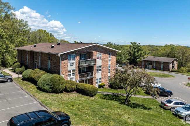
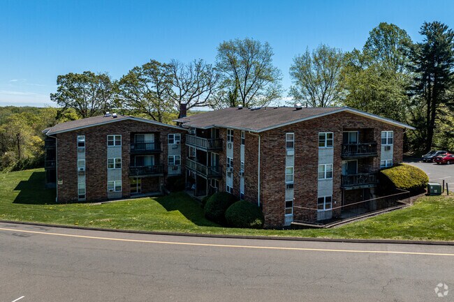
Property Record
15 Ridge Ct E, West Haven, CT 06516

Property Detail
15 Ridge Ct E
Apartmenthouse5plusunits
South Central Ct
R2
Connecticut
AE The base floodplain where base flood elevations are provided. AE Zones are now used on new format FIRMs instead of A1-A30 Zones.
10.62 AC
2025
West Haven
2025
Westchester/So Connecticut
154200
New Haven, CT
20,216 SF
WHAV-000041-000056
NEARBY LISTINGS FOR SALE OR LEASE
-
-
-
No Photo
-
-
-
-
-
View all West Haven listings for sale on LoopNet.com
DEMOGRAPHICS near 15 Ridge Ct E
1 mile
3 mile
5 mile
2025 Total Population
18,716
89,634
216,191
2030 Population
19,092
90,681
217,626
Pop Growth 2025-2030
+ 2.01%
+ 1.17%
+ 0.66%
Average Age
37
39
38
2025 Total Households
6,377
34,402
83,552
HH Growth 2025-2030
+ 2.05%
+ 1.24%
+ 0.73%
Median Household Inc
$65,570
$67,386
$68,516
Avg Household Size
2.50
2.40
2.30
2025 Avg HH Vehicles
2.00
2.00
1.00
Median Home Value
$261,797
$299,492
$327,863
Median Year Built
1970
1958
1956
Nearby Places
Map Layers
Map Styles
 Street
 Aerial
Layers
 Traffic
 Biking
Places
Listings with unknown addresses are not visible on the map
- Restaurants
- Banks
- Shops
- Fitness
- Groceries
PUBLIC TRANSPORTATION
COMMUTER RAIL
West Haven (New Haven - Metro-North Railroad)
Drive
Walk
Distance
West Haven (New Haven - Metro-North Railroad)
2 min
16 min
0.8 mi
New Haven (New Haven - Metro-North Railroad)
Drive
Walk
Distance
New Haven (New Haven - Metro-North Railroad)
6 min
2.8 mi
AIRPORT
Tweed/New Haven
Drive
Walk
Distance
Tweed/New Haven
16 min
7.9 mi
Freight Ports
Port of New Haven
Drive
Walk
Distance
Port of New Haven
11 min
5.0 mi
Nearby Properties
Address
Land Use
TOTAL SIZE
Lot Size
Zoning
Address
Land Use
TOTAL SIZE
Lot Size
Zoning
289,886 SF
2.21 AC
BD2
Address
Land Use
TOTAL SIZE
Lot Size
Zoning
56,359 SF
17.09 AC
RCPD
Address
Land Use
TOTAL SIZE
Lot Size
Zoning
50.14 AC
PRD
Address
Land Use
TOTAL SIZE
Lot Size
Zoning
81,870 SF
3.86 AC
RM2
Address
Land Use
TOTAL SIZE
Lot Size
Zoning
302,262 SF
10.40 AC
RM1
Address
Land Use
TOTAL SIZE
Lot Size
Zoning
133,767 SF
1.25 AC
BD2
Address
Land Use
TOTAL SIZE
Lot Size
Zoning
486,703 SF
2.12 AC
BD
Address
Land Use
TOTAL SIZE
Lot Size
Zoning
72,708 SF
1.91 AC
PDU 87
Address
Land Use
TOTAL SIZE
Lot Size
Zoning
117,902 SF
1.41 AC
BD
Address
Land Use
TOTAL SIZE
Lot Size
Zoning
42.52 AC
PF
Address
Land Use
TOTAL SIZE
Lot Size
Zoning
287,844 SF
2.11 AC
IL
Address
Land Use
TOTAL SIZE
Lot Size
Zoning
158,622 SF
2.09 AC
BA/RM2
Address
Land Use
TOTAL SIZE
Lot Size
Zoning
29.78 AC
PRD
Address
Land Use
TOTAL SIZE
Lot Size
Zoning
76,945 SF
8.52 AC
RM2
Address
Land Use
TOTAL SIZE
Lot Size
Zoning
35.05 AC
LI-2
Address
Land Use
TOTAL SIZE
Lot Size
Zoning
125,577 SF
0.90 AC
RH2
Address
Land Use
TOTAL SIZE
Lot Size
Zoning
205,756 SF
1.27 AC
PDD 15
Address
Land Use
TOTAL SIZE
Lot Size
Zoning
88,578 SF
0.42 AC
PDD 98
Address
Land Use
TOTAL SIZE
Lot Size
Zoning
840,277 SF
4.28 AC
BD2
Address
Land Use
TOTAL SIZE
Lot Size
Zoning
91,976 SF
0.11 AC
PDD 98
Address
Land Use
TOTAL SIZE
Lot Size
Zoning
576 SF
RS2
Address
Land Use
TOTAL SIZE
Lot Size
Zoning
119,187 SF
1.38 AC
RO
Address
Land Use
TOTAL SIZE
Lot Size
Zoning
54,372 SF
2.42 AC
BD2
Address
Land Use
TOTAL SIZE
Lot Size
Zoning
125,676 SF
22.12 AC
BOP
Address
Land Use
TOTAL SIZE
Lot Size
Zoning
194,140 SF
1.50 AC
BD3
Address
Land Use
TOTAL SIZE
Lot Size
Zoning
85,592 SF
1.75 AC
BD1
Address
Land Use
TOTAL SIZE
Lot Size
Zoning
228,347 SF
0.66 AC
BA
Address
Land Use
TOTAL SIZE
Lot Size
Zoning
253,181 SF
1.86 AC
RH2
Address
Land Use
TOTAL SIZE
Lot Size
Zoning
26,560 SF
4.22 AC
RM2
Address
Land Use
TOTAL SIZE
Lot Size
Zoning
155,143 SF
1.11 AC
BD
The World's #1 Commercial Real Estate Marketplace
Connect with us
© 2026 CoStar Group
The information above has been obtained from sources believed reliable. While we do not doubt its accuracy we have not verified it and make no guarantee, warranty or representation about it. It is your responsibility to independently confirm its accuracy and completeness. Any projections, opinions, assumptions, or estimates used are for example only and do not represent the current or future performance of the property. The value of this transaction to you depends on tax and other factors which should be evaluated by your tax, financial, and legal advisors. You and your advisors should conduct a careful, independent investigation of the property to determine to your satisfaction the suitability of the property for your needs.