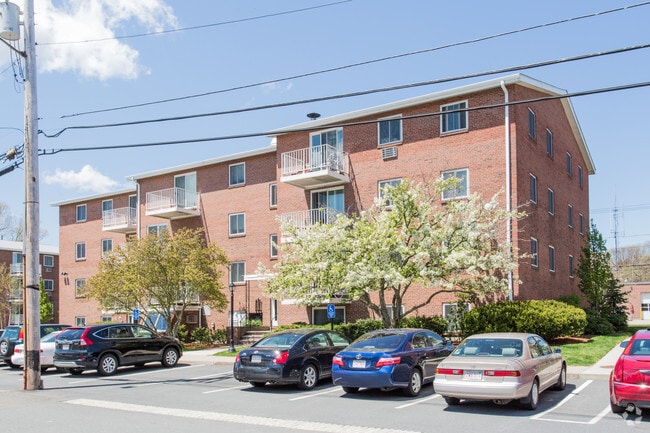
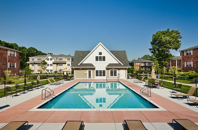
Property Record
15 Ridgecrest Ter, West Roxbury, MA 02132
NEARBY LISTINGS FOR SALE OR LEASE
Property Detail
15 Ridgecrest Ter
Apartment
Suffolk
X
Massachusetts
25021C0044F
4.40 AC
2025
Upper Washington-Spring St
2025
Boston
130406
Boston-Cambridge-Newton, MA-NH
126,702 SF
WROX-000000-000020-012112
DEMOGRAPHICS near 15 Ridgecrest Ter
1 Mile
3 Mile
5 Mile
2024 Total Population
15,772
132,297
329,089
2029 Population
15,031
126,930
316,832
Pop Growth 2024-2029
(4.70%)
(4.06%)
(3.72%)
Average Age
41
42
41
2024 Total Households
6,281
50,590
123,701
HH Growth 2024-2029
(5.25%)
(4.57%)
(4.18%)
Median Household Inc
$83,628
$101,688
$102,852
Avg Household Size
2.40
2.50
2.50
2024 Avg HH Vehicles
1.00
2.00
1.00
Median Home Value
$609,398
$650,332
$744,185
Median Year Built
1961
1951
1951
Nearby Places
Map Layers
Map Styles
 Street
 Aerial
- Restaurants
- Banks
- Shops
- Fitness
- Groceries
PUBLIC TRANSPORTATION
COMMUTER RAIL
West Roxbury (Needham Line - Massachusetts Bay Transportation Authority Commuter Rail (Purple Line))
DRIVE
WALK
Distance
West Roxbury (Needham Line - Massachusetts Bay Transportation Authority Commuter Rail (Purple Line))
6 min
2.3 mi
Hyde Park (Franklin Line - Massachusetts Bay Transportation Authority Commuter Rail (Purple Line), Providence/Stoughton Line - Massachusetts Bay Transportation Authority Commuter Rail (Purple Line))
DRIVE
WALK
Distance
Hyde Park (Franklin Line - Massachusetts Bay Transportation Authority Commuter Rail (Purple Line), Providence/Stoughton Line - Massachusetts Bay Transportation Authority Commuter Rail (Purple Line))
9 min
3.6 mi
AIRPORT
General Edward Lawrence Logan International
DRIVE
WALK
Distance
General Edward Lawrence Logan International
25 min
11.7 mi
Freight Ports
Port of Boston
DRIVE
WALK
Distance
Port of Boston
23 min
10.1 mi
Nearby Properties
Address
Land Use
TOTAL SIZE
Lot Size
Zoning
Address
Land Use
TOTAL SIZE
Lot Size
Zoning
30,845 SF
50.36 AC
SR1
Address
Land Use
TOTAL SIZE
Lot Size
Zoning
317,049 SF
11.22 AC
M05
Address
Land Use
TOTAL SIZE
Lot Size
Zoning
45,000 SF
14.30 AC
E
Address
Land Use
TOTAL SIZE
Lot Size
Zoning
355,941 SF
4.60 AC
A
Address
Land Use
TOTAL SIZE
Lot Size
Zoning
413,827 SF
9.49 AC
RDO
Address
Land Use
TOTAL SIZE
Lot Size
Zoning
179.13 AC
E
Address
Land Use
TOTAL SIZE
Lot Size
Zoning
225,042 SF
63.16 AC
RA
Address
Land Use
TOTAL SIZE
Lot Size
Zoning
11.66 AC
LM
Address
Land Use
TOTAL SIZE
Lot Size
Zoning
34.93 AC
LM
Address
Land Use
TOTAL SIZE
Lot Size
Zoning
270,991 SF
33.25 AC
RA
Address
Land Use
TOTAL SIZE
Lot Size
Zoning
21,830 SF
158.48 AC
E
Address
Land Use
TOTAL SIZE
Lot Size
Zoning
3.18 AC
M05
Address
Land Use
TOTAL SIZE
Lot Size
Zoning
26,569 SF
45.93 AC
RC
Address
Land Use
TOTAL SIZE
Lot Size
Zoning
332,100 SF
4.63 AC
M05
Address
Land Use
TOTAL SIZE
Lot Size
Zoning
8.18 AC
B
Address
Land Use
TOTAL SIZE
Lot Size
Zoning
22.95 AC
E
Address
Land Use
TOTAL SIZE
Lot Size
Zoning
83,891 SF
3.47 AC
RA
Address
Land Use
TOTAL SIZE
Lot Size
Zoning
475,102 SF
36.81 AC
A
Address
Land Use
TOTAL SIZE
Lot Size
Zoning
45.72 AC
LM
Address
Land Use
TOTAL SIZE
Lot Size
Zoning
15 AC
Address
Land Use
TOTAL SIZE
Lot Size
Zoning
7.45 AC
M05
Address
Land Use
TOTAL SIZE
Lot Size
Zoning
2.35 AC
E
Address
Land Use
TOTAL SIZE
Lot Size
Zoning
99,104 SF
11.48 AC
S10
Address
Land Use
TOTAL SIZE
Lot Size
Zoning
156,310 SF
9.40 AC
E
Address
Land Use
TOTAL SIZE
Lot Size
Zoning
100,963 SF
17.69 AC
A
Address
Land Use
TOTAL SIZE
Lot Size
Zoning
94.34 AC
E
Address
Land Use
TOTAL SIZE
Lot Size
Zoning
266,074 SF
44.50 AC
E
Address
Land Use
TOTAL SIZE
Lot Size
Zoning
143,591 SF
14.71 AC
MR3
Address
Land Use
TOTAL SIZE
Lot Size
Zoning
35.07 AC
PUB
Address
Land Use
TOTAL SIZE
Lot Size
Zoning
148.18 AC
E
The World's #1 Commercial Real Estate Marketplace
Connect with us
© 2025 CoStar Group
The information above has been obtained from sources believed reliable. While we do not doubt its accuracy we have not verified it and make no guarantee, warranty or representation about it. It is your responsibility to independently confirm its accuracy and completeness. Any projections, opinions, assumptions, or estimates used are for example only and do not represent the current or future performance of the property. The value of this transaction to you depends on tax and other factors which should be evaluated by your tax, financial, and legal advisors. You and your advisors should conduct a careful, independent investigation of the property to determine to your satisfaction the suitability of the property for your needs.