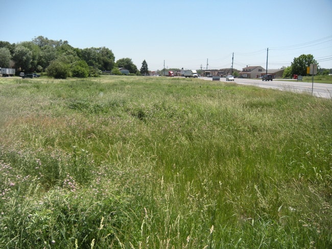
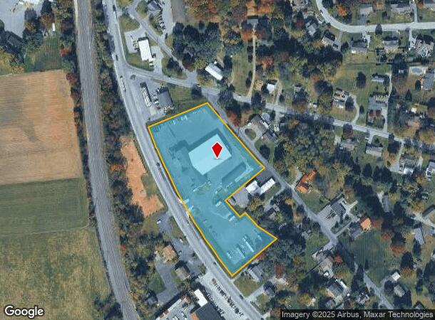
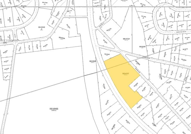
Property Record
15 Route 41 Rd, Gap, PA 17527
NEARBY LISTINGS FOR SALE OR LEASE
Property Detail
15 Route 41 Rd
Lancaster, PA
NEWPORT RD
550-45107-0-0000
Lancaster
Lightindustrial
Pennsylvania
X
1a
42071C0557F
3.40 AC
2024
Lancaster County
2025
Philadelphia
014202
DEMOGRAPHICS near 15 Route 41 Rd
1 Mile
3 Mile
5 Mile
2024 Total Population
2,076
9,846
19,709
2029 Population
2,078
9,872
19,774
Pop Growth 2024-2029
+ 0.10%
+ 0.26%
+ 0.33%
Average Age
39
37
36
2024 Total Households
694
3,063
6,111
HH Growth 2024-2029
+ 0.14%
+ 0.33%
+ 0.46%
Median Household Inc
$97,413
$89,106
$85,986
Avg Household Size
2.80
3.10
3.10
2024 Avg HH Vehicles
2.00
2.00
2.00
Median Home Value
$318,027
$307,700
$307,574
Median Year Built
1964
1974
1976
Nearby Places
Map Layers
Map Styles
 Street
 Aerial
- Restaurants
- Banks
- Shops
- Fitness
- Groceries
PUBLIC TRANSPORTATION
COMMUTER RAIL
Parkesburg Amtrak (Keystone Service - Amtrak)
DRIVE
WALK
Distance
Parkesburg Amtrak (Keystone Service - Amtrak)
12 min
6.7 mi
Freight Ports
Port of Wilmington, RI
DRIVE
WALK
Distance
Port of Wilmington, RI
63 min
36.1 mi
SALE & LEASE HISTORY
LISTING DATE
SALE/LEASE

Sep 24, 2016
For Sale
Nearby Properties
Address
Land Use
TOTAL SIZE
Lot Size
Zoning
Address
Land Use
TOTAL SIZE
Lot Size
Zoning
982,485 SF
51.90 AC
I
Address
Land Use
TOTAL SIZE
Lot Size
Zoning
291,116 SF
31.17 AC
I
Address
Land Use
TOTAL SIZE
Lot Size
Zoning
85,746 SF
19.70 AC
RC
Address
Land Use
TOTAL SIZE
Lot Size
Zoning
87,426 SF
15 AC
A
Address
Land Use
TOTAL SIZE
Lot Size
Zoning
41,103 SF
2.20 AC
Address
Land Use
TOTAL SIZE
Lot Size
Zoning
60,700 SF
7.80 AC
Address
Land Use
TOTAL SIZE
Lot Size
Zoning
90,177 SF
21.40 AC
I
Address
Land Use
TOTAL SIZE
Lot Size
Zoning
14,851 SF
172.50 AC
Address
Land Use
TOTAL SIZE
Lot Size
Zoning
54,305 SF
3.70 AC
Address
Land Use
TOTAL SIZE
Lot Size
Zoning
61,716 SF
6.15 AC
R-2
Address
Land Use
TOTAL SIZE
Lot Size
Zoning
35,568 SF
12.70 AC
R
Address
Land Use
TOTAL SIZE
Lot Size
Zoning
62,057 SF
5.80 AC
C1
Address
Land Use
TOTAL SIZE
Lot Size
Zoning
76,389 SF
13.40 AC
A
Address
Land Use
TOTAL SIZE
Lot Size
Zoning
7,345 SF
2.38 AC
GC
Address
Land Use
TOTAL SIZE
Lot Size
Zoning
31,339 SF
7.20 AC
OS
Address
Land Use
TOTAL SIZE
Lot Size
Zoning
75,610 SF
9.90 AC
C1
Address
Land Use
TOTAL SIZE
Lot Size
Zoning
44,119 SF
9.20 AC
I
Address
Land Use
TOTAL SIZE
Lot Size
Zoning
10,320 SF
5.59 AC
Address
Land Use
TOTAL SIZE
Lot Size
Zoning
5 AC
R-1
Address
Land Use
TOTAL SIZE
Lot Size
Zoning
22,688 SF
11.68 AC
Address
Land Use
TOTAL SIZE
Lot Size
Zoning
56,616 SF
6.57 AC
I
Address
Land Use
TOTAL SIZE
Lot Size
Zoning
25,855 SF
12.87 AC
GC
Address
Land Use
TOTAL SIZE
Lot Size
Zoning
8,551 SF
111.33 AC
A
Address
Land Use
TOTAL SIZE
Lot Size
Zoning
31.44 AC
R
Address
Land Use
TOTAL SIZE
Lot Size
Zoning
Address
Land Use
TOTAL SIZE
Lot Size
Zoning
49,324 SF
3.80 AC
I
Address
Land Use
TOTAL SIZE
Lot Size
Zoning
6,435 SF
115.90 AC
A
Address
Land Use
TOTAL SIZE
Lot Size
Zoning
30,453 SF
5.90 AC
Address
Land Use
TOTAL SIZE
Lot Size
Zoning
6,530 SF
83.24 AC
A
The World's #1 Commercial Real Estate Marketplace
Connect with us
© 2026 CoStar Group
The information above has been obtained from sources believed reliable. While we do not doubt its accuracy we have not verified it and make no guarantee, warranty or representation about it. It is your responsibility to independently confirm its accuracy and completeness. Any projections, opinions, assumptions, or estimates used are for example only and do not represent the current or future performance of the property. The value of this transaction to you depends on tax and other factors which should be evaluated by your tax, financial, and legal advisors. You and your advisors should conduct a careful, independent investigation of the property to determine to your satisfaction the suitability of the property for your needs.