Property Record
15 Spring Branch Dr, Oxford, AL 36203
NEARBY LISTINGS FOR SALE OR LEASE
Property Detail
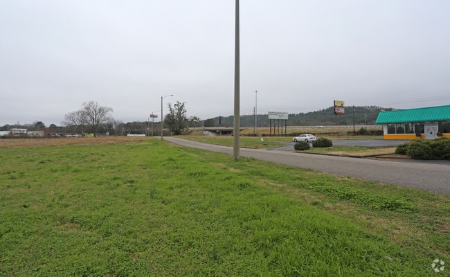
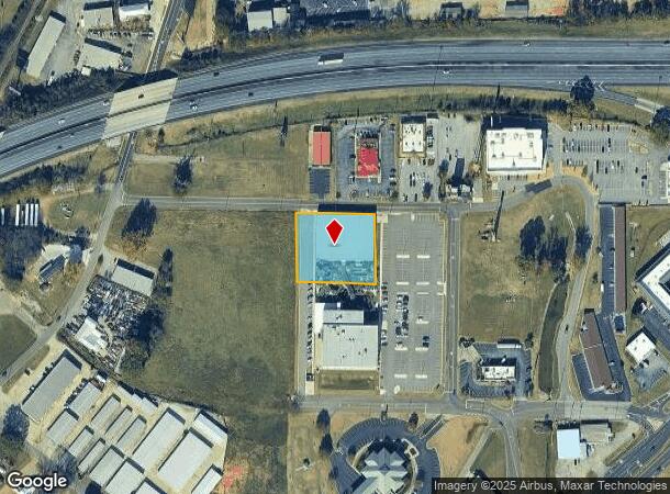
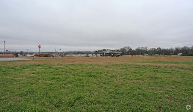
15 Spring Branch Dr
Anniston-Oxford-Jacksonville, AL
A Parcel Of Land In Sec30, T16s, R8e
21-09-30-4-002-015.004
SEC 30 TSP 16S RNG 08E BEG 200 E OF INT W LINE SE1/4 & S ROW SPRING BRANCH DR TH E 232 SE 186.3 SE 207.8 W 440.64 N 205.02 TO
Vacantlandnec
Calhoun
X
Alabama
01015C0402E
1.11 AC
2025
Gadsden/Anniston Area
2025
Other Market Areas
001103
DEMOGRAPHICS near 15 Spring Branch Dr
1 Mile
3 Mile
5 Mile
2024 Total Population
2,229
17,959
42,624
2029 Population
2,197
17,575
42,115
Pop Growth 2024-2029
(1.44%)
(2.14%)
(1.19%)
Average Age
41
40
42
2024 Total Households
844
7,154
17,406
HH Growth 2024-2029
(1.66%)
(2.31%)
(1.25%)
Median Household Inc
$34,553
$53,431
$49,196
Avg Household Size
2.30
2.40
2.30
2024 Avg HH Vehicles
2.00
2.00
2.00
Median Home Value
$99,754
$158,506
$142,850
Median Year Built
1968
1979
1975
Nearby Places
Map Layers
Map Styles
 Street
 Aerial
- Restaurants
- Banks
- Shops
- Fitness
- Groceries
PUBLIC TRANSPORTATION
COMMUTER RAIL
DRIVE
WALK
Distance
7 min
3.6 mi
SALE & LEASE HISTORY
LISTING DATE
SALE/LEASE

Sep 24, 2016
For Sale
Jul 17, 2017
For Sale
Nearby Properties
Address
Land Use
TOTAL SIZE
Lot Size
Zoning
Address
Land Use
TOTAL SIZE
Lot Size
Zoning
128,399 SF
17 AC
Address
Land Use
TOTAL SIZE
Lot Size
Zoning
5.32 AC
Address
Land Use
TOTAL SIZE
Lot Size
Zoning
7,752 SF
182 AC
Address
Land Use
TOTAL SIZE
Lot Size
Zoning
18.90 AC
Address
Land Use
TOTAL SIZE
Lot Size
Zoning
1,972 SF
22.80 AC
Address
Land Use
TOTAL SIZE
Lot Size
Zoning
17,254 SF
22 AC
Address
Land Use
TOTAL SIZE
Lot Size
Zoning
87,750 SF
25 AC
Address
Land Use
TOTAL SIZE
Lot Size
Zoning
4,356 SF
60.40 AC
Address
Land Use
TOTAL SIZE
Lot Size
Zoning
1,335 SF
76 AC
Address
Land Use
TOTAL SIZE
Lot Size
Zoning
341,374 SF
15.88 AC
Address
Land Use
TOTAL SIZE
Lot Size
Zoning
201,670 SF
27.50 AC
Address
Land Use
TOTAL SIZE
Lot Size
Zoning
74,927 SF
2.47 AC
Address
Land Use
TOTAL SIZE
Lot Size
Zoning
346,532 SF
41 AC
Address
Land Use
TOTAL SIZE
Lot Size
Zoning
64,772 SF
2.56 AC
Address
Land Use
TOTAL SIZE
Lot Size
Zoning
56,520 SF
2.51 AC
Address
Land Use
TOTAL SIZE
Lot Size
Zoning
4,366 SF
0.97 AC
Address
Land Use
TOTAL SIZE
Lot Size
Zoning
54,232 SF
2.27 AC
Address
Land Use
TOTAL SIZE
Lot Size
Zoning
50,180 SF
7.60 AC
Address
Land Use
TOTAL SIZE
Lot Size
Zoning
135,128 SF
10.01 AC
Address
Land Use
TOTAL SIZE
Lot Size
Zoning
14,015 SF
8.50 AC
Address
Land Use
TOTAL SIZE
Lot Size
Zoning
12,695 SF
0.75 AC
Address
Land Use
TOTAL SIZE
Lot Size
Zoning
86,508 SF
20 AC
Address
Land Use
TOTAL SIZE
Lot Size
Zoning
Address
Land Use
TOTAL SIZE
Lot Size
Zoning
31,104 SF
36 AC
Address
Land Use
TOTAL SIZE
Lot Size
Zoning
227,530 SF
24 AC
Address
Land Use
TOTAL SIZE
Lot Size
Zoning
4,118 SF
15.74 AC
Address
Land Use
TOTAL SIZE
Lot Size
Zoning
6,400 SF
12.24 AC
Address
Land Use
TOTAL SIZE
Lot Size
Zoning
98,306 SF
20 AC
Address
Land Use
TOTAL SIZE
Lot Size
Zoning
128,064 SF
7.70 AC
Address
Land Use
TOTAL SIZE
Lot Size
Zoning
194,310 SF
9.11 AC
The World's #1 Commercial Real Estate Marketplace
Connect with us
© 2026 CoStar Group
The information above has been obtained from sources believed reliable. While we do not doubt its accuracy we have not verified it and make no guarantee, warranty or representation about it. It is your responsibility to independently confirm its accuracy and completeness. Any projections, opinions, assumptions, or estimates used are for example only and do not represent the current or future performance of the property. The value of this transaction to you depends on tax and other factors which should be evaluated by your tax, financial, and legal advisors. You and your advisors should conduct a careful, independent investigation of the property to determine to your satisfaction the suitability of the property for your needs.