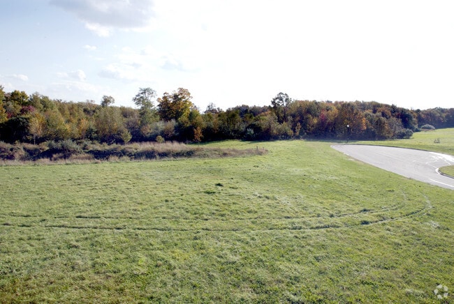
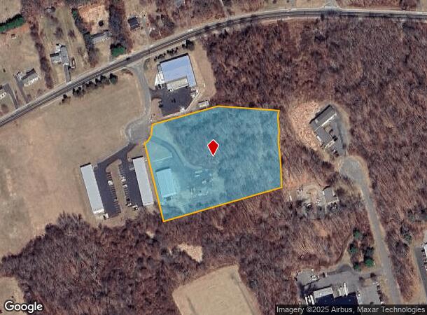
Property Record
15 Swicklas Ct, Plymouth, CT 06782

NEARBY LISTINGS FOR SALE OR LEASE
Property Detail
15 Swicklas Ct
Torrington, CT
Litchfield
PLYM-000020-000018-000003-000005
Connecticut
Parkingstructure
3-5
2025
3.11 AC
2025
SE Litchfield County
425400
Hartford
5,760 SF
DEMOGRAPHICS near 15 Swicklas Ct
1 Mile
3 Mile
5 Mile
2024 Total Population
1,574
14,525
49,315
2029 Population
1,565
14,420
49,217
Pop Growth 2024-2029
(0.57%)
(0.72%)
(0.20%)
Average Age
44
43
42
2024 Total Households
626
6,132
20,092
HH Growth 2024-2029
(0.64%)
(0.72%)
(0.22%)
Median Household Inc
$103,783
$83,916
$82,859
Avg Household Size
2.40
2.30
2.40
2024 Avg HH Vehicles
2.00
2.00
2.00
Median Home Value
$279,719
$261,649
$263,247
Median Year Built
1980
1968
1968
Nearby Places
Map Layers
Map Styles
 Street
 Aerial
- Restaurants
- Banks
- Shops
- Fitness
- Groceries
PUBLIC TRANSPORTATION
AIRPORT
Bradley International
DRIVE
WALK
Distance
Bradley International
64 min
36.3 mi
Freight Ports
Port of New Haven
DRIVE
WALK
Distance
Port of New Haven
54 min
36.4 mi
SALE & LEASE HISTORY
LISTING DATE
SALE/LEASE

Sep 24, 2016
For Sale
Nearby Properties
Address
Land Use
TOTAL SIZE
Lot Size
Zoning
Address
Land Use
TOTAL SIZE
Lot Size
Zoning
139 AC
IP-25
Address
Land Use
TOTAL SIZE
Lot Size
Zoning
121,917 SF
28.60 AC
R-15
Address
Land Use
TOTAL SIZE
Lot Size
Zoning
3.35 AC
RA2
Address
Land Use
TOTAL SIZE
Lot Size
Zoning
45,377 SF
91.90 AC
R-40
Address
Land Use
TOTAL SIZE
Lot Size
Zoning
49,977 SF
15.56 AC
R-25
Address
Land Use
TOTAL SIZE
Lot Size
Zoning
205,964 SF
14.35 AC
IP-3
Address
Land Use
TOTAL SIZE
Lot Size
Zoning
9.90 AC
M
Address
Land Use
TOTAL SIZE
Lot Size
Zoning
34.36 AC
RA2
Address
Land Use
TOTAL SIZE
Lot Size
Zoning
10 AC
RA1
Address
Land Use
TOTAL SIZE
Lot Size
Zoning
2.77 AC
C
Address
Land Use
TOTAL SIZE
Lot Size
Zoning
18,252 SF
1.56 AC
GC
Address
Land Use
TOTAL SIZE
Lot Size
Zoning
3.99 AC
RA1
Address
Land Use
TOTAL SIZE
Lot Size
Zoning
99,750 SF
9.10 AC
IP-3
Address
Land Use
TOTAL SIZE
Lot Size
Zoning
22,938 SF
1.92 AC
M
Address
Land Use
TOTAL SIZE
Lot Size
Zoning
953.93 AC
RA1
Address
Land Use
TOTAL SIZE
Lot Size
Zoning
4.30 AC
RA2
Address
Land Use
TOTAL SIZE
Lot Size
Zoning
94,414 SF
6.50 AC
M
Address
Land Use
TOTAL SIZE
Lot Size
Zoning
11.25 AC
RA2
Address
Land Use
TOTAL SIZE
Lot Size
Zoning
11,920 SF
4.20 AC
RA15
Address
Land Use
TOTAL SIZE
Lot Size
Zoning
53,240 SF
8.40 AC
IP-3
Address
Land Use
TOTAL SIZE
Lot Size
Zoning
49,690 SF
3.59 AC
M
Address
Land Use
TOTAL SIZE
Lot Size
Zoning
2.22 AC
M
Address
Land Use
TOTAL SIZE
Lot Size
Zoning
9,594 SF
1.87 AC
GC
Address
Land Use
TOTAL SIZE
Lot Size
Zoning
2.10 AC
C
Address
Land Use
TOTAL SIZE
Lot Size
Zoning
7.03 AC
C
Address
Land Use
TOTAL SIZE
Lot Size
Zoning
6.10 AC
M
Address
Land Use
TOTAL SIZE
Lot Size
Zoning
2.30 AC
GC
Address
Land Use
TOTAL SIZE
Lot Size
Zoning
3.96 AC
RA2
Address
Land Use
TOTAL SIZE
Lot Size
Zoning
130,374 SF
10.50 AC
M2
Address
Land Use
TOTAL SIZE
Lot Size
Zoning
59,840 SF
3.70 AC
BG
The World's #1 Commercial Real Estate Marketplace
Connect with us
© 2025 CoStar Group
The information above has been obtained from sources believed reliable. While we do not doubt its accuracy we have not verified it and make no guarantee, warranty or representation about it. It is your responsibility to independently confirm its accuracy and completeness. Any projections, opinions, assumptions, or estimates used are for example only and do not represent the current or future performance of the property. The value of this transaction to you depends on tax and other factors which should be evaluated by your tax, financial, and legal advisors. You and your advisors should conduct a careful, independent investigation of the property to determine to your satisfaction the suitability of the property for your needs.