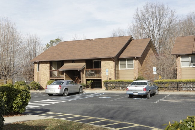
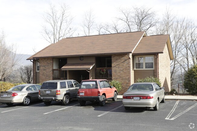
Property Record
15 Timber Ridge Cir, Clyde, NC 28721

Property Detail
15 Timber Ridge Cir
8637-50-3554
15 TIMBER RIDGE CIR 94 TIMBER RIDGE CIR 57 TIMBER RIDGE CIR AND OTHERS
Officebuilding
HAYWOOD
CC1
North Carolina
B and X Area of moderate flood hazard, usually the area between the limits of the 100-year and 500-year floods.
2.40 AC
0
Haywood County
2025
Asheville
920502
Waynesville, NC
625 SF
NEARBY LISTINGS FOR SALE OR LEASE
-
-
View all Clyde listings for sale on LoopNet.com
DEMOGRAPHICS near 15 Timber Ridge Cir
1 mile
3 mile
5 mile
2024 Total Population
2,133
9,160
26,839
2029 Population
2,073
9,016
26,649
Pop Growth 2024-2029
(2.81%)
(1.57%)
(0.71%)
Average Age
41
43
44
2024 Total Households
888
3,832
11,456
HH Growth 2024-2029
(2.93%)
(1.64%)
(0.79%)
Median Household Inc
$69,929
$69,883
$64,344
Avg Household Size
2.40
2.30
2.30
2024 Avg HH Vehicles
2.00
2.00
2.00
Median Home Value
$250,552
$273,859
$275,591
Median Year Built
1985
1982
1977
Nearby Places
Map Layers
Map Styles
 Street
 Aerial
Transit
 Traffic
 Biking
Places
Listings with unknown addresses are not visible on the map
- Restaurants
- Banks
- Shops
- Fitness
- Groceries
PUBLIC TRANSPORTATION
AIRPORT
Asheville Regional
Drive
Walk
Distance
Asheville Regional
40 min
29.9 mi
Freight Ports
North Charleston Terminal
Drive
Walk
Distance
North Charleston Terminal
312 min
273.7 mi
Nearby Properties
Address
Land Use
TOTAL SIZE
Lot Size
Zoning
Address
Land Use
TOTAL SIZE
Lot Size
Zoning
52,051 SF
55.78 AC
Address
Land Use
TOTAL SIZE
Lot Size
Zoning
5,800 SF
54.05 AC
COI
Address
Land Use
TOTAL SIZE
Lot Size
Zoning
17,244 SF
40.20 AC
Address
Land Use
TOTAL SIZE
Lot Size
Zoning
88,994 SF
19.51 AC
CR1
Address
Land Use
TOTAL SIZE
Lot Size
Zoning
12,520 SF
3.26 AC
COI
Address
Land Use
TOTAL SIZE
Lot Size
Zoning
35,901 SF
12.80 AC
Address
Land Use
TOTAL SIZE
Lot Size
Zoning
16,836 SF
0.57 AC
Address
Land Use
TOTAL SIZE
Lot Size
Zoning
115,911 SF
16.92 AC
Address
Land Use
TOTAL SIZE
Lot Size
Zoning
14,806 SF
9.76 AC
Address
Land Use
TOTAL SIZE
Lot Size
Zoning
30,460 SF
13.04 AC
Address
Land Use
TOTAL SIZE
Lot Size
Zoning
5,152 SF
2.01 AC
Address
Land Use
TOTAL SIZE
Lot Size
Zoning
28,922 SF
28.92 AC
Address
Land Use
TOTAL SIZE
Lot Size
Zoning
4,031 SF
96.51 AC
Address
Land Use
TOTAL SIZE
Lot Size
Zoning
1,800 SF
4.21 AC
Address
Land Use
TOTAL SIZE
Lot Size
Zoning
7,592 SF
3.66 AC
CC2
Address
Land Use
TOTAL SIZE
Lot Size
Zoning
4,006 SF
2.92 AC
Address
Land Use
TOTAL SIZE
Lot Size
Zoning
25,357 SF
3.38 AC
Address
Land Use
TOTAL SIZE
Lot Size
Zoning
25,436 SF
5 AC
Address
Land Use
TOTAL SIZE
Lot Size
Zoning
58,988 SF
6.21 AC
CNC2
Address
Land Use
TOTAL SIZE
Lot Size
Zoning
14,529 SF
2.54 AC
Address
Land Use
TOTAL SIZE
Lot Size
Zoning
1,706 SF
3.95 AC
Address
Land Use
TOTAL SIZE
Lot Size
Zoning
8,520 SF
1.34 AC
Address
Land Use
TOTAL SIZE
Lot Size
Zoning
14,600 SF
26.78 AC
Address
Land Use
TOTAL SIZE
Lot Size
Zoning
3,846 SF
11.71 AC
Address
Land Use
TOTAL SIZE
Lot Size
Zoning
4,972 SF
12.24 AC
COI
Address
Land Use
TOTAL SIZE
Lot Size
Zoning
2,622 SF
2.50 AC
Address
Land Use
TOTAL SIZE
Lot Size
Zoning
6,941 SF
2.12 AC
Address
Land Use
TOTAL SIZE
Lot Size
Zoning
4,032 SF
5.09 AC
CC2
Address
Land Use
TOTAL SIZE
Lot Size
Zoning
8,886 SF
3.20 AC
Address
Land Use
TOTAL SIZE
Lot Size
Zoning
6,901 SF
2.61 AC
The World's #1 Commercial Real Estate Marketplace
Connect with us
© 2026 CoStar Group
The information above has been obtained from sources believed reliable. While we do not doubt its accuracy we have not verified it and make no guarantee, warranty or representation about it. It is your responsibility to independently confirm its accuracy and completeness. Any projections, opinions, assumptions, or estimates used are for example only and do not represent the current or future performance of the property. The value of this transaction to you depends on tax and other factors which should be evaluated by your tax, financial, and legal advisors. You and your advisors should conduct a careful, independent investigation of the property to determine to your satisfaction the suitability of the property for your needs.