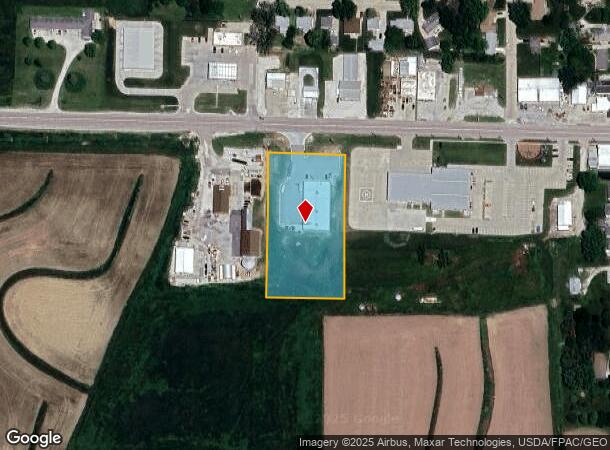
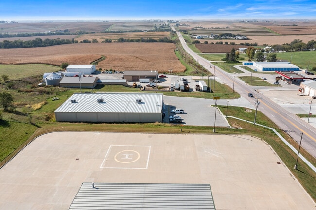
Property Record
15 W Main St, Treynor, IA 51575
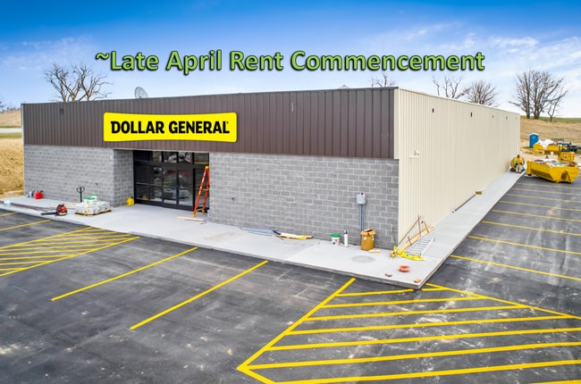
This Property Is For Sale
NEARBY LISTINGS FOR SALE OR LEASE
-
-
View all Treynor listings for sale on LoopNet.com
Property Detail
15 W Main St
Omaha-Council Bluffs, NE-IA
TREYNOR TOWN 12-74-42 PT NE NE COMM 856.35'W & 46.57'S TH S423.98' W228.71' N423.80' E227.97' TO~POB (PARCEL 22139)
7442 12 226 023
Pottawattamie
Storebuilding
Iowa
2025
2.22 AC
2025
W Pottawattamie County
021602
Omaha/Council Bluffs
DEMOGRAPHICS near 15 W Main St
1 Mile
3 Mile
5 Mile
2024 Total Population
1,135
1,490
2,130
2029 Population
1,132
1,485
2,120
Pop Growth 2024-2029
(0.26%)
(0.34%)
(0.47%)
Average Age
40
40
41
2024 Total Households
424
553
785
HH Growth 2024-2029
(0.24%)
(0.36%)
(0.51%)
Median Household Inc
$93,650
$95,029
$96,848
Avg Household Size
2.70
2.70
2.70
2024 Avg HH Vehicles
2.00
2.00
2.00
Median Home Value
$216,667
$232,168
$256,091
Median Year Built
1968
1967
1968
Nearby Places
Map Layers
Map Styles
 Street
 Aerial
- Restaurants
- Banks
- Shops
- Fitness
- Groceries
PUBLIC TRANSPORTATION
AIRPORT
Eppley Airfield
DRIVE
WALK
Distance
Eppley Airfield
35 min
22.1 mi
Freight Ports
Tulsa Port Of Catoosa
DRIVE
WALK
Distance
Tulsa Port Of Catoosa
469 min
422.9 mi
Nearby Properties
Address
Land Use
TOTAL SIZE
Lot Size
Zoning
Address
Land Use
TOTAL SIZE
Lot Size
Zoning
39.52 AC
Address
Land Use
TOTAL SIZE
Lot Size
Zoning
15.70 AC
Address
Land Use
TOTAL SIZE
Lot Size
Zoning
1.69 AC
Address
Land Use
TOTAL SIZE
Lot Size
Zoning
13,338 SF
2.67 AC
Address
Land Use
TOTAL SIZE
Lot Size
Zoning
10,240 SF
1.59 AC
Address
Land Use
TOTAL SIZE
Lot Size
Zoning
0.83 AC
Address
Land Use
TOTAL SIZE
Lot Size
Zoning
1.03 AC
Address
Land Use
TOTAL SIZE
Lot Size
Zoning
75.50 AC
Address
Land Use
TOTAL SIZE
Lot Size
Zoning
2,880 SF
5.19 AC
I-1
Address
Land Use
TOTAL SIZE
Lot Size
Zoning
2.49 AC
Address
Land Use
TOTAL SIZE
Lot Size
Zoning
11,665 SF
8.92 AC
Address
Land Use
TOTAL SIZE
Lot Size
Zoning
7.35 AC
A-2
Address
Land Use
TOTAL SIZE
Lot Size
Zoning
0.56 AC
Address
Land Use
TOTAL SIZE
Lot Size
Zoning
6,396 SF
1.59 AC
Address
Land Use
TOTAL SIZE
Lot Size
Zoning
11,220 SF
0.72 AC
Address
Land Use
TOTAL SIZE
Lot Size
Zoning
4.72 AC
R-2
Address
Land Use
TOTAL SIZE
Lot Size
Zoning
0.34 AC
Address
Land Use
TOTAL SIZE
Lot Size
Zoning
6,200 SF
0.43 AC
Address
Land Use
TOTAL SIZE
Lot Size
Zoning
4,252 SF
1.27 AC
Address
Land Use
TOTAL SIZE
Lot Size
Zoning
1,200 SF
0.63 AC
Address
Land Use
TOTAL SIZE
Lot Size
Zoning
8,040 SF
0.43 AC
Address
Land Use
TOTAL SIZE
Lot Size
Zoning
46.34 AC
Address
Land Use
TOTAL SIZE
Lot Size
Zoning
1,368 SF
77.86 AC
A-2
Address
Land Use
TOTAL SIZE
Lot Size
Zoning
Address
Land Use
TOTAL SIZE
Lot Size
Zoning
3,304 SF
0.42 AC
Address
Land Use
TOTAL SIZE
Lot Size
Zoning
3,920 SF
0.34 AC
Address
Land Use
TOTAL SIZE
Lot Size
Zoning
2,160 SF
0.35 AC
Address
Land Use
TOTAL SIZE
Lot Size
Zoning
4,000 SF
0.16 AC
The World's #1 Commercial Real Estate Marketplace
Connect with us
© 2025 CoStar Group
The information above has been obtained from sources believed reliable. While we do not doubt its accuracy we have not verified it and make no guarantee, warranty or representation about it. It is your responsibility to independently confirm its accuracy and completeness. Any projections, opinions, assumptions, or estimates used are for example only and do not represent the current or future performance of the property. The value of this transaction to you depends on tax and other factors which should be evaluated by your tax, financial, and legal advisors. You and your advisors should conduct a careful, independent investigation of the property to determine to your satisfaction the suitability of the property for your needs.