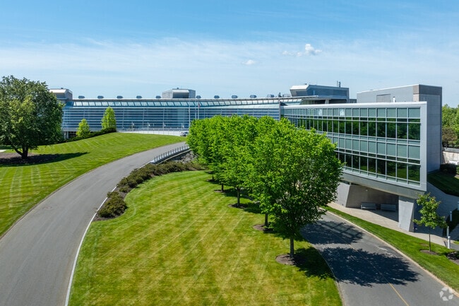
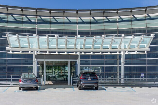
Property Record
15 Wellness Way, Canton, MA 02021

Property Detail
15 Wellness Way
Charitableorganization
NORFOLK
5
Massachusetts
B and X Area of moderate flood hazard, usually the area between the limits of the 100-year and 500-year floods.
46.37 AC
2024
Route 1 South
2025
Boston
415101
Boston-Cambridge-Newton, MA-NH
13,272 SF
CANT-000068-000000-000003
NEARBY LISTINGS FOR SALE OR LEASE
DEMOGRAPHICS near 15 Wellness Way
1 mile
3 mile
5 mile
2025 Total Population
1,471
37,481
193,756
2030 Population
1,525
38,262
197,931
Pop Growth 2025-2030
+ 3.67%
+ 2.08%
+ 2.15%
Average Age
43
41
42
2025 Total Households
493
13,418
73,717
HH Growth 2025-2030
+ 3.85%
+ 2.28%
+ 2.25%
Median Household Inc
$170,512
$142,463
$110,421
Avg Household Size
2.90
2.60
2.50
2025 Avg HH Vehicles
2.00
2.00
2.00
Median Home Value
$848,880
$784,147
$709,671
Median Year Built
1966
1961
1960
Nearby Places
Map Layers
Map Styles
 Street
 Aerial
Layers
 Traffic
 Biking
Places
Listings with unknown addresses are not visible on the map
- Restaurants
- Banks
- Shops
- Fitness
- Groceries
PUBLIC TRANSPORTATION
COMMUTER RAIL
Route 128 (Providence/Stoughton Line - Massachusetts Bay Transportation Authority Commuter Rail (Purple Line))
Drive
Walk
Distance
Route 128 (Providence/Stoughton Line - Massachusetts Bay Transportation Authority Commuter Rail (Purple Line))
6 min
3.1 mi
Readville (Fairmount Line - Massachusetts Bay Transportation Authority Commuter Rail (Purple Line), Franklin Line - Massachusetts Bay Transportation Authority Commuter Rail (Purple Line))
Drive
Walk
Distance
Readville (Fairmount Line - Massachusetts Bay Transportation Authority Commuter Rail (Purple Line), Franklin Line - Massachusetts Bay Transportation Authority Commuter Rail (Purple Line))
11 min
3.3 mi
AIRPORT
General Edward Lawrence Logan International
Drive
Walk
Distance
General Edward Lawrence Logan International
25 min
19.8 mi
Freight Ports
Port of Boston
Drive
Walk
Distance
Port of Boston
1 min
10.9 mi
SALE & LEASE HISTORY
LISTING DATE
SALE/LEASE

Mar 30, 2018
For Lease
Apr 05, 2017
For Sale
Nearby Properties
Address
Land Use
TOTAL SIZE
Lot Size
Zoning
Address
Land Use
TOTAL SIZE
Lot Size
Zoning
413,827 SF
9.49 AC
RDO
Address
Land Use
TOTAL SIZE
Lot Size
Zoning
225,042 SF
63.16 AC
RA
Address
Land Use
TOTAL SIZE
Lot Size
Zoning
11.66 AC
LM
Address
Land Use
TOTAL SIZE
Lot Size
Zoning
0.25 AC
RH
Address
Land Use
TOTAL SIZE
Lot Size
Zoning
270,991 SF
33.25 AC
RA
Address
Land Use
TOTAL SIZE
Lot Size
Zoning
226,304 SF
2.89 AC
Address
Land Use
TOTAL SIZE
Lot Size
Zoning
18,451 SF
19.07 AC
Address
Land Use
TOTAL SIZE
Lot Size
Zoning
351,699 SF
27.36 AC
Address
Land Use
TOTAL SIZE
Lot Size
Zoning
254,787 SF
55.40 AC
Address
Land Use
TOTAL SIZE
Lot Size
Zoning
267,103 SF
20.23 AC
10
Address
Land Use
TOTAL SIZE
Lot Size
Zoning
180,022 SF
3.74 AC
Address
Land Use
TOTAL SIZE
Lot Size
Zoning
83,891 SF
3.47 AC
RA
Address
Land Use
TOTAL SIZE
Lot Size
Zoning
45.72 AC
LM
Address
Land Use
TOTAL SIZE
Lot Size
Zoning
154,871 SF
34.30 AC
10
Address
Land Use
TOTAL SIZE
Lot Size
Zoning
81,796 SF
11.87 AC
Address
Land Use
TOTAL SIZE
Lot Size
Zoning
195,690 SF
14.98 AC
NV
Address
Land Use
TOTAL SIZE
Lot Size
Zoning
185,592 SF
37.21 AC
Address
Land Use
TOTAL SIZE
Lot Size
Zoning
62,043 SF
10.68 AC
6
Address
Land Use
TOTAL SIZE
Lot Size
Zoning
170,482 SF
18.60 AC
Address
Land Use
TOTAL SIZE
Lot Size
Zoning
160,716 SF
18.87 AC
11
Address
Land Use
TOTAL SIZE
Lot Size
Zoning
329,800 SF
18.49 AC
Address
Land Use
TOTAL SIZE
Lot Size
Zoning
130,356 SF
14.70 AC
9
Address
Land Use
TOTAL SIZE
Lot Size
Zoning
285,511 SF
29.38 AC
RD
Address
Land Use
TOTAL SIZE
Lot Size
Zoning
361,239 SF
37.28 AC
Address
Land Use
TOTAL SIZE
Lot Size
Zoning
128,753 SF
17.50 AC
10
Address
Land Use
TOTAL SIZE
Lot Size
Zoning
127,278 SF
7.89 AC
Address
Land Use
TOTAL SIZE
Lot Size
Zoning
354,197 SF
24.13 AC
Address
Land Use
TOTAL SIZE
Lot Size
Zoning
160,508 SF
9.46 AC
Address
Land Use
TOTAL SIZE
Lot Size
Zoning
177,372 SF
18.76 AC
E
The World's #1 Commercial Real Estate Marketplace
Connect with us
© 2026 CoStar Group
The information above has been obtained from sources believed reliable. While we do not doubt its accuracy we have not verified it and make no guarantee, warranty or representation about it. It is your responsibility to independently confirm its accuracy and completeness. Any projections, opinions, assumptions, or estimates used are for example only and do not represent the current or future performance of the property. The value of this transaction to you depends on tax and other factors which should be evaluated by your tax, financial, and legal advisors. You and your advisors should conduct a careful, independent investigation of the property to determine to your satisfaction the suitability of the property for your needs.