Property Record
150 E Fire Tower Rd, Winterville, NC 28590
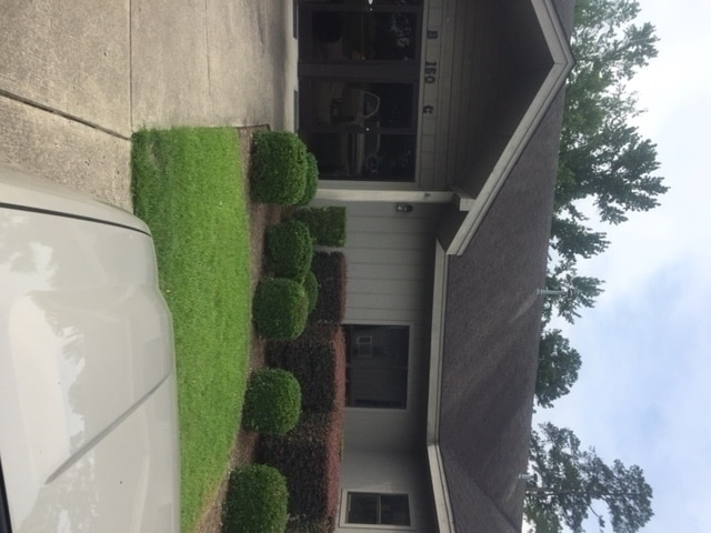


Property Detail
150 E Fire Tower Rd
038102
FIRE TOWER RD
Officebuilding
PITT
OR
North Carolina
B and X Area of moderate flood hazard, usually the area between the limits of the 100-year and 500-year floods.
0.84 AC
2025
North Carolina Northeast Area
2025
Other Market Areas
001304
Greenville, NC
10,450 SF
NEARBY LISTINGS FOR SALE OR LEASE
DEMOGRAPHICS near 150 E Fire Tower Rd
1 mile
3 mile
5 mile
2025 Total Population
8,199
53,817
118,765
2030 Population
8,481
55,196
122,930
Pop Growth 2025-2030
+ 3.44%
+ 2.56%
+ 3.51%
Average Age
40
38
36
2025 Total Households
3,517
22,969
49,160
HH Growth 2025-2030
+ 3.64%
+ 2.73%
+ 3.91%
Median Household Inc
$82,584
$68,619
$61,880
Avg Household Size
2.30
2.30
2.20
2025 Avg HH Vehicles
2.00
2.00
2.00
Median Home Value
$328,396
$273,612
$255,854
Median Year Built
1996
1994
1993
Nearby Places
Map Layers
Map Styles
 Street
 Aerial
Layers
 Traffic
 Biking
Places
Listings with unknown addresses are not visible on the map
- Restaurants
- Banks
- Shops
- Fitness
- Groceries
PUBLIC TRANSPORTATION
AIRPORT
Pitt-Greenville
Drive
Walk
Distance
Pitt-Greenville
19 min
10.2 mi
Freight Ports
Port of Morehead City
Drive
Walk
Distance
Port of Morehead City
124 min
83.1 mi
SALE & LEASE HISTORY
LISTING DATE
SALE/LEASE

May 07, 2018
For Lease
Jun 30, 2025
For Sale
Jul 13, 2020
For Lease
Nearby Properties
Address
Land Use
TOTAL SIZE
Lot Size
Zoning
Address
Land Use
TOTAL SIZE
Lot Size
Zoning
33,163 SF
20.14 AC
OR
Address
Land Use
TOTAL SIZE
Lot Size
Zoning
512,349 SF
39.27 AC
CG
Address
Land Use
TOTAL SIZE
Lot Size
Zoning
33,791 SF
21.01 AC
OR
Address
Land Use
TOTAL SIZE
Lot Size
Zoning
251,145 SF
84.25 AC
RA20
Address
Land Use
TOTAL SIZE
Lot Size
Zoning
24,032 SF
22.74 AC
R6
Address
Land Use
TOTAL SIZE
Lot Size
Zoning
25,290 SF
18.26 AC
OR
Address
Land Use
TOTAL SIZE
Lot Size
Zoning
251,265 SF
30.17 AC
0&I
Address
Land Use
TOTAL SIZE
Lot Size
Zoning
90,108 SF
11.27 AC
OI
Address
Land Use
TOTAL SIZE
Lot Size
Zoning
162,126 SF
30 AC
OI
Address
Land Use
TOTAL SIZE
Lot Size
Zoning
6,148 SF
10.75 AC
R6
Address
Land Use
TOTAL SIZE
Lot Size
Zoning
152,334 SF
15.92 AC
CG
Address
Land Use
TOTAL SIZE
Lot Size
Zoning
93,340 SF
14.63 AC
AR
Address
Land Use
TOTAL SIZE
Lot Size
Zoning
19,183 SF
5.85 AC
OR
Address
Land Use
TOTAL SIZE
Lot Size
Zoning
97,638 SF
28.62 AC
R9S
Address
Land Use
TOTAL SIZE
Lot Size
Zoning
20,742 SF
12.83 AC
R6
Address
Land Use
TOTAL SIZE
Lot Size
Zoning
121,384 SF
17.80 AC
CG
Address
Land Use
TOTAL SIZE
Lot Size
Zoning
63,504 SF
15.20 AC
CG
Address
Land Use
TOTAL SIZE
Lot Size
Zoning
118,668 SF
9.49 AC
CH
Address
Land Use
TOTAL SIZE
Lot Size
Zoning
84,649 SF
44.78 AC
AR
Address
Land Use
TOTAL SIZE
Lot Size
Zoning
75,300 SF
8.64 AC
GB
Address
Land Use
TOTAL SIZE
Lot Size
Zoning
124,845 SF
13.48 AC
CG
Address
Land Use
TOTAL SIZE
Lot Size
Zoning
98,836 SF
45.03 AC
RA20
Address
Land Use
TOTAL SIZE
Lot Size
Zoning
55,402 SF
37.57 AC
RA20
Address
Land Use
TOTAL SIZE
Lot Size
Zoning
139,128 SF
6.57 AC
OI
Address
Land Use
TOTAL SIZE
Lot Size
Zoning
56,748 SF
1.72 AC
OI
Address
Land Use
TOTAL SIZE
Lot Size
Zoning
60,050 SF
24.76 AC
OR
Address
Land Use
TOTAL SIZE
Lot Size
Zoning
7,540 SF
8.73 AC
R6
Address
Land Use
TOTAL SIZE
Lot Size
Zoning
8,968 SF
17.20 AC
R6
Address
Land Use
TOTAL SIZE
Lot Size
Zoning
11,784 SF
3.98 AC
OR
Address
Land Use
TOTAL SIZE
Lot Size
Zoning
19,628 SF
7.06 AC
OR
The World's #1 Commercial Real Estate Marketplace
Connect with us
© 2026 CoStar Group
The information above has been obtained from sources believed reliable. While we do not doubt its accuracy we have not verified it and make no guarantee, warranty or representation about it. It is your responsibility to independently confirm its accuracy and completeness. Any projections, opinions, assumptions, or estimates used are for example only and do not represent the current or future performance of the property. The value of this transaction to you depends on tax and other factors which should be evaluated by your tax, financial, and legal advisors. You and your advisors should conduct a careful, independent investigation of the property to determine to your satisfaction the suitability of the property for your needs.