Property Record
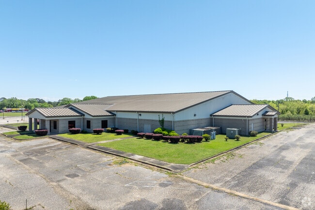
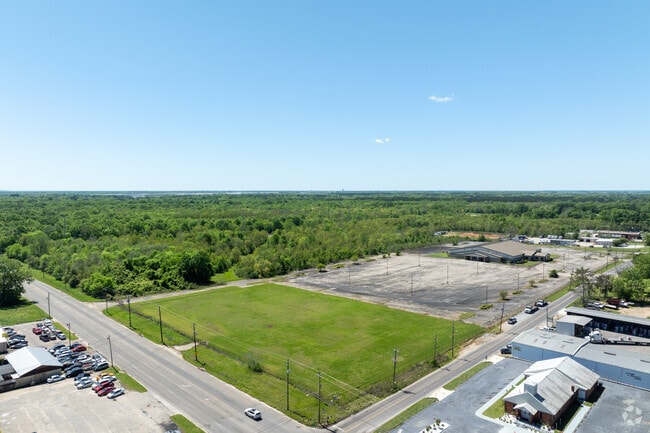
150 E Fleming Rd, Montgomery, AL 36105

Property Detail
150 E Fleming Rd
10-09-31-3-001-001.003
9.01 ACRES LYING IN THE SE 1/4 OF THE NW 1/4 OF SECTION 31, T-16-N, R-18-E FURTHER DESCRIBED AS BEG AT SW INT OF NORMAN
Theater
Montgomery
M1
Alabama
B and X Area of moderate flood hazard, usually the area between the limits of the 100-year and 500-year floods.
6 AC
0
South Montgomery
2025
Montgomery
005904
Montgomery, AL
34,846 SF
NEARBY LISTINGS FOR SALE OR LEASE
DEMOGRAPHICS near 150 E Fleming Rd
1 mile
3 mile
5 mile
2025 Total Population
6,293
45,781
106,153
2030 Population
6,319
46,067
106,176
Pop Growth 2025-2030
+ 0.41%
+ 0.62%
+ 0.02%
Average Age
40
40
38
2025 Total Households
2,541
18,823
43,019
HH Growth 2025-2030
+ 0.59%
+ 0.81%
+ 0.13%
Median Household Inc
$39,285
$50,797
$48,468
Avg Household Size
2.40
2.30
2.30
2025 Avg HH Vehicles
2.00
2.00
2.00
Median Home Value
$68,444
$121,547
$127,414
Median Year Built
1962
1963
1970
Nearby Places
Map Layers
Map Styles
 Street
 Aerial
Layers
 Traffic
 Biking
Places
Listings with unknown addresses are not visible on the map
- Restaurants
- Banks
- Shops
- Fitness
- Groceries
PUBLIC TRANSPORTATION
AIRPORT
Montgomery Regional (Dannelly Field)
Drive
Walk
Distance
Montgomery Regional (Dannelly Field)
21 min
9.9 mi
SALE & LEASE HISTORY
LISTING DATE
SALE/LEASE

Mar 08, 2023
For Sale
Dec 11, 2017
For Sale
Apr 10, 2023
For Sale
Nearby Properties
Address
Land Use
TOTAL SIZE
Lot Size
Zoning
Address
Land Use
TOTAL SIZE
Lot Size
Zoning
260,402 SF
17 AC
O-2
Address
Land Use
TOTAL SIZE
Lot Size
Zoning
1,408 SF
Address
Land Use
TOTAL SIZE
Lot Size
Zoning
3,670 SF
239.11 AC
Address
Land Use
TOTAL SIZE
Lot Size
Zoning
40,829 SF
50.49 AC
SD
Address
Land Use
TOTAL SIZE
Lot Size
Zoning
9,060 SF
524.11 AC
Address
Land Use
TOTAL SIZE
Lot Size
Zoning
32,902 SF
14 AC
R-75-M
Address
Land Use
TOTAL SIZE
Lot Size
Zoning
341,170 SF
O-2
Address
Land Use
TOTAL SIZE
Lot Size
Zoning
14,733 SF
19 AC
O-2
Address
Land Use
TOTAL SIZE
Lot Size
Zoning
249,231 SF
20 AC
INST
Address
Land Use
TOTAL SIZE
Lot Size
Zoning
135,573 SF
35 AC
O-2
Address
Land Use
TOTAL SIZE
Lot Size
Zoning
92,810 SF
100 AC
M-3
Address
Land Use
TOTAL SIZE
Lot Size
Zoning
61,137 SF
59 AC
INST
Address
Land Use
TOTAL SIZE
Lot Size
Zoning
57,565 SF
1.50 AC
T4-R
Address
Land Use
TOTAL SIZE
Lot Size
Zoning
95,886 SF
3.19 AC
B-4
Address
Land Use
TOTAL SIZE
Lot Size
Zoning
54,384 SF
0.65 AC
Address
Land Use
TOTAL SIZE
Lot Size
Zoning
8,652 SF
5.28 AC
R-75-D
Address
Land Use
TOTAL SIZE
Lot Size
Zoning
154,202 SF
14.90 AC
B-4
Address
Land Use
TOTAL SIZE
Lot Size
Zoning
91,241 SF
9.10 AC
R-65-S
Address
Land Use
TOTAL SIZE
Lot Size
Zoning
88,234 SF
O-1
Address
Land Use
TOTAL SIZE
Lot Size
Zoning
65,357 SF
4.29 AC
R-65-M
Address
Land Use
TOTAL SIZE
Lot Size
Zoning
4.69 AC
R-75-S
Address
Land Use
TOTAL SIZE
Lot Size
Zoning
3,078 SF
11 AC
R-60-S
Address
Land Use
TOTAL SIZE
Lot Size
Zoning
2,380 SF
9.80 AC
R-65-M
Address
Land Use
TOTAL SIZE
Lot Size
Zoning
1,693 SF
3.29 AC
B-1-A-Q
Address
Land Use
TOTAL SIZE
Lot Size
Zoning
176,106 SF
19.22 AC
M-3
Address
Land Use
TOTAL SIZE
Lot Size
Zoning
8,483 SF
18.66 AC
M-1
Address
Land Use
TOTAL SIZE
Lot Size
Zoning
87,441 SF
9.90 AC
INST
Address
Land Use
TOTAL SIZE
Lot Size
Zoning
46,760 SF
4.38 AC
R-65-D
Address
Land Use
TOTAL SIZE
Lot Size
Zoning
40,554 SF
3.20 AC
INST
Address
Land Use
TOTAL SIZE
Lot Size
Zoning
88,994 SF
5.16 AC
INST
The World's #1 Commercial Real Estate Marketplace
Connect with us
© 2026 CoStar Group
The information above has been obtained from sources believed reliable. While we do not doubt its accuracy we have not verified it and make no guarantee, warranty or representation about it. It is your responsibility to independently confirm its accuracy and completeness. Any projections, opinions, assumptions, or estimates used are for example only and do not represent the current or future performance of the property. The value of this transaction to you depends on tax and other factors which should be evaluated by your tax, financial, and legal advisors. You and your advisors should conduct a careful, independent investigation of the property to determine to your satisfaction the suitability of the property for your needs.