Property Record
150 E Fremont Ave, Sunnyvale, CA 94087


NEARBY LISTINGS FOR SALE OR LEASE
Property Detail
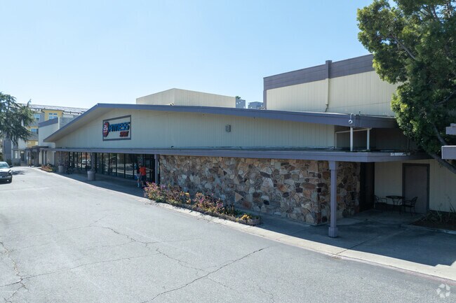
150 E Fremont Ave
San Jose-Sunnyvale-Santa Clara, CA
J C Mulligan 02
309-01-009
LOT 1,2
Recreationalentertainmentgeneral
Santa Clara
X
California
06087C0050E
1,2
2024
2.52 AC
2025
Sunnyvale
508203
South Bay/San Jose
33,723 SF
DEMOGRAPHICS near 150 E Fremont Ave
1 Mile
3 Mile
5 Mile
2024 Total Population
32,221
234,754
484,383
2029 Population
31,120
227,392
468,920
Pop Growth 2024-2029
(3.42%)
(3.14%)
(3.19%)
Average Age
39
39
39
2024 Total Households
11,468
86,273
178,734
HH Growth 2024-2029
(3.68%)
(3.31%)
(3.37%)
Median Household Inc
$171,247
$183,415
$171,336
Avg Household Size
2.70
2.70
2.60
2024 Avg HH Vehicles
2.00
2.00
2.00
Median Home Value
$1,135,908
$1,133,799
$1,127,360
Median Year Built
1971
1972
1971
Nearby Places
Map Layers
Map Styles
 Street
 Aerial
- Restaurants
- Banks
- Shops
- Fitness
- Groceries
PUBLIC TRANSPORTATION
COMMUTER RAIL
Sunnyvale (Caltrain - Caltrain (Caltrain), Express - Caltrain (Caltrain), Limited - Caltrain (Caltrain), Local Weekday - Caltrain (Caltrain), Local Weekend - Caltrain (Caltrain))
DRIVE
WALK
Distance
Sunnyvale (Caltrain - Caltrain (Caltrain), Express - Caltrain (Caltrain), Limited - Caltrain (Caltrain), Local Weekday - Caltrain (Caltrain), Local Weekend - Caltrain (Caltrain))
5 min
2.2 mi
Lawrence (Caltrain - Caltrain (Caltrain), Limited - Caltrain (Caltrain), Local Weekday - Caltrain (Caltrain), Local Weekend - Caltrain (Caltrain))
DRIVE
WALK
Distance
Lawrence (Caltrain - Caltrain (Caltrain), Limited - Caltrain (Caltrain), Local Weekday - Caltrain (Caltrain), Local Weekend - Caltrain (Caltrain))
8 min
3.9 mi
AIRPORT
Norman Y Mineta San Jose International
DRIVE
WALK
Distance
Norman Y Mineta San Jose International
14 min
6.1 mi
San Francisco International
DRIVE
WALK
Distance
San Francisco International
38 min
29.9 mi
Metro Oakland International
DRIVE
WALK
Distance
Metro Oakland International
51 min
38.6 mi
Freight Ports
Port of Redwood City
DRIVE
WALK
Distance
Port of Redwood City
23 min
16.8 mi
Nearby Properties
Address
Land Use
TOTAL SIZE
Lot Size
Zoning
Address
Land Use
TOTAL SIZE
Lot Size
Zoning
2,819,800 SF
91.85 AC
CU
Address
Land Use
TOTAL SIZE
Lot Size
Zoning
777,000 SF
17.84 AC
MS
Address
Land Use
TOTAL SIZE
Lot Size
Zoning
57,096 SF
58.04 AC
PM0
Address
Land Use
TOTAL SIZE
Lot Size
Zoning
424,316 SF
22.37 AC
SU
Address
Land Use
TOTAL SIZE
Lot Size
Zoning
107,203 SF
21.74 AC
MXD2
Address
Land Use
TOTAL SIZE
Lot Size
Zoning
16.72 AC
MSLSP
Address
Land Use
TOTAL SIZE
Lot Size
Zoning
196,100 SF
1.32 AC
PCMR
Address
Land Use
TOTAL SIZE
Lot Size
Zoning
73,425 SF
14.20 AC
MS
Address
Land Use
TOTAL SIZE
Lot Size
Zoning
4 AC
DSP/1
Address
Land Use
TOTAL SIZE
Lot Size
Zoning
587,826 SF
2.54 AC
DSP/1
Address
Land Use
TOTAL SIZE
Lot Size
Zoning
353,745 SF
14.82 AC
PPSP
Address
Land Use
TOTAL SIZE
Lot Size
Zoning
833,956 SF
55.15 AC
PD
Address
Land Use
TOTAL SIZE
Lot Size
Zoning
531,132 SF
21.33 AC
R4PD
Address
Land Use
TOTAL SIZE
Lot Size
Zoning
304,000 SF
6.79 AC
PM0
Address
Land Use
TOTAL SIZE
Lot Size
Zoning
146,390 SF
9.04 AC
MP
Address
Land Use
TOTAL SIZE
Lot Size
Zoning
162,205 SF
18.69 AC
MS
Address
Land Use
TOTAL SIZE
Lot Size
Zoning
23,709 SF
7.48 AC
PPSP
Address
Land Use
TOTAL SIZE
Lot Size
Zoning
211,024 SF
9.92 AC
P
Address
Land Use
TOTAL SIZE
Lot Size
Zoning
8.22 AC
PD
Address
Land Use
TOTAL SIZE
Lot Size
Zoning
63,131 SF
4.73 AC
P41
Address
Land Use
TOTAL SIZE
Lot Size
Zoning
287,644 SF
10.04 AC
PPSP
Address
Land Use
TOTAL SIZE
Lot Size
Zoning
897,944 SF
7.40 AC
PD
Address
Land Use
TOTAL SIZE
Lot Size
Zoning
32.93 AC
PC
Address
Land Use
TOTAL SIZE
Lot Size
Zoning
1,016,763 SF
7.63 AC
CC
Address
Land Use
TOTAL SIZE
Lot Size
Zoning
381,064 SF
20.42 AC
R322
Address
Land Use
TOTAL SIZE
Lot Size
Zoning
33,964 SF
3.95 AC
PPSP
Address
Land Use
TOTAL SIZE
Lot Size
Zoning
57,536 SF
9.79 AC
MXD1
Address
Land Use
TOTAL SIZE
Lot Size
Zoning
121,000 SF
8.77 AC
PPSPI
Address
Land Use
TOTAL SIZE
Lot Size
Zoning
156,960 SF
1.52 AC
DSP/1
Address
Land Use
TOTAL SIZE
Lot Size
Zoning
141,232 SF
7.98 AC
P(CGM
The World's #1 Commercial Real Estate Marketplace
Connect with us
© 2026 CoStar Group
The information above has been obtained from sources believed reliable. While we do not doubt its accuracy we have not verified it and make no guarantee, warranty or representation about it. It is your responsibility to independently confirm its accuracy and completeness. Any projections, opinions, assumptions, or estimates used are for example only and do not represent the current or future performance of the property. The value of this transaction to you depends on tax and other factors which should be evaluated by your tax, financial, and legal advisors. You and your advisors should conduct a careful, independent investigation of the property to determine to your satisfaction the suitability of the property for your needs.