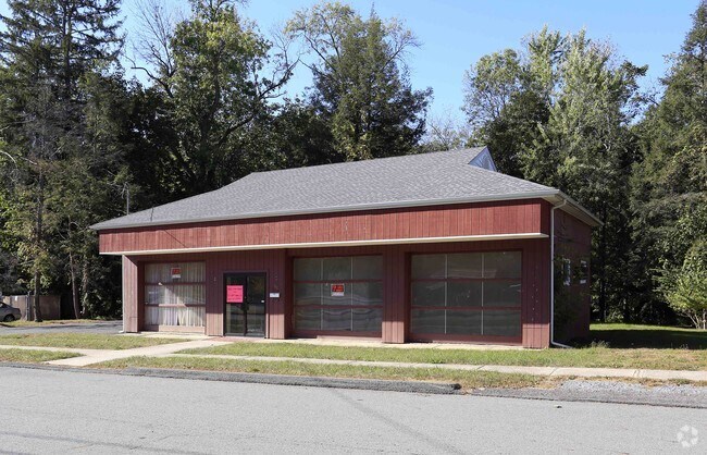
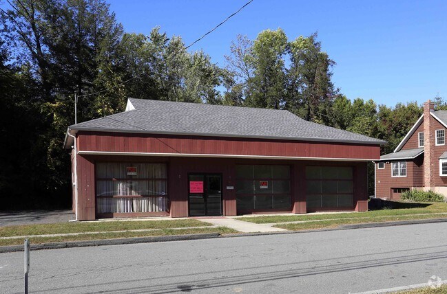
Property Record
150 E Main St, Walden, NY 12586

Property Detail
150 E Main St
334205-307-000-0004-009.000-0000
LT 2 + PT LT 1 MRS THOMASPARTIAL A/V
Commercialnec
Orange
R4
New York
A Areas with a 1% annual chance of flooding and a 26% chance of flooding over the life of a 30-year mortgage.
9.000
2024
0.35 AC
2024
Newburgh
010702
Northern New Jersey
1,688 SF
Kiryas Joel-Poughkeepsie-Newburgh, NY
NEARBY LISTINGS FOR SALE OR LEASE
DEMOGRAPHICS near 150 E Main St
1 mile
3 mile
5 mile
2024 Total Population
6,107
14,850
33,759
2029 Population
6,224
15,138
34,212
Pop Growth 2024-2029
+ 1.92%
+ 1.94%
+ 1.34%
Average Age
39
40
41
2024 Total Households
2,220
5,188
11,852
HH Growth 2024-2029
+ 1.94%
+ 2.02%
+ 1.39%
Median Household Inc
$83,274
$98,298
$103,325
Avg Household Size
2.70
2.70
2.70
2024 Avg HH Vehicles
2.00
2.00
2.00
Median Home Value
$347,412
$368,799
$376,937
Median Year Built
1956
1969
1975
Nearby Places
Map Layers
Map Styles
 Street
 Aerial
Transit
 Traffic
 Biking
Places
Listings with unknown addresses are not visible on the map
- Restaurants
- Banks
- Shops
- Fitness
- Groceries
PUBLIC TRANSPORTATION
AIRPORT
New York Stewart International
Drive
Walk
Distance
New York Stewart International
17 min
8.5 mi
SALE & LEASE HISTORY
LISTING DATE
SALE/LEASE

Oct 09, 2017
For Lease
Oct 09, 2017
For Sale
Jun 18, 2018
For Sale
Nearby Properties
Address
Land Use
TOTAL SIZE
Lot Size
Zoning
Address
Land Use
TOTAL SIZE
Lot Size
Zoning
221,958 SF
12.10 AC
ID
Address
Land Use
TOTAL SIZE
Lot Size
Zoning
109,108 SF
15.60 AC
B2
Address
Land Use
TOTAL SIZE
Lot Size
Zoning
32,505 SF
15.10 AC
I1
Address
Land Use
TOTAL SIZE
Lot Size
Zoning
38,624 SF
11.50 AC
I1
Address
Land Use
TOTAL SIZE
Lot Size
Zoning
14,376 SF
63.90 AC
01
Address
Land Use
TOTAL SIZE
Lot Size
Zoning
72,852 SF
2.20 AC
Address
Land Use
TOTAL SIZE
Lot Size
Zoning
102,239 SF
62.90 AC
RA2
Address
Land Use
TOTAL SIZE
Lot Size
Zoning
64,191 SF
10 AC
06
Address
Land Use
TOTAL SIZE
Lot Size
Zoning
85,275 SF
70.20 AC
RA-.5
Address
Land Use
TOTAL SIZE
Lot Size
Zoning
28,443 SF
34.70 AC
04OP
Address
Land Use
TOTAL SIZE
Lot Size
Zoning
18,386 SF
54.70 AC
RA-.5
Address
Land Use
TOTAL SIZE
Lot Size
Zoning
74,046 SF
58.30 AC
Address
Land Use
TOTAL SIZE
Lot Size
Zoning
195,821 SF
27.50 AC
I1
Address
Land Use
TOTAL SIZE
Lot Size
Zoning
111,517 SF
0.32 AC
R3
Address
Land Use
TOTAL SIZE
Lot Size
Zoning
Address
Land Use
TOTAL SIZE
Lot Size
Zoning
87,952 SF
9.80 AC
I1
Address
Land Use
TOTAL SIZE
Lot Size
Zoning
82,465 SF
14.40 AC
I1
Address
Land Use
TOTAL SIZE
Lot Size
Zoning
81,563 SF
5.70 AC
B4
Address
Land Use
TOTAL SIZE
Lot Size
Zoning
26,988 SF
53 AC
RA2
Address
Land Use
TOTAL SIZE
Lot Size
Zoning
2.10 AC
R5
Address
Land Use
TOTAL SIZE
Lot Size
Zoning
78,179 SF
30.50 AC
I1
Address
Land Use
TOTAL SIZE
Lot Size
Zoning
52,267 SF
4.60 AC
RM2
Address
Land Use
TOTAL SIZE
Lot Size
Zoning
35.80 AC
I1
Address
Land Use
TOTAL SIZE
Lot Size
Zoning
34.20 AC
Address
Land Use
TOTAL SIZE
Lot Size
Zoning
19,208 SF
4.10 AC
R4
Address
Land Use
TOTAL SIZE
Lot Size
Zoning
51,257 SF
8.50 AC
RM1
Address
Land Use
TOTAL SIZE
Lot Size
Zoning
36,648 SF
3.10 AC
R4
Address
Land Use
TOTAL SIZE
Lot Size
Zoning
19,138 SF
7.40 AC
04OP
Address
Land Use
TOTAL SIZE
Lot Size
Zoning
23,040 SF
12.10 AC
RA2
Address
Land Use
TOTAL SIZE
Lot Size
Zoning
1,724 SF
23 AC
B4
The World's #1 Commercial Real Estate Marketplace
Connect with us
© 2026 CoStar Group
The information above has been obtained from sources believed reliable. While we do not doubt its accuracy we have not verified it and make no guarantee, warranty or representation about it. It is your responsibility to independently confirm its accuracy and completeness. Any projections, opinions, assumptions, or estimates used are for example only and do not represent the current or future performance of the property. The value of this transaction to you depends on tax and other factors which should be evaluated by your tax, financial, and legal advisors. You and your advisors should conduct a careful, independent investigation of the property to determine to your satisfaction the suitability of the property for your needs.