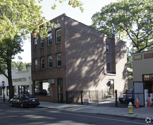
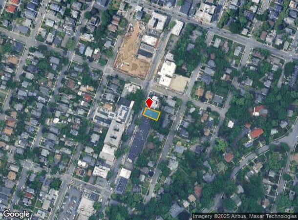
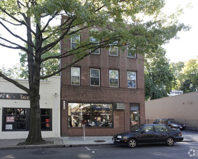
Property Record
150 Fifth Ave, Pelham, NY 10803
NEARBY LISTINGS FOR SALE OR LEASE
-
-
-
-
-
-
-
-
-
-
-
-
-
-
-
-
-
No Photo
-
-
-
View all Pelham listings for sale on LoopNet.com
Property Detail
150 Fifth Ave
4403-163-036-00002-000-0012
Map Pelhamville
Commercialofficeresidentialmixeduse
Westchester
X
New York
36119C0341F
12.000
2025
0.10 AC
2024
Southeast
005300
Westchester/So Connecticut
3,794 SF
New York-Jersey City-White Plains, NY-NJ
DEMOGRAPHICS near 150 Fifth Ave
1 Mile
3 Mile
5 Mile
2024 Total Population
34,385
281,783
730,425
2029 Population
33,060
269,130
691,023
Pop Growth 2024-2029
(3.85%)
(4.49%)
(5.39%)
Average Age
41
41
41
2024 Total Households
12,293
106,861
270,623
HH Growth 2024-2029
(3.90%)
(4.56%)
(5.70%)
Median Household Inc
$93,671
$83,429
$71,121
Avg Household Size
2.70
2.50
2.60
2024 Avg HH Vehicles
1.00
1.00
1.00
Median Home Value
$548,618
$544,647
$569,341
Median Year Built
1947
1951
1952
Nearby Places
- Restaurants
- Banks
- Shops
- Fitness
- Groceries
PUBLIC TRANSPORTATION
COMMUTER RAIL
Pelham Station (New Haven Line - Metro-North Commuter Railroad Company (Metro-North))
DRIVE
WALK
Distance
Pelham Station (New Haven Line - Metro-North Commuter Railroad Company (Metro-North))
1 min
7 min
0.4 mi
Mount Vernon East Station (New Haven Line - Metro-North Commuter Railroad Company (Metro-North))
DRIVE
WALK
Distance
Mount Vernon East Station (New Haven Line - Metro-North Commuter Railroad Company (Metro-North))
4 min
1.7 mi
AIRPORT
LaGuardia
DRIVE
WALK
Distance
LaGuardia
25 min
14.4 mi
Westchester County
DRIVE
WALK
Distance
Westchester County
24 min
16.0 mi
John F Kennedy International
DRIVE
WALK
Distance
John F Kennedy International
31 min
22.0 mi
Freight Ports
NY - Red Hook Container Terminal
DRIVE
WALK
Distance
NY - Red Hook Container Terminal
40 min
24.9 mi
Nearby Properties
Address
Land Use
TOTAL SIZE
Lot Size
Zoning
Address
Land Use
TOTAL SIZE
Lot Size
Zoning
18,000 SF
13.85 AC
A
Address
Land Use
TOTAL SIZE
Lot Size
Zoning
201,590 SF
4.13 AC
BA
Address
Land Use
TOTAL SIZE
Lot Size
Zoning
301,156 SF
13.94 AC
A
Address
Land Use
TOTAL SIZE
Lot Size
Zoning
70,737 SF
1.67 AC
BB
Address
Land Use
TOTAL SIZE
Lot Size
Zoning
4,000 SF
19.83 AC
BUS
Address
Land Use
TOTAL SIZE
Lot Size
Zoning
Address
Land Use
TOTAL SIZE
Lot Size
Zoning
Address
Land Use
TOTAL SIZE
Lot Size
Zoning
269,100 SF
1.63 AC
R4
Address
Land Use
TOTAL SIZE
Lot Size
Zoning
64,165 SF
3.24 AC
B
Address
Land Use
TOTAL SIZE
Lot Size
Zoning
165,529 SF
7.05 AC
RA3
Address
Land Use
TOTAL SIZE
Lot Size
Zoning
1,028,976 SF
23.03 AC
R5
Address
Land Use
TOTAL SIZE
Lot Size
Zoning
1,038,034 SF
23.41 AC
R5
Address
Land Use
TOTAL SIZE
Lot Size
Zoning
12,150 SF
482.09 AC
PARK
Address
Land Use
TOTAL SIZE
Lot Size
Zoning
5,170 SF
9.08 AC
B
Address
Land Use
TOTAL SIZE
Lot Size
Zoning
240,000 SF
6.49 AC
C4-3
Address
Land Use
TOTAL SIZE
Lot Size
Zoning
306,540 SF
11.67 AC
R5
Address
Land Use
TOTAL SIZE
Lot Size
Zoning
336,240 SF
8.45 AC
R5
Address
Land Use
TOTAL SIZE
Lot Size
Zoning
125,143 SF
2.21 AC
R4
Address
Land Use
TOTAL SIZE
Lot Size
Zoning
219,285 SF
15.51 AC
R4
Address
Land Use
TOTAL SIZE
Lot Size
Zoning
181,092 SF
3.47 AC
R4
Address
Land Use
TOTAL SIZE
Lot Size
Zoning
103,158 SF
1.82 AC
R4
Address
Land Use
TOTAL SIZE
Lot Size
Zoning
141,156 SF
9.37 AC
C4-1
Address
Land Use
TOTAL SIZE
Lot Size
Zoning
Address
Land Use
TOTAL SIZE
Lot Size
Zoning
38,912 SF
19.25 AC
R4
Address
Land Use
TOTAL SIZE
Lot Size
Zoning
7,855 SF
1.10 AC
C
Address
Land Use
TOTAL SIZE
Lot Size
Zoning
143,260 SF
1.79 AC
R5
Address
Land Use
TOTAL SIZE
Lot Size
Zoning
117,954 SF
3.27 AC
R4
Address
Land Use
TOTAL SIZE
Lot Size
Zoning
185,595 SF
1.40 AC
C4-1
Address
Land Use
TOTAL SIZE
Lot Size
Zoning
35,325 SF
4.66 AC
R5
Address
Land Use
TOTAL SIZE
Lot Size
Zoning
91,463 SF
0.69 AC
The World's #1 Commercial Real Estate Marketplace
Connect with us
© 2025 CoStar Group
The information above has been obtained from sources believed reliable. While we do not doubt its accuracy we have not verified it and make no guarantee, warranty or representation about it. It is your responsibility to independently confirm its accuracy and completeness. Any projections, opinions, assumptions, or estimates used are for example only and do not represent the current or future performance of the property. The value of this transaction to you depends on tax and other factors which should be evaluated by your tax, financial, and legal advisors. You and your advisors should conduct a careful, independent investigation of the property to determine to your satisfaction the suitability of the property for your needs.